
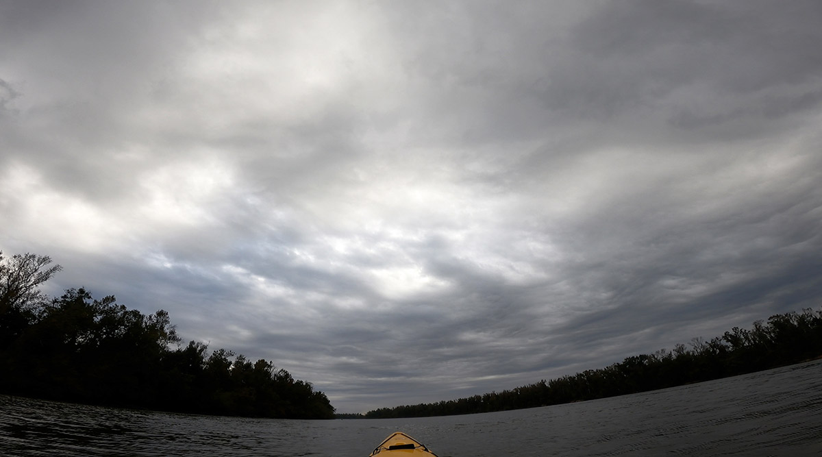
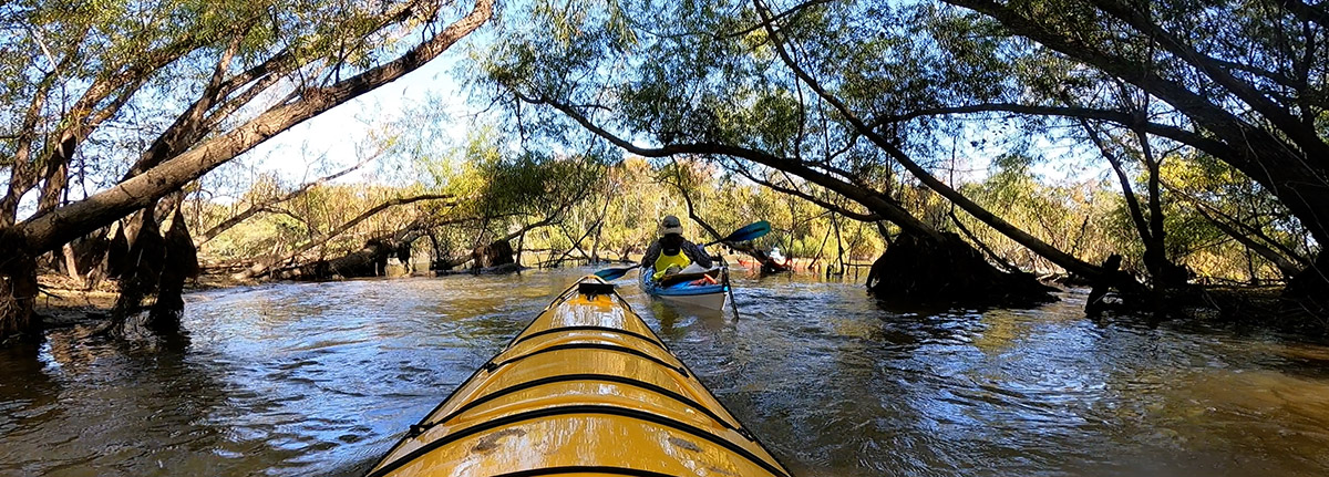
Previous RiverTrek videos have been split into two parts. This year, experience all of the Apalachicola River in one sitting. The video is about twenty minutes long.
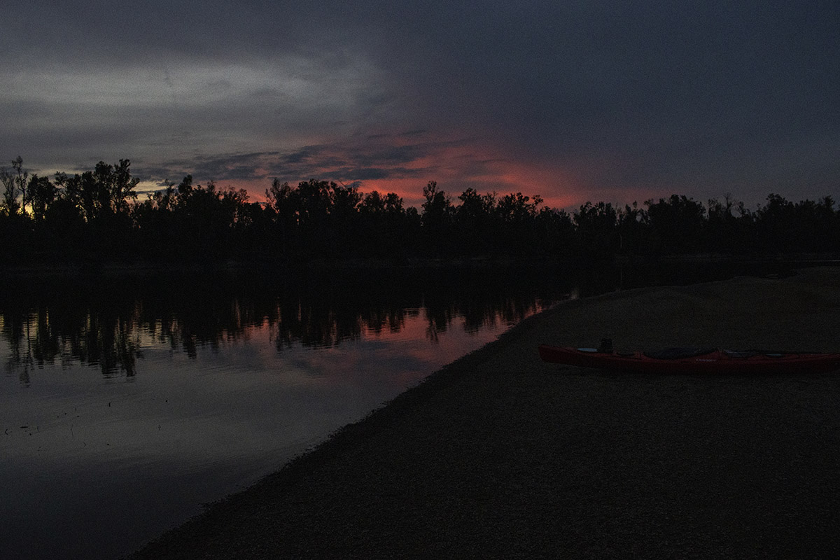
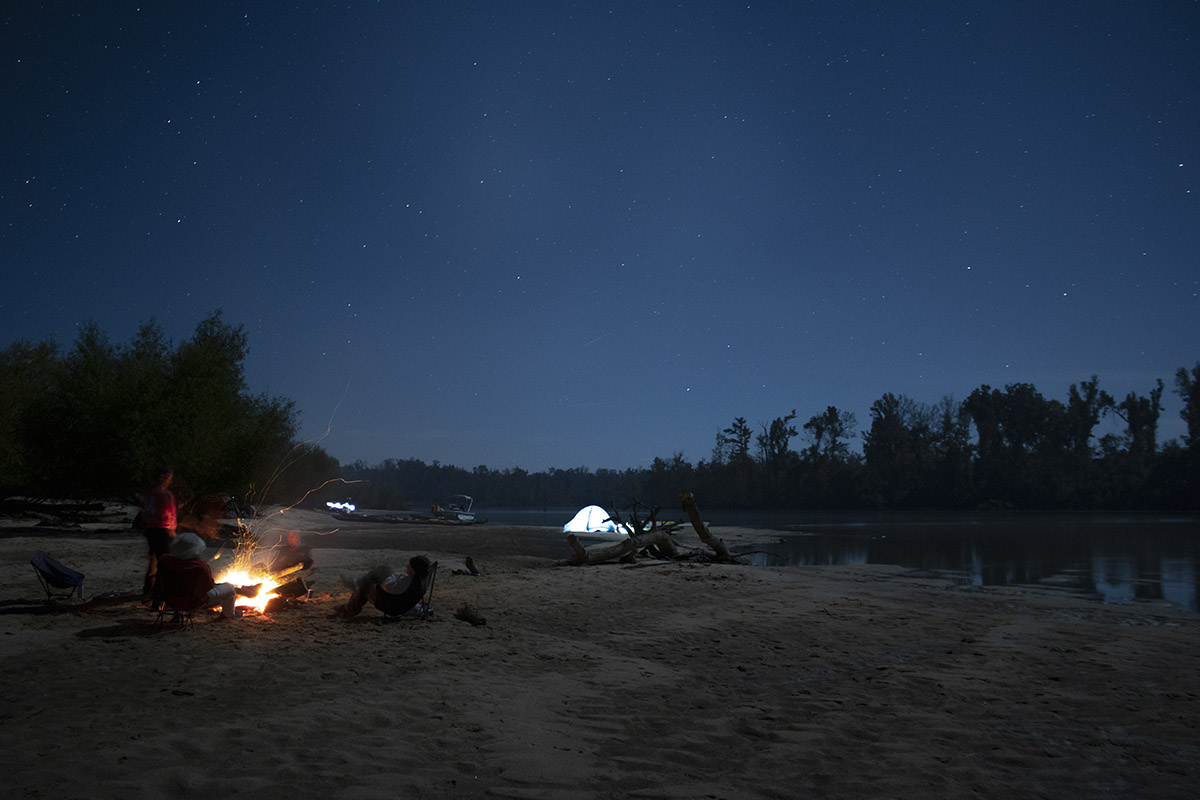
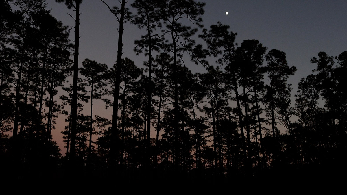
A few of us are sitting around a campfire, the Apalachicola River twinkling before us under a half moon. Many of the others have gone to their tents, experiencing that pleasant tiredness that comes from paddling twenty miles a day for three days, and a 6 pm sunset. It feels like midnight, but it’s probably closer to 7:30.
As we joke and tell stories, bright spotlights shine onto us from the river; a passing boat has become curious about the tents and kayaks littering the sand bar. A couple of us return the curiosity, wading out into the shallow water for a closer look. Soon, I hear Doug Alderson call out, “Rob, bring your camera!”
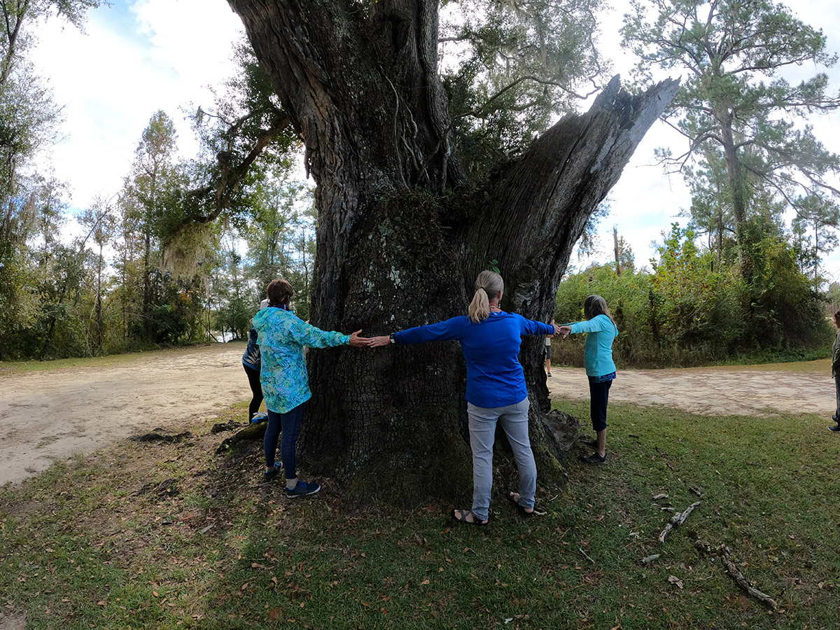
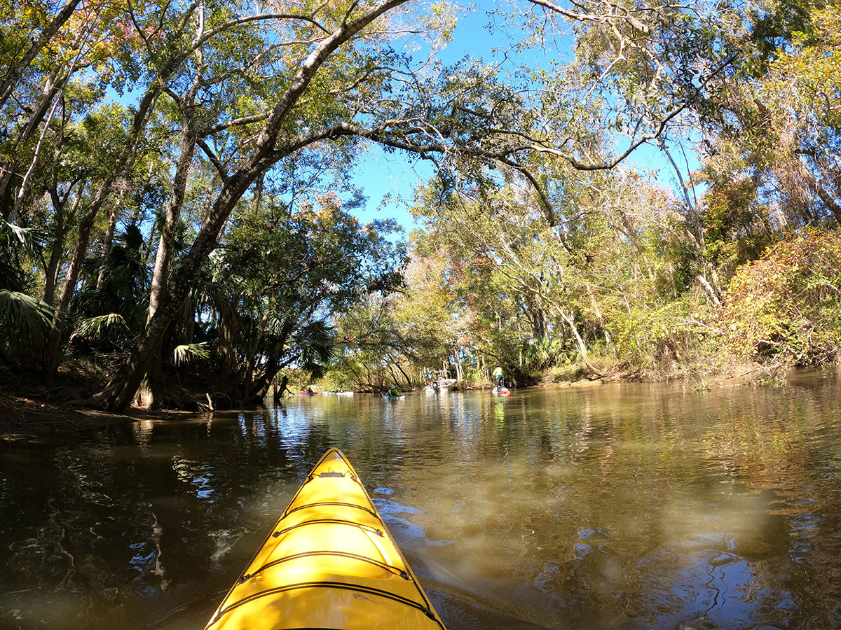
When you take a trip like RiverTrek more than once, you pass all the same places. Alum Bluff, Sand Mountain, Owl Creek. And yet, every RiverTrek is different. Weather this year forced us to postpone the trip for a month, and so we’re much deeper into the yellows, reds, and oranges of fall than usual. Some years the river is lower, in others it’s high and flowing fast. We can never know what animals we’ll see or hear, though a few sights and sounds are common on the river.
And then there are the people, both the paddlers and the ones we meet along the way.
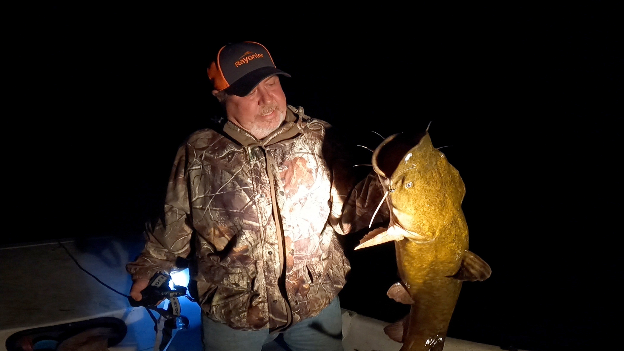
The two local fishermen in the boat were out checking their trot lines. Earlier, they’d caught some of the largest catfish I’ve ever seen up close. Two are invasive flathead catfish, the other a native blue. “Really good eating,” says Flint Norris, holding up a flathead weighing, he approximates, about fifteen pounds.
They invite us to a fish fry tomorrow night, but by then we’ll be over twenty miles away at Owl Creek. We talk about river stewardship, and RiverTrekker Cameron Barton finds she and Flint have a friend in common. We chat for ten or fifteen minutes, and head back to dry our feet by the fire. Another RiverTrek memory made.
What is RiverTrek?
Nine years ago, I was offered the opportunity to kayak down the entire Apalachicola and document it for the Ecology Blog. Back then the blog was called In the Grass, On the Reef, and it focused largely on salt marshes and oyster reefs. I would spend five days following fresh water as it made its way from Jim Woodruff Dam to Apalachicola Bay; there, the fresh meets the salt, creating the mix that gives us the world famous Apalachicola oysters.
Well, that was the idea. It turned out that in 2012, not so much fresh water flowed down to mix with salt, and the oyster fishery crashed. The world, and this blog, turned its eyes to Apalachicola Bay.
Over the course of those five days, though, I picked up story ideas beyond oysters that would keep me coming back for years.
RiverTrek is an annual fundraiser for Apalachicola Riverkeeper. A team of paddlers solicit donations from their communities, and when it’s done, they embark on a five day adventure down the river. They kayak for about twenty miles a day, watching the river change, from the tall bluffs in the north to the swamps and marshes of the river delta. RiverTrekkers camp by the water each night, and speakers teach them about the ecology, history, and culture of the river.
In this regard, it’s as much an outreach and education event as it is a fundraiser. That’s why media members like myself are invited along. The speakers, the experiences, and the situation around freshwater flows differ from year to year; for this reason, I returned to document parts of this trip over the years. This will be my first full RiverTrek since that 2012 trip.
Five Days on the Apalachicola
Each of those other stories had a specific focus. The river and bay dealing with drought and water management. Seeing the river through the eyes of my four-year-old son. Fossils showing us how the river has changed over tens of millions of years.
As for this year- I just want to show you the river. This is a taste of what it’s like to spend five days on the Apalachicola. There were some educational experiences along the way. We’ll pass by places I’ve covered over the years, and I will link to those stories so that you can further explore the area around the river if you wish.
Right now, we’re waking up early and throwing kayaks atop our cars, and making sure we’ve packed every bit of gear we’ll need. Next stop: Chattahoochee.
RiverTrek at a Glance
- The trip is roughly 107 miles. We put in at mile 105, and kayak almost 1.5 miles in and out of Owl Creek. On any given trip, we may explore sloughs and creeks (like Sutton Lake), adding a mile or two more to the total.
- Apalachicola Riverkeeper is a nonprofit that advocates for the Apalachicola River and Bay system. This includes lobbying and legal action. It also includes research and conservation work, such as cleanups and the slough restoration project.
- You can learn more about RiverTrek on the Apalachicola Riverkeeper web site.
- If you’re interested in planning your own Apalachicola River kayak camping trip, consult the Apalachicola Blueway Guide.
RiverTrek Day 1: Chattahoochee to a Sand Bar just North of Alum Bluff
Put in: Clyde Hopkins Park in Chattahoochee Mile 105
Take out: Sand Bar one mile north of Alum Bluff Mile 85
Miles paddled: 20
Clyde Hopkins Park is one mile south of Jim Woodruff Dam, which is the start of the Apalachicola River. The dam was built where the Flint and Chattahoochee Rivers meet at the Florida/ Georgia line. Behind it is Lake Seminole, and a system of dams and reservoirs managed by the Army Corps of Engineers (ACE).
The dam symbolizes the ACE management of the river’s freshwater flows, and it’s the first major landmark on the river. So it’s no surprise that a lot of RiverTrekkers paddle upstream for a closer look. Doug half jokingly calls after them, “You’re going the wrong way!”
It’s a large group this year. Thirteen paddlers raised funds. Janice Hindson joins them to scout the river for a possible Paddle Florida trip. I make fifteen. There are subgroups of people who already know each other, but as late as the third day, someone will occasionally lean in and ask, “Do you know everyone’s name yet?”
Five days is plenty of time to share at least one experience and/or one conversation with everyone.
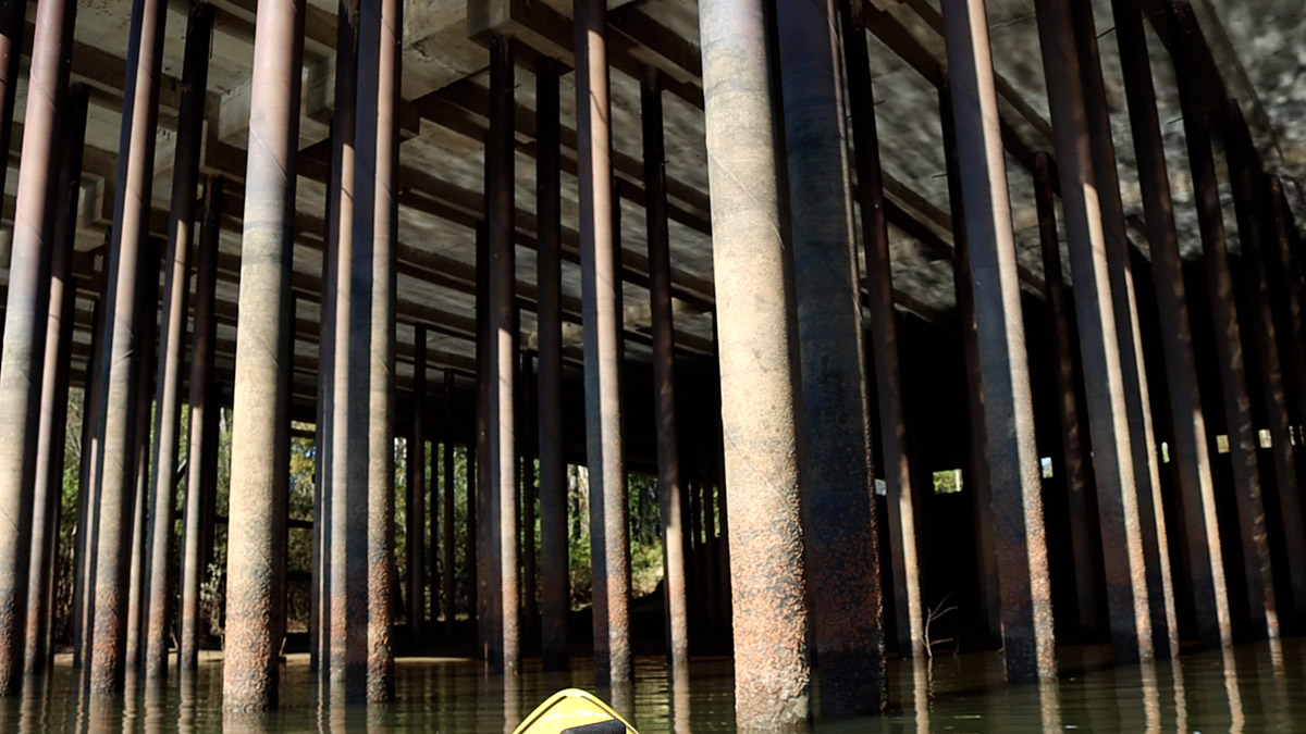
Mile 103 | Jackson County Port Authority
Day one towers above us. Here we see some of the largest man made structures we’ll see on this trip- a dam, bridges, and our current stop- as well as the heights of the Apalachicola Bluffs and Ravines region.
Cameron and Lee Rigby stop to admire the way the light dances on the rows of columns holding the Jackson County Port Authority high above us. The height of the platform equals the height of the barges that, decades ago, would pull up to it. We pass fields of training dikes meant to focus the flow of the river and speed the passage of the large boats. Deeper river channels also speed water, and so sand from the river bottom has enlarged many of the sand bars we pass.
These alterations have affected the flow of water into the floodplain, as we learned a couple of years ago in tupelo swamps near Estiffanulga. In a couple of days, we’ll see what Apalachicola Riverkeeper is doing to try and fix the problem.
Mile 95 | The Gregory House/ Torreya State Park
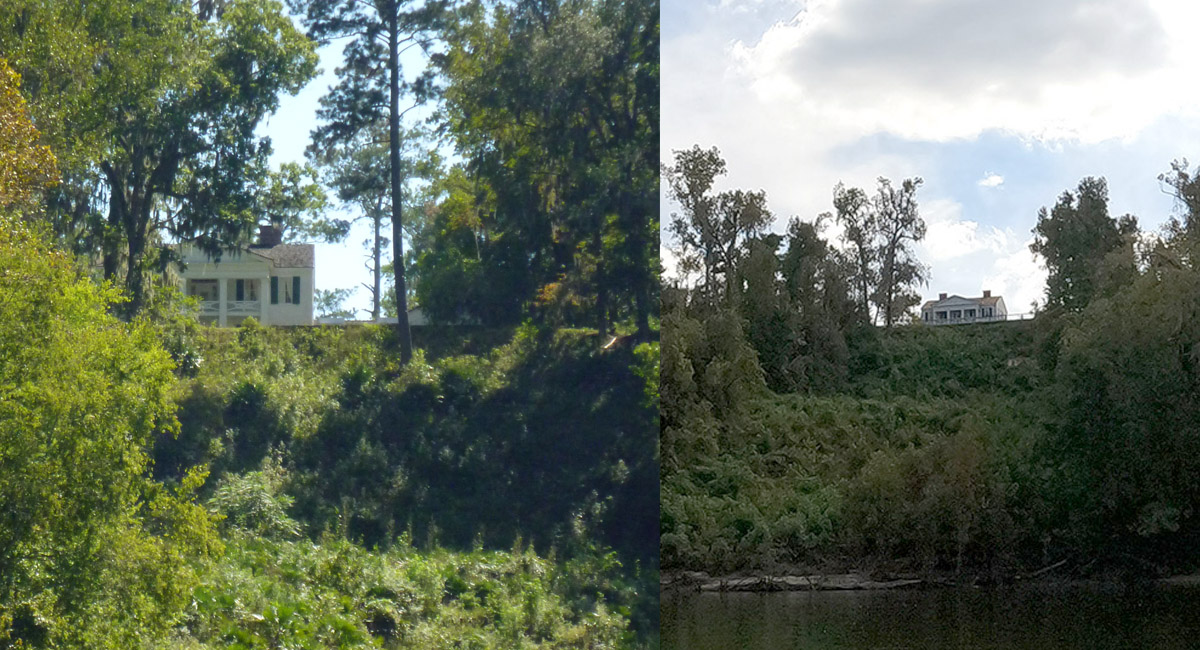
A couple of years ago, I went to Torreya State Park to check on its recovery after Hurricane Michael in 2018. Park manager Jason Vickery estimated that nearly every tree in the park was damaged in some way, and that’s not counting all the trees that were lost. This is my first time passing the park on the water in some years, and view has been altered.
Mile 94 | Ocheesee Landing
There are houseboats all along the river, and the largest concentration is by Ocheesee Landing. It’s a weekday, so it’s relatively quiet. On weekends, people come out to their floating fish/ hunting/ recreation camps, and we might see ATVs zipping about.
The Apalachicola Bluffs and Ravines region
On the east side of the river, we pass Torreya State Park and then The Nature Conservancy’s Apalachicola Bluffs and Ravines Preserve. Together, they protect slope forests, steephead ravines, and tall river bluffs. The steep slopes and deep, narrow ravines here are home to a high diversity of plant and animal life, making this a top biodiversity hotspot.
Mile 85 | Sand Bar
Ken Jones speeds ahead in the support boat to scout the sand bar across from Alum Bluff. In some years, enough of it is exposed to accommodate a large group. This year, we stay on a much larger sand bar to the north of the bluff.
I would have loved to camp across from the towering bluff, and shot video of it into the night. And yet, it’s a majestic way to start the morning, to kayak up to it.
Just as on my first RiverTrek, barred owls in this part of the river are vocal throughout the night. In fact, we hear them every night of the trip. And, while we’re gathered around the fire, we hear coyotes howling in the distance.
RiverTrek Day 2: Sand Bar North of Alum Bluff to Estiffanulga Bluff
Put in: Sand Bar one mile north of Alum Bluff Mile 85
Take out: Estiffanulga County Park Mile 63
Miles paddled: 22
Doug wants us on the water by 8:30 am every morning, and hopefully earlier every day after as we develop our routines. I take the camera out around 7:00 to film the fog on the river, which shrouds the bluff across from us. Killdeer peep at the far end of the sand bar, and mullet are jumping. They usually jump three times. The first jump I hear. The second jump I see and I quickly pan my camera. What you see in the video is that third jump.
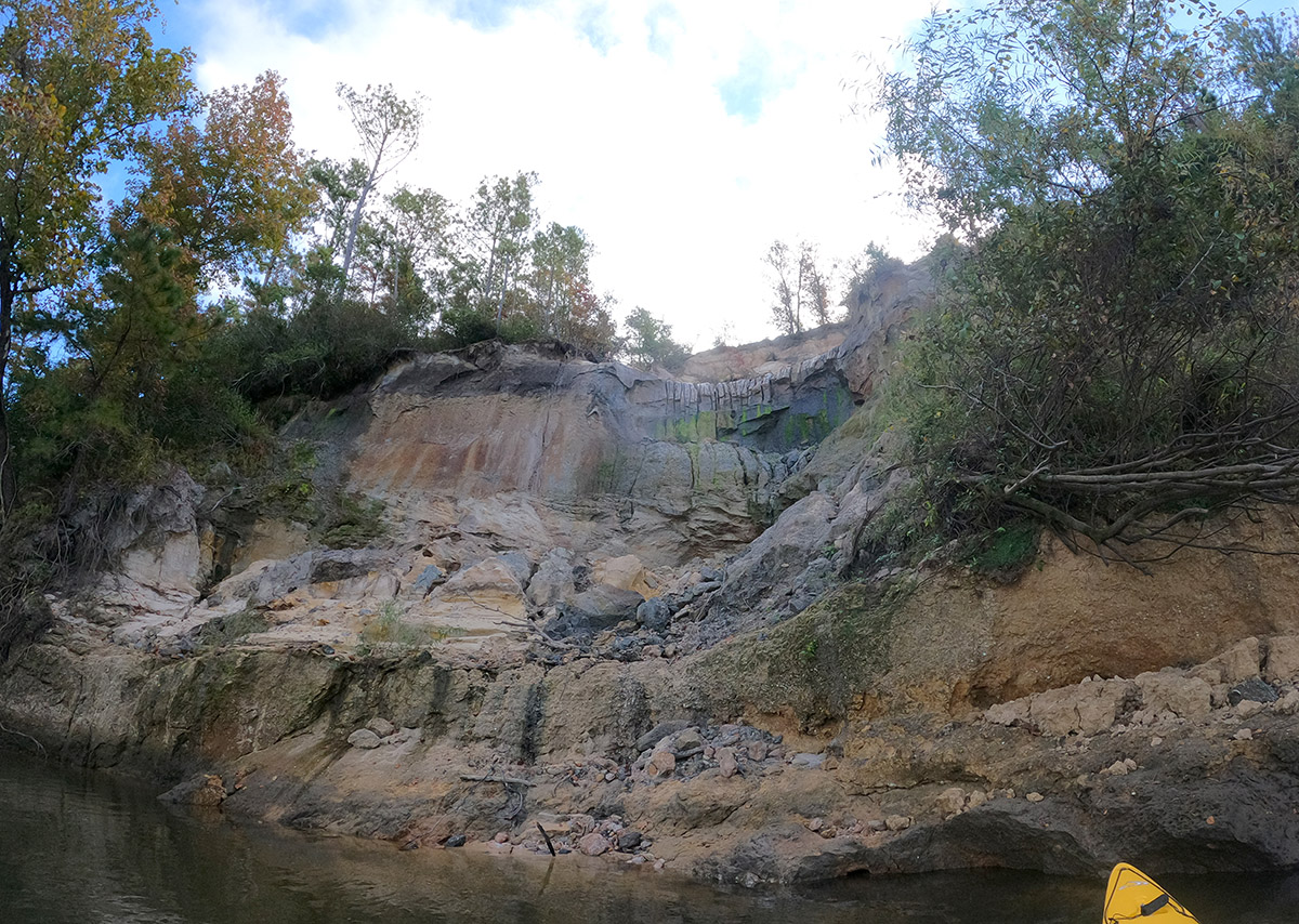
Mile 84 | Alum Bluff

I was talking with RiverTrek founder Earl Morrogh one time, and he said of Alum Bluff something along the lines of, “It’s not beautiful, but it is impressive.”
Alum Bluff is Florida’s largest geological outcropping, and its tallest river bluff. You can get to the top of it by hiking the Garden of Eden Trail, which I did last year with my family. The trail takes you in and out of steephead ravines and fire dependent sandhill habitat. We hiked it a couple of days after a prescribed burn, and I returned a few months later during the peak of wildflower season to see how this ecosystem responded to fire.
The RiverTrek team stops on the sand bar across from Alum Bluff to admire it. We notice canine tracks in the sand- were these the coyotes we heard last night?
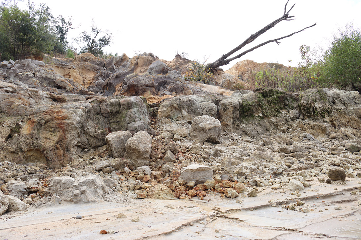
Doug mentioned that this the most experienced group of paddlers ever on a RiverTrek, and they like to keep moving. However, I did discuss ahead of time with Cameron Barton, a teacher at Tallahassee’s Maclay School, that we’d take our time here. Bob Ackerman and Joe Webb stay back with us to take a closer look.
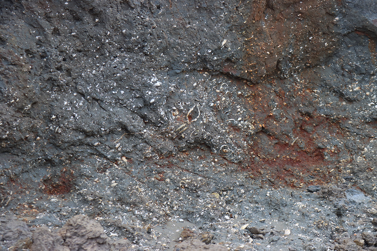
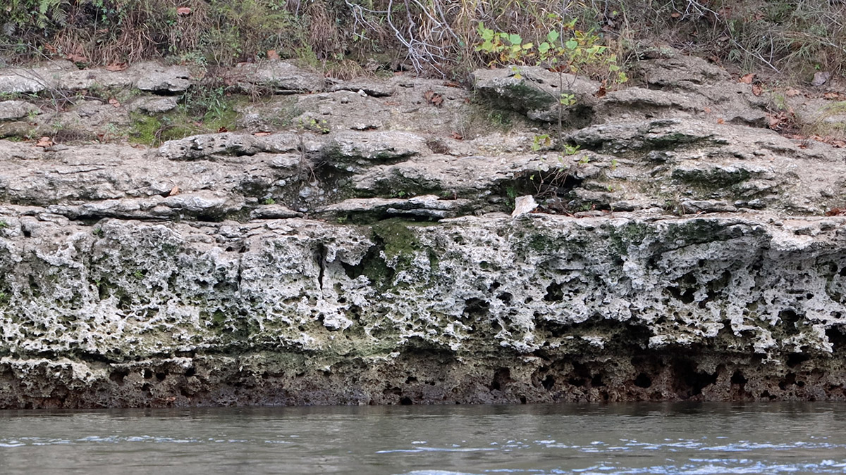
Cameron points out this rock face full of fossils. There is over 20 million years of this area’s story recorded in these fossils, telling tales of rising and falling sea levels. On the 2016 RiverTrek, Florida State Geologist Harley Means told us that story. This was once Apalachicola Bay, where enormous megalodon sharks hunted whales.
When you wrap your head around the time scale revealed in these rocks, it can make you feel small.
“Seeing the fossils in there,” Cameron says, “it just- it makes you realize that we’re a tiny little blip, and this beautiful place has been around for a really long time.
A Steephead Ravine in its Infancy
From the support boat, Ken Jones calls out that he sees the beginnings of a steephead ravine. Water is trickling down the rocky bluff, emanating from below the sand layer above it. Last year we learned about how the combination of deep sandhills and a hard rock layer by the river creates trickles that, over time, carve out steepheads. We also looked at some of the rare flora and fauna found in them. And a few years ago, we climbed into a steephead ravine with Dr. Bruce Means in search of the Apalachicola dusky salamander.
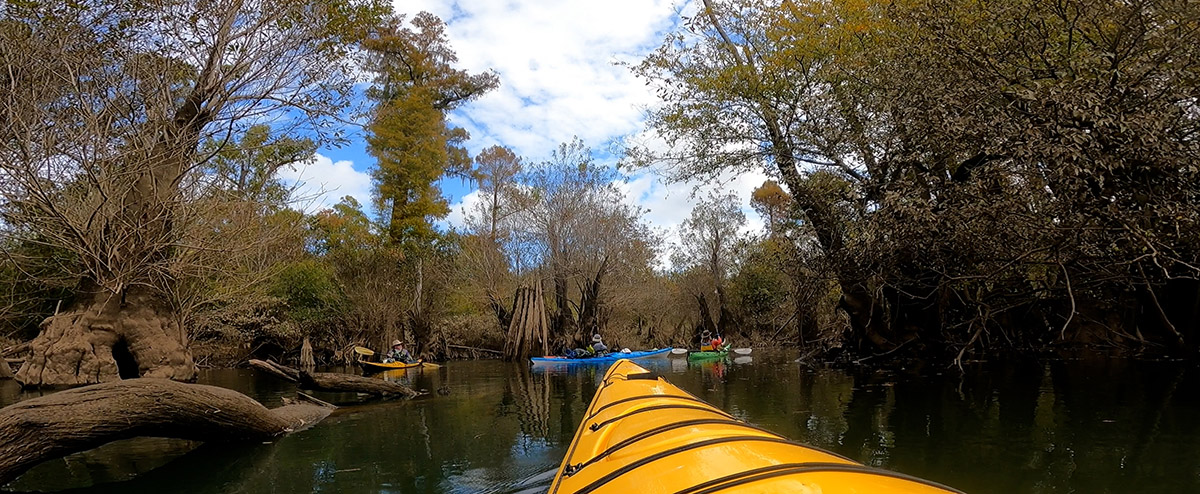
Mile 78 | Sutton Lake and Bayou
Just south of Alum Bluff, we pass Bristol Bluff. That’s the end of the Apalachicola Bluffs and Ravines. The land flattens out, and more channels branch out into the floodplain, and into extensive networks of cypress/ tupelo swamps.
Sutton Lake is one of my favorites. We pass up Sutton Creek, which is lined with houseboats. Cameron and Kim Miller see a nice sized gator on a porch, and while Kim drifts closer to take a photo, she spooks the gator, and it dives in and swims under her kayak. The sad part is that I was too far behind her, and have no footage of this.
Sutton Lake has some of the larger cypress and tupelo trees in the Apalachicola basin. They likely escaped logging because of their hollow trunks. Depending on the water level, and how much time you want to take threading between cypress buttresses, you can kayak pretty far into the bayou. We didn’t this year, but we did in a wet 2013.
Rain in the Forecast
This is the fourth RiverTrek I’ve paddled some part of, and I’ve never yet felt a single drop of rain. We kayak under this sky, doing our best to beat the rain to Estiffanulga. I’ll be honest- this has been a hard day for me. I haven’t kayaked these distances in years, and the other paddlers are serious. Whenever I stop to shoot video of anything I find interesting, I struggle to catch back up.
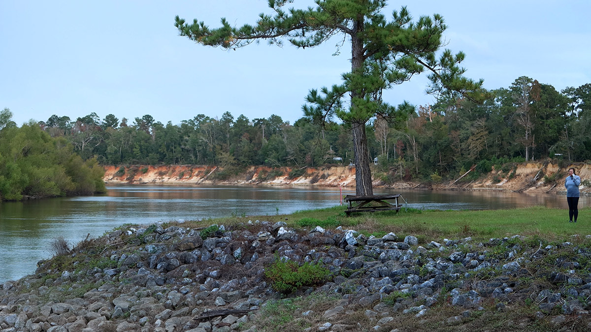
Mile 63 | Estiffanulga County Park
When we get to Estiffanulga, however, we’ve already traveled 42 miles. Something clicks, and tomorrow is easier. After dinner, Doug talks about hiking the Appalachian Trail, and how it takes a couple of days to break in. At some point while we were racing storms, my arms broke in.
The sandbar across the river is too small for us, so we carry our loaded kayaks up the ramp to the top of Estiffanulga Bluff. I mentioned the land flattening almost twenty miles ago, but here’s one more good sized bluff south of the Cody Escarpment.
Dinner is a delicious paella and coleslaw brought by veteran ‘Trekkers Mike Mendez and Katie McCormick. It’s nice to see a couple more people with whom I’ve shared this adventure.
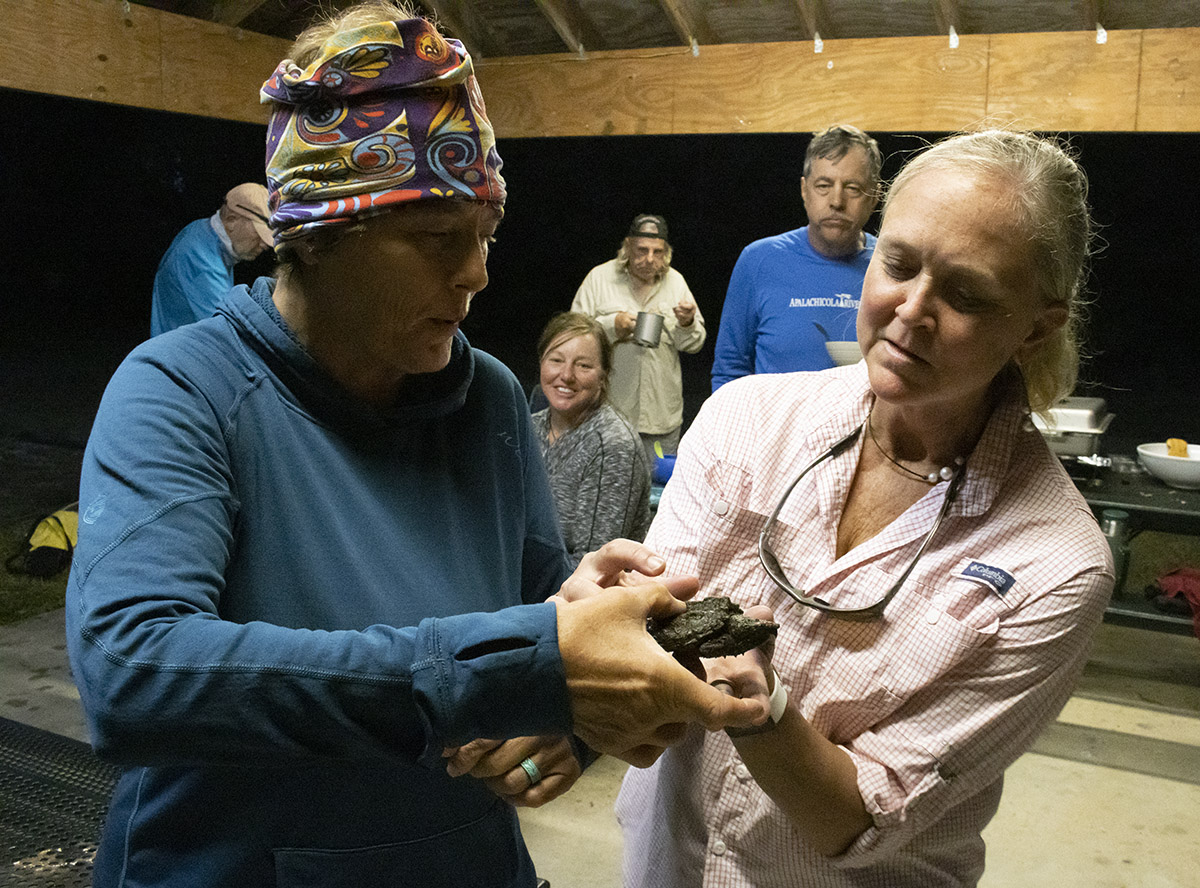
“The Reptile Show”
Florida Fish and Wildlife biologist Pierson Hill rounded up reptiles from around the area to show us tonight. First is a little baby alligator snapping turtle:
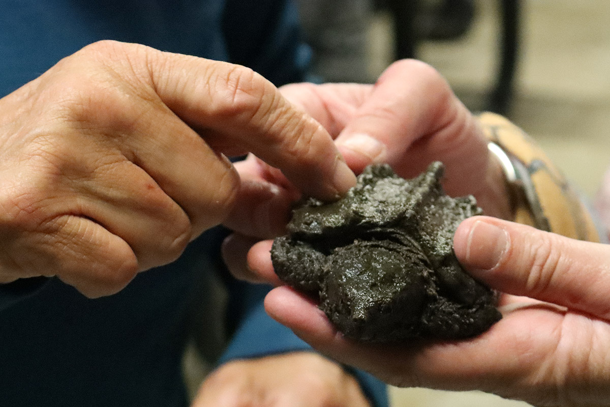
Here’s an animal I’d like to get footage of in the wild, as an adult. But, you know, zoomed in from a short distance.
Next, Pierson takes out a couple of snakes. Wayne Douchkoff faces a long time fear by handling a couple of them- the nonvenomous ones.
“I recognize my fears, and I don’t want to die with any fears.” Wayne says. “I took up skydiving a few years ago because I was afraid of heights. So it seemed only logical if there was an opportunity to handle snakes that I should try handling a snake.”
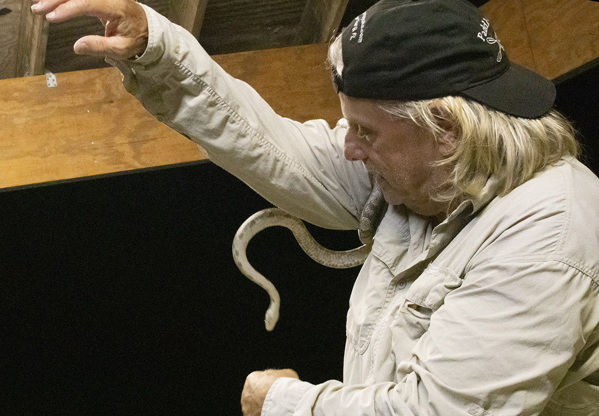
Wayne spent a good deal of time with the second snake, a white oak snake (Elaphe obsoleta spoloides), as you can see in the video. Pierson next takes out a baby alligator, and then surprises everyone by tossing an eastern diamondback rattlesnake on the floor before us.
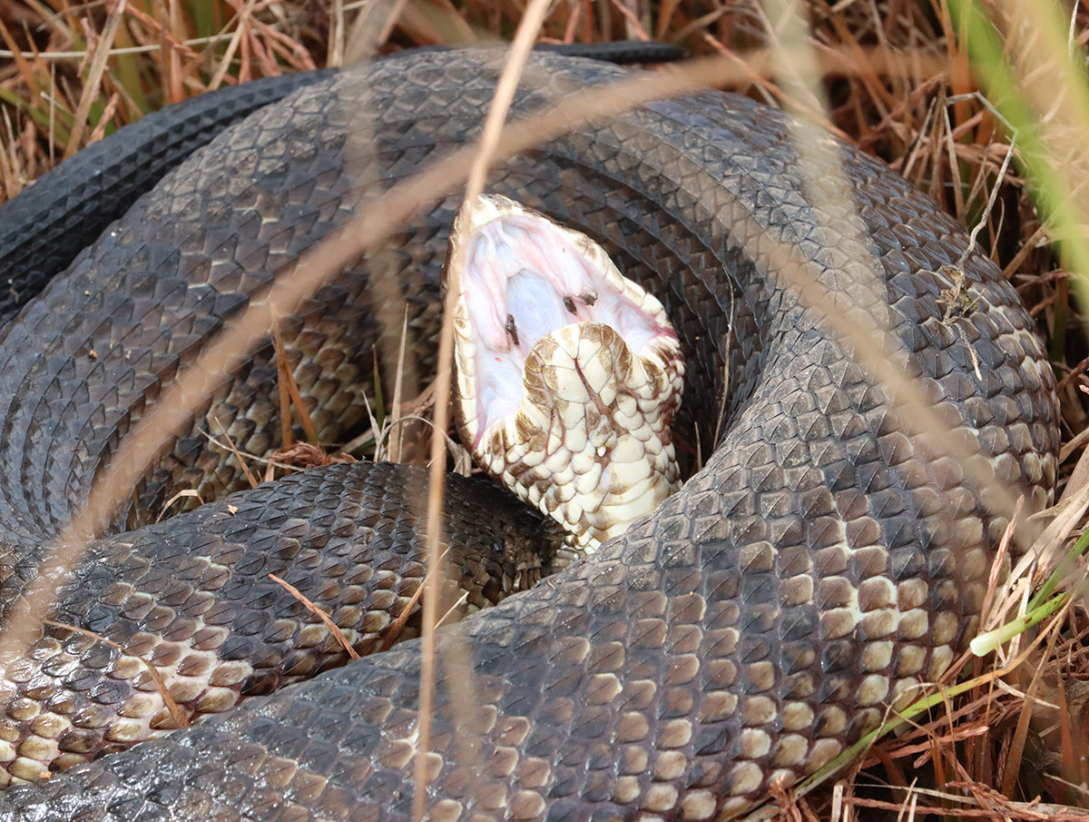
Pierson found the rattler injured on the road, telling us its damaged mouth would have a hard time biting us. I’m told that on last year’s RiverTrek, he tossed a cottonmouth on the floor and it slithered by everyone’s feet. He maintains that this is a docile animal that only strikes when provoked.
A few weeks later, I join Pierson just south of here in search of frosted flatwoods salamanders. He predicted we’d see at least one cottonmouth in the wetlands where the salamanders lay their eggs, and he was right.
No campfire tonight, but after Pierson leaves, a few of stay up (until 9 pm!) telling jokes as it starts to rain. One or two of us remember hatches left open on a kayak or rain flies not put on tents, and rush out from the pavilion.
RiverTrek Day 3: Estiffanulga to a Sand Bar North of Wewahitchka
Put in: Estiffanulga County Park Mile 63
Take out: Sand Bar north of Wewahitchka Mile 45
Miles paddled: 18
On a previous RiverTrek, paddler Chris Robertson said that day three is where everything starts to click. As he said then, you’ve now spent enough time away from your daily concerns, and this frees you. You’ve spent two days on the water, and slept two days by it, and the river is your reality now.
Also, there aren’t any major landmarks to see or explore, so you just paddle.
We continue to stop and snack on sand bars, and so this is a good time to talk about these conveniently placed rest stops.
Ken Jones, our support boat driver, is also the project manager for Apalachicola Riverkeeper’s slough restoration project. We’ll visit their restoration sites over the next couple of days. But that story is one that starts, in part, here on the river’s sand bars.
Sand Bars and Sloughs
Earlier we discussed how a deeper river channel would move water more quickly. The Army Corps of Engineers dumped the sand dredged from the river bottom on point bars, the natural sand bars that form on the inside curves of the river.
From what Ken tells me, the ACE relied on the river to carry the excess mounds of sand from the bars:
“When the high waters would come, they would come out there with bulldozers and they would push the sand back into the river. And the higher flow from the river, theoretically, would carry the sand downstream.” It did carry it downstream, but not all the way out of the river system.
“Where we have these sloughs, though, the water from the Apalachicola is moving into the sloughs, the water slows down, the sand drops out. And that’s how we get these sloughs all clogged up. It’s just the extra sand that’s in the system… mostly because of dredging that has created these issues.”
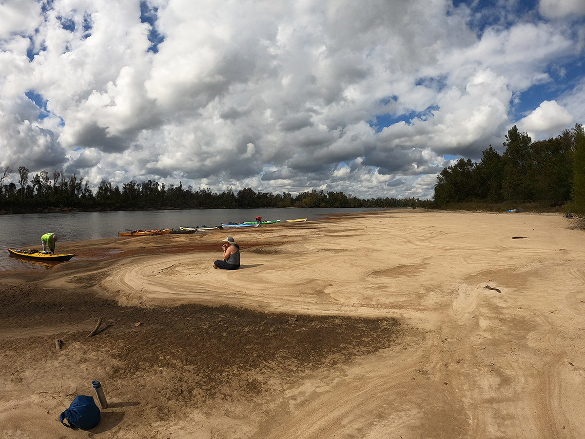
Mile 45 | Sand Bar north of Wewahitchka
This trip was rescheduled from October, conflicting with a previously planned trip for Riverkeeper Georgia Ackerman. She couldn’t join us, but she did make and send several pots of a tasty vegetarian gumbo for tonight’s dinner.
Tonight, we meet the two fishermen from the opening scene in this blog post. The invasive flathead catfish they catch aren’t from as far away as what we usually call invasive species. The Asian clams (Corbicula fluminea) we see at the edges of sand bars, for instance, are from half a world away.

Flathead catfish are native to the Mississippi, Missouri, and Ohio Rivers. They are such, as Flint says, good eating, that the fish have been introduced into waterways all over the country. This placed a large, hungry predator into new ecosystems, affecting fish populations in the flathead’s nonnative waters, where they are now considered invasive.
RiverTrek Day 4: Sand Bar north of Wewahitchka to Owl Creek
Put in: Sand Bar north of Wewahitchka Mile 45
Take out: Hickory Landing in Owl Creek Mile 22 +1.5 miles up the creek
Miles paddled: 24.5 miles
I’m up early to film sand bar footage. I once again catch that third mullet jump, and at the instant it splashes into the river, I hear a gun shot. Soon after, a boat speeds by with hunting dogs in the bow. We’ll hear gunshots echo from the forests surrounding the river throughout the day, and we’ll pass many more boats today and tomorrow than on the first three days.

Mile 36 | Sand Mountain
It’s a bittersweet return to Sand Mountain for me. Most RiverTrekkers look forward to climbing up and, a little winded, looking down at the river. Last time I was here, though, I was with my then four-year old son Max. He’d been wanting to climb it ever since seeing the 2012 RiverTrek video, which I’d show him as a one-year old.
I feel guilty, yes, but I’ve still been looking forward to this. I’ll be back here with Max and his little brother one day.
There is a well worn walkway up to the top of Sand Mountain. You do your best to keep moving as you sink into the deep sand. Four-year old Max weighed next to nothing, and practically floated up and down at will. I do not weigh next to nothing.
I park my kayak on the other side of the “mountain” from this walkway. As a few of us walk across, we enter a vegetated area. Whitney Sanford looks up and says, “this would be kind of easy right here.” The sand is held together by roots all the way up this swath, and not so loose as to let us sink in. It’s a little more like climbing than the usual sand wading.
I won’t say it was easy, not for me anyway, but I was less winded than in the other years I’ve been here.
Under Sand Mountain: Corley Slough
According to Ken Jones, Sand Mountain was once an oxbow in the river. We passed another oxbow a few miles back, just south of the sand bar where we camped:
I used the time rewind feature on Google Earth, and until as recently as 2017, that island was connected to the land to the west. This is an oxbow, a process whereby the river straightens itself out. But you can see how a barge would have a hard time navigating that bend.
“And so what the Corps did was they cut,” Ken says of the Sand Mountain oxbow, “they cut the the narrow section of the of the meander away to straighten the river and allow the barges to be able to go through there. And that’s a natural process. It just happens over many, many years.”
The removal left a large, cleared area next to the river. It was a convenient place to dump sand. It was also the location of Corley Slough, a place where the river flowed into the floodplain between the Apalachicola and Chipola rivers.
Douglas Slough
Not all sloughs in the river have been blocked as thoroughly as Corley Slough, but as we talked about earlier, quite a lot of them have a certain amount of blockage.
We kayak into Douglas Slough, which has a narrow entrance, the current flowing hard past it. As one of the less skilled paddlers on the trip, I get a face full of willow on the way in.
We gather around and listen to Ken talk about Apalachicola Riverkeeper’s project to restore this and two other sloughs. Sloughs, especially here in the southern half of the river, connect to networks of cypress/ tupelo swamps. In the video, Lee Rigby expresses his love of tupelo honey, and this is where it comes from. These swamps are also important foraging grounds for the fish of the river system, and a major source of nutrients for the Apalachicola Bay estuary.
Riverkeeper has identified three sloughs which, when cleared of excess sand, would restore the largest amount of connectivity to the system. I visited Ken and his team earlier in the year, and you can get more details on their project by reading that story.
Mile 22 | Owl Creek
For a long time now, I’ve been meaning to camp on Owl Creek with my family, and spend time exploring it and the smaller creeks that feed into it. The creek is lined with mile after mile of ogeechee tupelo trees. Their leaves are golden now, and will soon drop into the water. Because of the gnarly way that tupelo branches arch, their bare branches can appear skeletal, a spectacular effect in a swamp full of them.
The leaves that fall will decompose into muck and add nutrients into the river and bay system.
We passed the last of the point bars a few miles after Sand Mountain. There are less breaks on this part of the river, and more and more waterways flowing into and out from the river.
Dinner tonight is a shrimp boil catered by Riverkeeper volunteers Jeff Smith, Roy Ogles, Cameron Baxley and Cait Snyder. Desserts were made by Lynn Wilder, who I have to thank, profusely, for lending me the kayak you see in every other shot in the video.
Hickory Landing is 1.5 miles from the river. Once we carry our kayaks up the ramp, we’re in a pine upland. Tonight, we sleep beneath the pines.
RiverTrek Day 5: Owl Creek to Apalachicola
Put in: Hickory Landing in Owl Creek Mile 22 +1.5 miles up the creek
Take out: Battery Park in Apalachicola Mile 0
Miles paddled: 23.5 miles
On the way out of Owl Creek, I pass through an island of tupelo trees just off of the boat ramp. Joe Webb told me how he made this trip last year with a couple of friends, only they kayaked 30+ miles a day for the first two days, arriving at Owl Creek on the third night and spending all of the fourth day here. Still a five day trip, just broken down differently.
Mile 14 | East River
There’s a sand spoil area across from East River where we eat half of our lunch after two hours of paddling. It’s not quite lunch time, but this is one of two areas we can stop before Apalachicola. In 2012, we did find a little mucky clearing in the floodplain for lunch, which we shared with a cottonmouth. This may be too large a group for that.
After half-lunch, we paddle across into East River, the restoration site I visited earlier this year. This is the northernmost channel of the river delta, forming its outer boundary and draining into East Bay, an important nursery for commercial seafood species. Opening this up will allow more fresh water, and the nutrients it picks up as it passes through the floodplain, into the bay.
Mile 0 | Apalachicola!
According to Doug, the most veteran of all RiverTrekkers, this is the easiest last day of them all. The wind is at our back, and the tide is going out- the exact opposite of 2012. Nothing much to report other than that, which is good. We’re full speed ahead here, and we want to keep together as we’re passing so many side channels. I’d love to have had the dslr out of the dry bag to get some shots of the juvenile little blue herons roosting by the water.
Right where the Jackson River meets the Apalachicola, we stop at another sand spoil and eat the second part of our lunch. We’re about five or six miles from Apalachicola, and we are to stay as close as possible for the rest of the trip.
The John Gorrie Bridge is the last major landmark we see, though it takes us over an hour to reach it. I’m looking forward to seeing my wife and kids, and I’m a little tired of paddling, but Lee’s idea intrigues me:
“Last time we got to Apalachicola, I just felt like, man, I just want to keep going to St. George!”
River-and-BayTrek? Maybe next year?