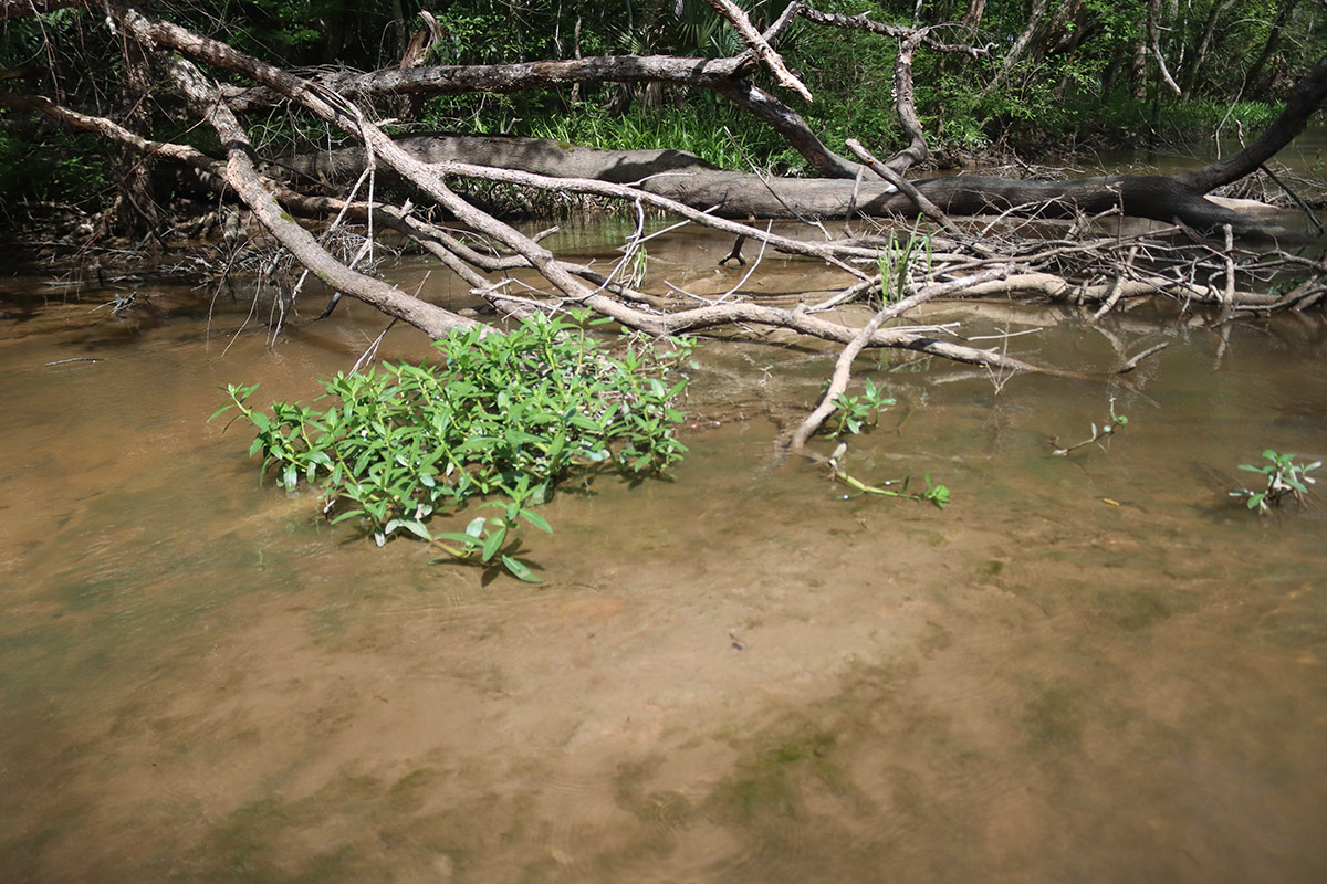
“The head of the East River right ahead of us,” Says Dan Tonsmeire. We’re creeping towards the mouth of the slough, which is mostly hidden behind a fallen willow tree. Dan, the retired Apalachicola Riverkeeper, is shuttling folks to a work site here for a Riverkeeper project.
“The willows and the grass here have built up on this kind of berm,” says Ken Jones, “that has migrated off the side and is starting to close- watch your head.” I duck under a willow branch as we enter the slough. Ken continues- “that’s closing this [slough] off. You can see all the sediment on this sort of plateau.”

Ken’s an engineer managing a slough restoration project with the Riverkeeper. He’s here today to look at the sediment at the mouth of the East River, and for a couple of miles upstream. Other engineers, decades ago, sent river sand onto the muck typically found in places like this. Those Army Corps of Engineers dredging projects have somewhat clogged the mouths of sloughs all along the river, cutting off connections to wetlands. Or, in this case, a major connection between the river and Apalachicola Bay.
Ken is pointing out that here, willows and reeds have taken root in the sediments clogging the opening. Their roots, in turn, gather more sediment around them. Plant roots have always played an important role in building and maintaining land; here, they’re likely extending a manmade mass.
Apalachicola Riverkeeper obtained enough funding to open up three such blockages along the river. They’re not going to come in and start digging right away; first, they need to figure out one thing- what should be the shape of this slough?

Sloughs and Swamps: the Lifeblood of the Apalachicola (a brief recap)
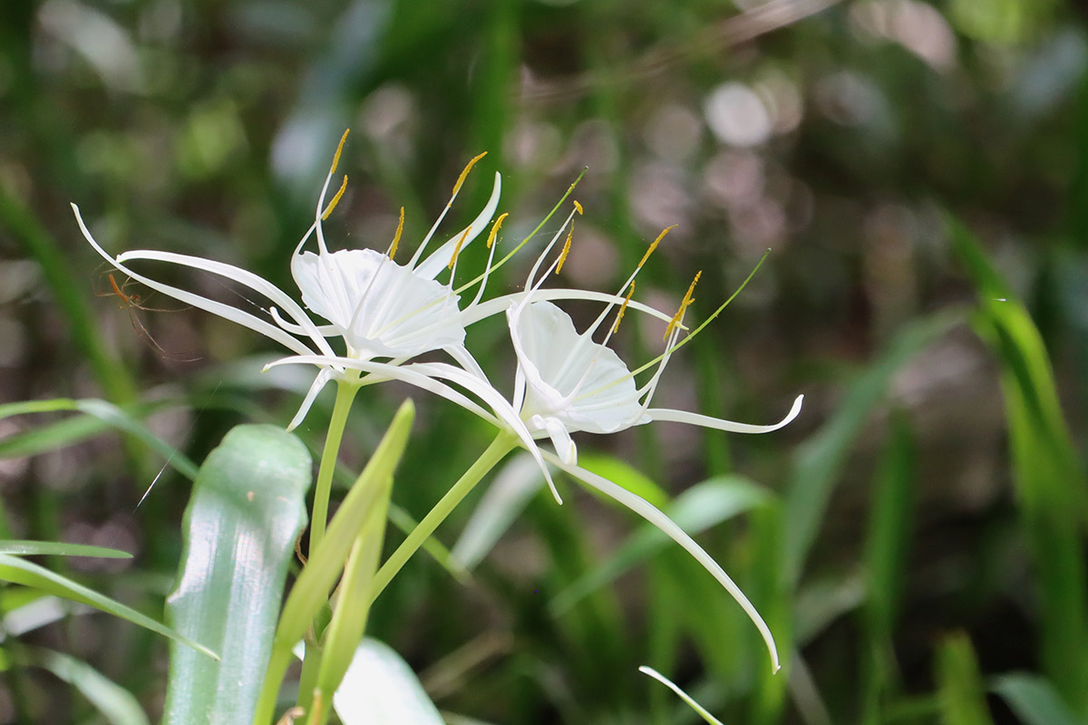
I’ve covered the sloughs and swamps of the Apalachicola for years. They’re a favorite topic because, as Dan says in the video, there are over 300 miles of these channels along the 106.5 miles of the river. They’re fun to kayak, because the nature of the waterways changes so much depending on the water level of the river. I once kayaked the River Styx in low water, squeaking through narrow openings between trees. A couple of years later, I talked to someone who went out when the slough was so flooded, he lost track of the channel and wandered the floodplain in search of a way back.
If you’ve read our posts on the floodplain, I don’t want to be repetitive. However, if you missed those stories or need a quick refresher, here it is.
One key is the variability of the water level. At low water, swamps can become partially or fully disconnected from the main river channel. Leaves decompose on the ground, forming a nutrient rich sludge. Then, the river floods, and that sludge runs down the river and into Apalachicola Bay. Those nutrients feed oysters and every other animal at the bottom of the estuary food web.
It’s a little different in the lower river. Here, the main river channel branches out repeatedly, looking kind of like a shower head on the map. All of the “nozzles” of the delta feed into different places in the bay, not as one large stream, but as a multitude of flows into marsh and oyster reef ecosystems.
The East River feeds into East Bay. “East Bay,” Dan says, “is the primary nursery area for Apalachicola Bay.”
Clean River Sand in the East River
As Dan points out, the East River is one of the first waterways to split from the main river and form the delta. If you zoom into the Google map above, you can follow the East River from East Bay back to the river. You’ll see how far it snakes through the floodplain, and how it’s the easternmost of the large distributaries feeding East Bay. Opening it further up would bring more nutrient loaded fresh water into the nursery.
But how much do they need to open it up?
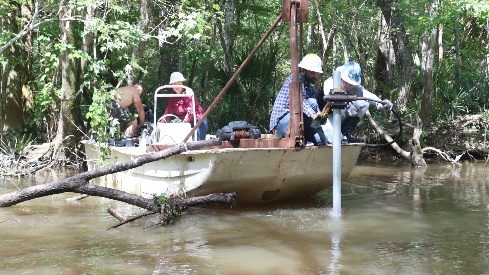
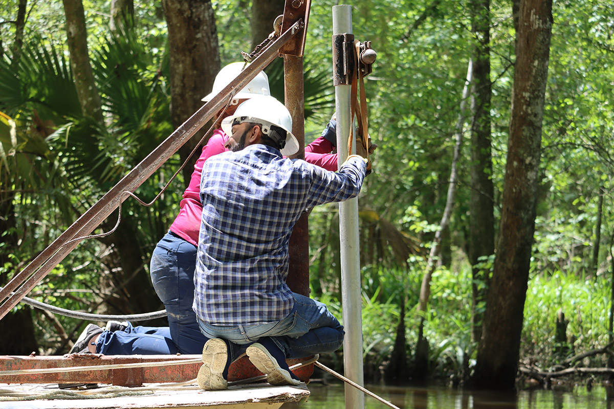
Ken and his team of University of Florida graduate students are trying to find the original shape of the channel. They first have to figure out how much river sand was pushed into the slough. To accomplish this, they’re taking core samples from various points along East River; basically, pushing tubes into the slough and taking out several feet of sediment.
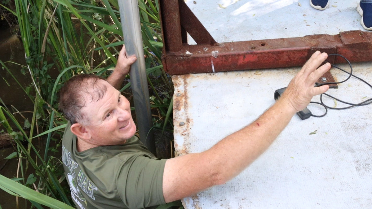
The first sampling site on their list sits under a bed of reeds here at the mouth. Oysterman Shannon Hartsfield pushes his boat into the reeds, tying the stern to an overhanging tree. Since the crash of the Apalachicola Bay oyster fishery in 2012, Shannon has helped with various research and restoration projects in the river and bay.
Two of the grad students, Lauren Williams and Love Kumar, work one of the tall tubes between the reeds and into the bottom here. The tube is attached to a vibracore motor, which allows the tube to penetrate the sediment by vibrating it.
What’s in the Core?
Once the vibracore gets shaking, the tube sinks in fast. They cap the top. Shannon jumps into the water and shimmies the core out, quickly slipping on a cap at the bottom so as not to lose the sample.
They pull the tube onto the cull board of Shannon’s boat. A cull board is where an oysterman will knock an clumps of oysters apart, throwing back the smaller oysters and loose shells.
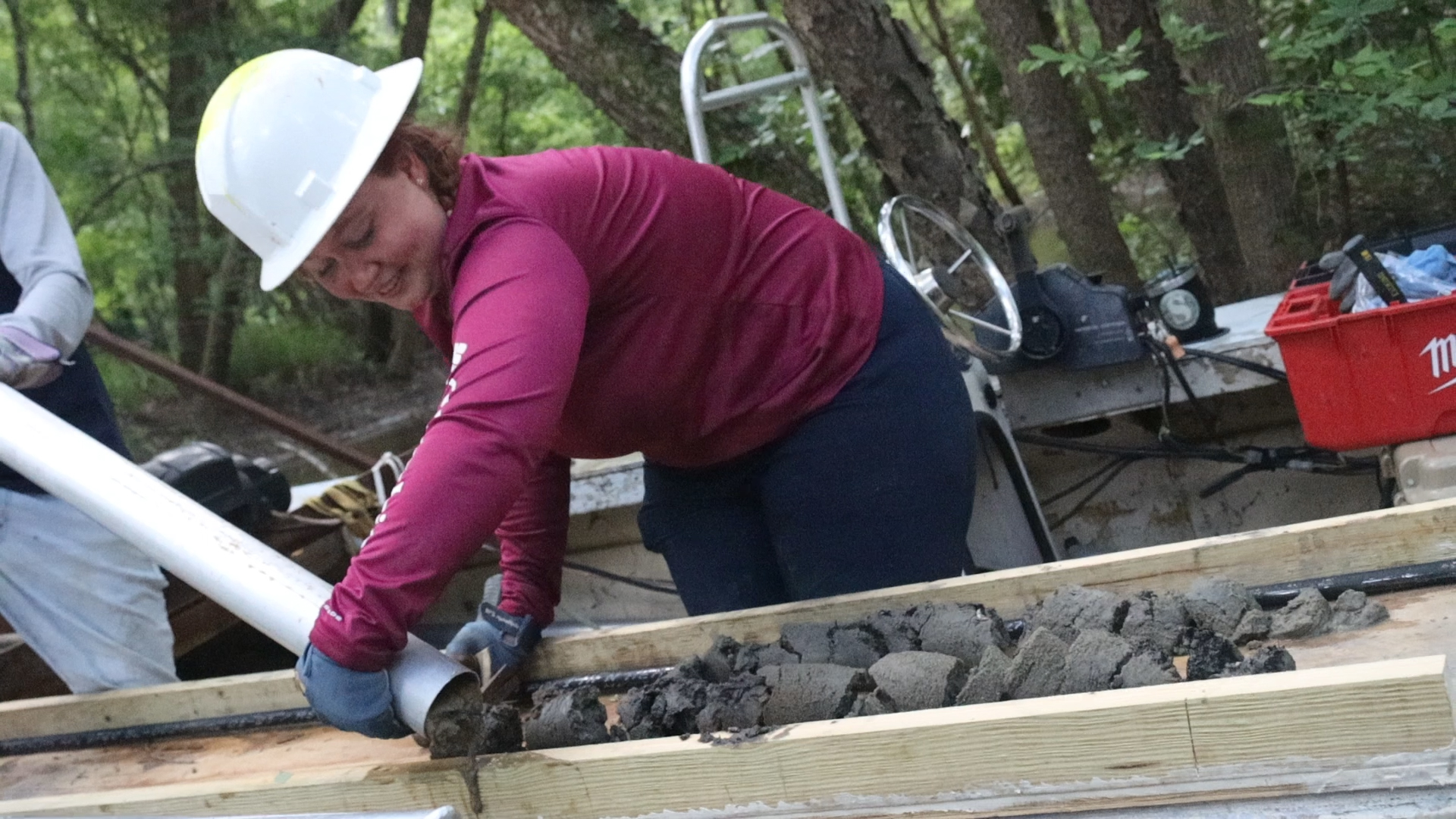
Lauren taps the tube with a hammer, and the core comes out in little discs.
“We have a total amount of 4′ 4″ of sediment.” She says after taking a tape measure to it. About two thirds of the sample looks like lighter colored sand than the rest. She measures each. “And that puts us at 2′ 11″ of sand. And it’s coarse. Quartz, mica- large flecks.”
The darker sediment is finer sand. The core, which is seven and a half feet long, didn’t reach the original bottom.

As we covered in our segment on soil earlier this year, sand is the largest grained soil type. The Apalachicola is lined with sand that flowed from as far away as the Appalachian Mountains, and that washes from sandhills along the river. The muck in the slough is smaller grained silt mixed with organic matter- decomposing leaves and dead plants.
The True Shape of the East River
Before taking the sample, they measured water depth. Adding the amount of sand to the depth of the water, they know how far below lies the natural bottom.
They’ll repeat this process for two miles up the East River, sampling along the center and at the edges of the channel. Ken and his team will then enter this data into a 3D bathymetric map of the slough. “And it’ll help guide us on how much material to excavate.”
One goal of the core samples is to determine the center of flow in the channel.
“We’ve run a line down the center of the channel, and we know what the bottom is down the center of that channel.” He says. “And we also ran another line down the deepest portion of the channel, which is the thalweg. And so, the presumption being that the deepest portion is where the channel is trying to return to its natural condition.”
Rather than excavate all of the sand, they plan to dig along the thalweg, “to let it start to function as it would naturally.” Ken says. “And it’ll start to establish its own hydrography after that.”
In other words, once water flows through that deeper center channel, it will continue to widen and find the contours that best suit it.
Data and the Apalachicola
These data points will help them create more accurate models of the Apalachicola floodplain, models that other researchers can use to figure out how the system is likely to respond to low flows that have become common in recent decades.
I recently wrote about the Apalachicola/ Chattahoochee/ Flint Stakeholders plan to share water sustainably in this watershed. The plan used models of the floodplain along with data collected by retired USGS researcher Helen Light.
Helen surveyed the floodplain from 1978 through 2006. During that time, she found, the floodplain had lost over 4 million trees. That included a 40% loss of tupelo trees. The cause, she determined, was the Army Corps of Engineers management of flows from the Woodruff Dam, along with alterations to the river that made it deeper. The sand removed from the river channel is what’s building up in the mouths of sloughs today.
Helen Light’s research was also used to help determine which sloughs to restore.
Ken’s team will share their data with the Apalachicola Bay System Initiative (ABSI). ABSI is based at the FSU Coastal and Marine Lab, and hopes to revive the Apalachicola oyster fishery. They’re conducting experiments over the next five years to the best way to get oysters to grow again, even when water isn’t abundant.
Shannon’s Story
Data and long term studies can tell us a lot. But so can the people who’ve lived their lives along the river.
Shannon Hartsfield is a fourth generation Apalachicola oysterman. In the late 1980s, he also dove for deadhead cypress and pine, trees lost in the river after they were logged. Back then, he says, the river was much darker.
“It was black, dark water… a dive light didn’t do no good diving in this river.” He says. “It was all touchy-feel. I’ve had a few hairy-scary situations. I’ve been on top of some big boys, maybe ten or twelve foot.”
Alligators aren’t the only animals in the river that bite.
“I must have been nineteen years old, and I stuck my hand in a big old catfish’s mouth. And I didn’t even have no gloves on back then…. anyway, you know how the mouth of a catfish is like sandpaper… I snatched my hand out and skinned both sides of it.”
Shannon says the river is much clearer now. It’s less scary, but maybe not in a good way for the river system.
“You can dive in the river now with a dive light. And you have visibility to twenty, twenty four inches.” The river bottom has changed as well. “It’s all sand now. It used to be, the bottom was all mud.”
“So the character of the river has changed,” says Ken Jones. “It used to be silts and clays and a lot of organics. And now we’re seeing clean, coarse sand.”
Apalachicola Riverkeeper hopes that by restoring connections between the river and floodplain, more of that swamp muck will return to the river, and feed the bay.