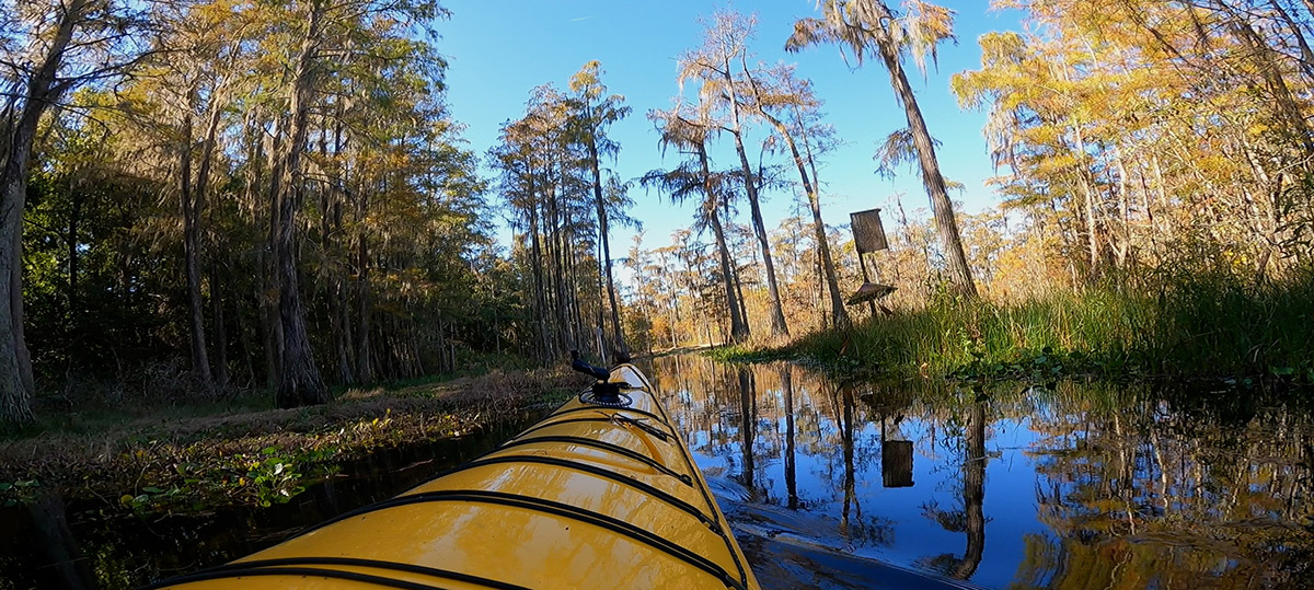
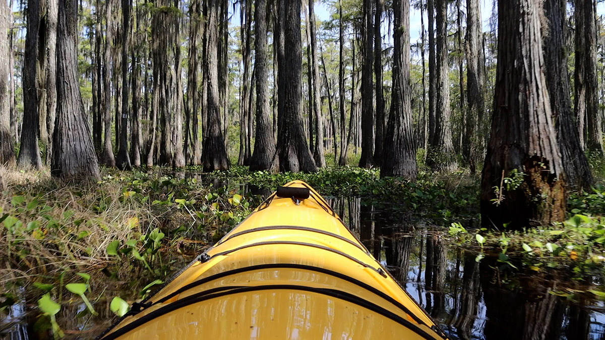
I’m smack dab in the middle of a lake, and I’m stuck in grass. It’s not uncommon to kayak through any Tallahassee lake and have to find a path through grasses, lily pads, and cypress stands. And of course our lakes get low. Lower Lake Lafayette, though, is easily the least open of our large Red Hills lakes. It feels much more like a swamp than a lake.
Leon County says as much in its water quality report for the lake: “Although pockets of open water are scattered throughout Lower Lake Lafayette, the ‘lake’ functions more like a wetland.”
You can see this in the map below. Google labels the lake’s open water “Lake Lafayette.” This is the area you see from the earthen dam separating it from Piney Z. Lake- where you cross when walking or cycling between JR Alford Greenway and Lafayette Heritage Trail Park.
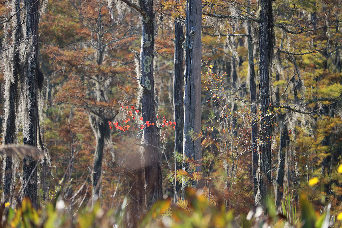
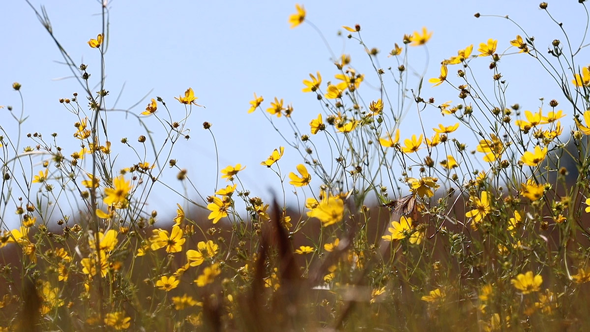
Scanning right (east) from that open water in satellite view, you can see some blue channels and scattered pools of water in all that green. Much of the lake is under the cover of cypress trees, grass, or other vegetation. Kayaking in the fall, I’m seeing meadows of beggarticks and goldenrod right on the lake. And yes, I’m also pushing my way through thin channels in the grass.
It does make for a different kind of paddling experience. Much of the trail is like kayaking a small creek. And then, it opens up, and here under the sun, you’re surrounded by wildflowers and pollinators. Next, you’re threading your way beneath a cypress canopy. Personally, I like the changing scenery and moving between tight and open spaces. I like being on a trail that doesn’t always feel like a trail.
Lafayette Passage Paddling Trail at a Glance
There are two public access points to the Lafayette Passage Paddling Trail.
- Lafayette Heritage Trail Park (7.8 mile round trip): From here, you can kayak .9 miles (or more if you choose to explore a little) across Piney Z. Lake to the earthen dam separating the lakes, and portage to Lower Lake Lafayette.
- Chaires Cross/ Lake to the Road (6.0 mile round trip): Where Chaires Cross meets the train track, turn onto Lake to the Road. The turn to the ramp is right where the road crosses the track again.
Two cutoffs (Cypress Pond and Michael’s Meander) bisect the main trail loop, allowing you to plan a shorter trip. Cutting across the Cypress Pond Cutoff and looping back to the boat ramp, at a leisurely pace taking photos and video, took me three hours and got me home in time for lunch.
Putting in at “Road to the Lake”
So I’ve picked up the kayak I’m borrowing for RiverTrek 2021, and I need to get used to paddling and shooting video from it. And if I’m getting footage, I might as well go somewhere we haven’t seen on the Ecology Blog, or seen often. We last tore through Lower Lake Lafayette on an airboat with FWC in 2013, a couple of years before they and the city cleared excessive vegetation from the lake. More on that below. But I figure it’s worth checking out with the trail open.
I drive east on US 27 to Chaires Cross, and turn left before the train tracks, down Road to the Lake (Best Tallahassee road name?). Turning right from Chaires Cross takes you down Capitola Road. On Capitola there are two entrances to L. Kirk Edwards WEA, which protects both Lower Lake Lafayette and the St. Marks River. If the lake floods, its waters flow over this land and into the river.
But back to Road to the Lake. After a couple of minutes, it hooks to the right and crosses the train track. Right at the point where it meets the track, to where you almost have to drive onto the track to turn left, is the ramp. The parking area is a little rough, and your feet will get muddy as you put in. It’s kind of perfect.
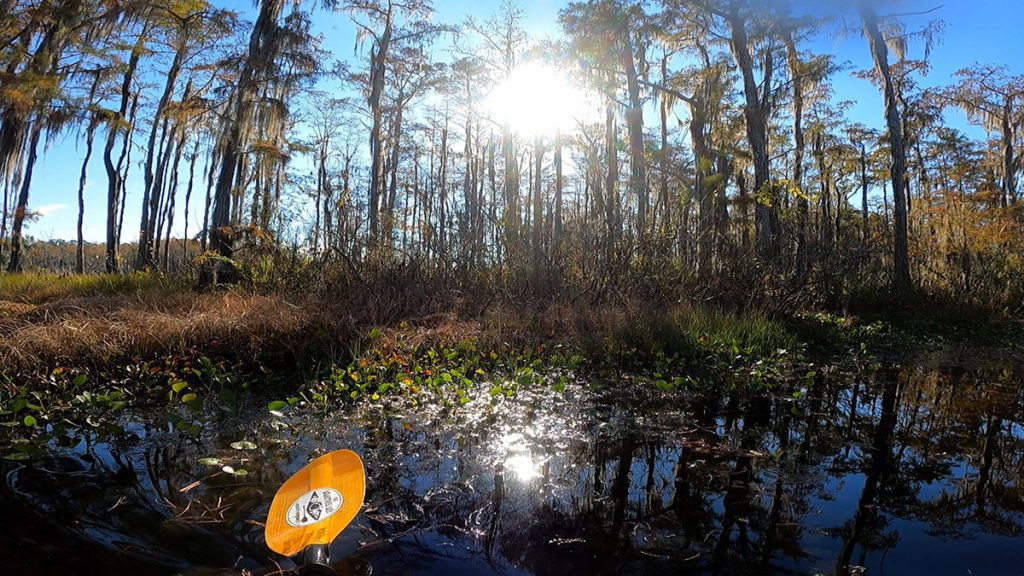
The trail map recommends checking the water gauge here before putting in, as the water can get low. If it’s one foot or higher, you should be good to go. The water’s not much higher than that today, which will make for a couple of tight squeezes.
Out on the Water, Two Paths to Choose
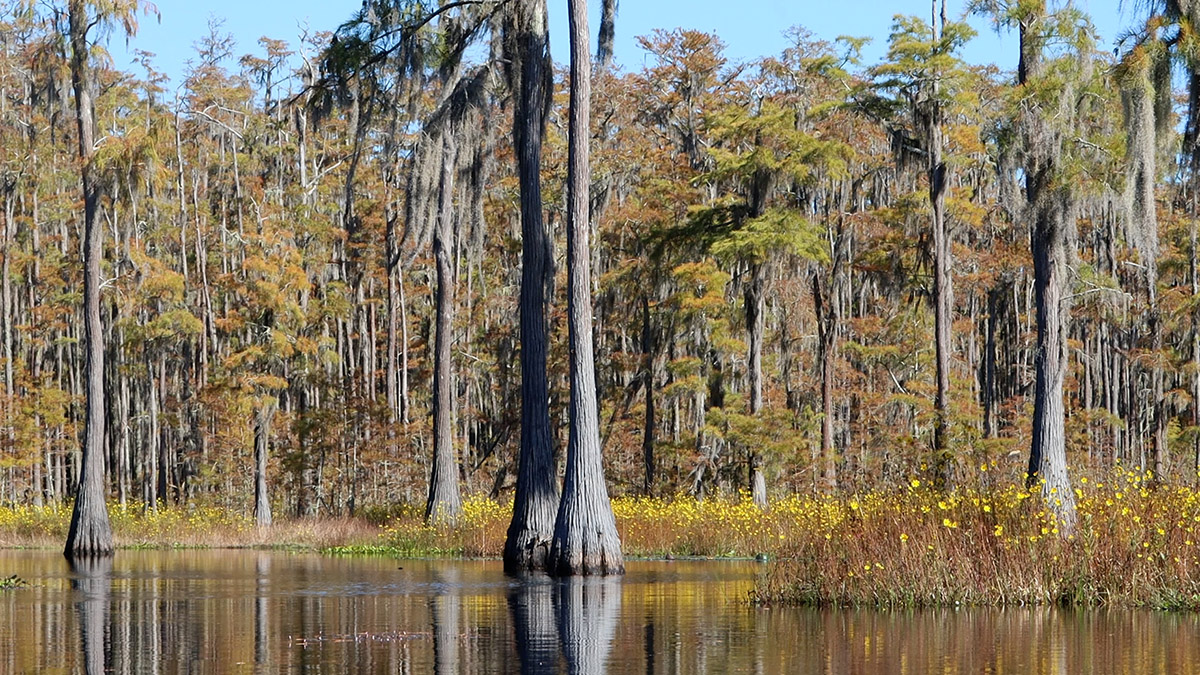
Here and the area just beyond the Piney Z. portage are the sunniest spots on the lake. Anywhere there’s a break in the cypress canopy on the lake, I see meadows of smallfruit beggarticks (Bidens mitis), mixed in with goldenrod in spots. Here, on the first of two trips, I see monarchs visiting the flowers.
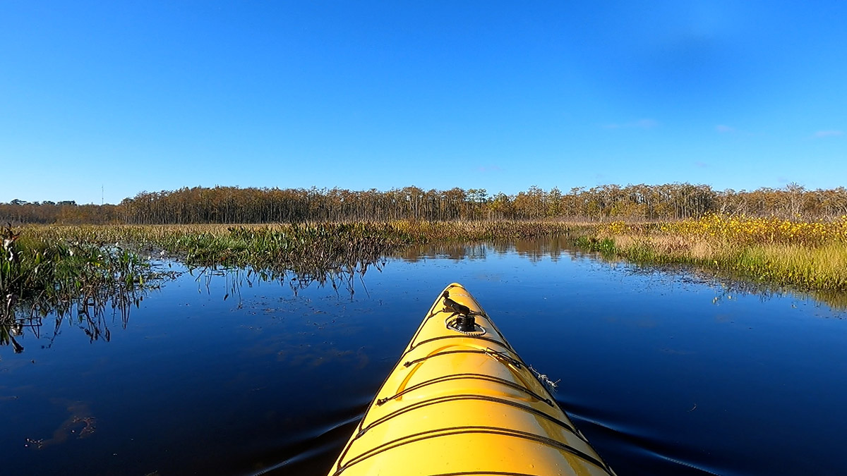
As you approach the tree line, you’re presented with a choice. To the right, the North Branch; to the left, the South Branch. The branches run near the north and south shores of the lake, converging again closer to Piney Z.. There are also two cutoffs that make smaller loops, which we will soon explore.
North Branch runs along the train track that has cut the lake off from Alford Arm since the mid-1800s. It’s more open than South Branch, which runs in and out of cypress stands. I see more birds along the South Branch. There’s a kingfisher that stays a few trees ahead of me, occasionally diving from a snag. In the distance I see great blue herons or great white egrets atop trees.
There are a few wood duck nesting boxes along South Branch. Twice, I startle wood ducks into flight from the surrounding grasses. I approach a third wood duck box more slowly, my finger on the record button. No luck this time.
I also have no luck getting a shot of the single wood stork that flies quickly overhead. Lower Lake Lafayette is home to a wood stork rookery, and I’d see many more when they nest in May and June.
Cutting across the Cypress Swamp
The City’s trail brochure points to stabilized water levels as a reason wood storks formed a rookery here. Lower Lake Lafayette was once a part of the larger Lake Lafayette, one of the area’s four large sinkhole lakes. In the late 1940s, the lake was segmented, and the water in Piney Z. Lake or Lower Lake Lafayette no longer drains into the sinkhole in Upper Lake Lafayette.
A couple of years ago, we visited another wood stork rookery across town. Retired DEP biologist Jim Stevenson explained to us that nesting wood storks need standing water below their cypress tree nests. The water keeps alligators patrolling beneath the cypress, preventing raccoons and other egg thieves from climbing up. As Stevenson said, if wood storks see their wetland’s water level is too low, they won’t nest there that year.
Because it won’t draw down, Lower Lake Lafayette is more likely to stay wet than it had been. However, not going dry threatens to choke the lake with vegetation, which might make it less suitable for wood storks. We’ll get to that in a second.
First, let’s get back to the trail. As I turn onto the Cypress Pond Cutoff, the water opens up and I start to see those flower meadows.
On either end of the cutoff, I have to thread my way through grass, and both times I’m stuck for a couple of minutes. It reminds me of a couple of tight spots exploring swamps along the Apalachicola on previous RiverTreks, so this turns out to be a good place to get in shape for it.
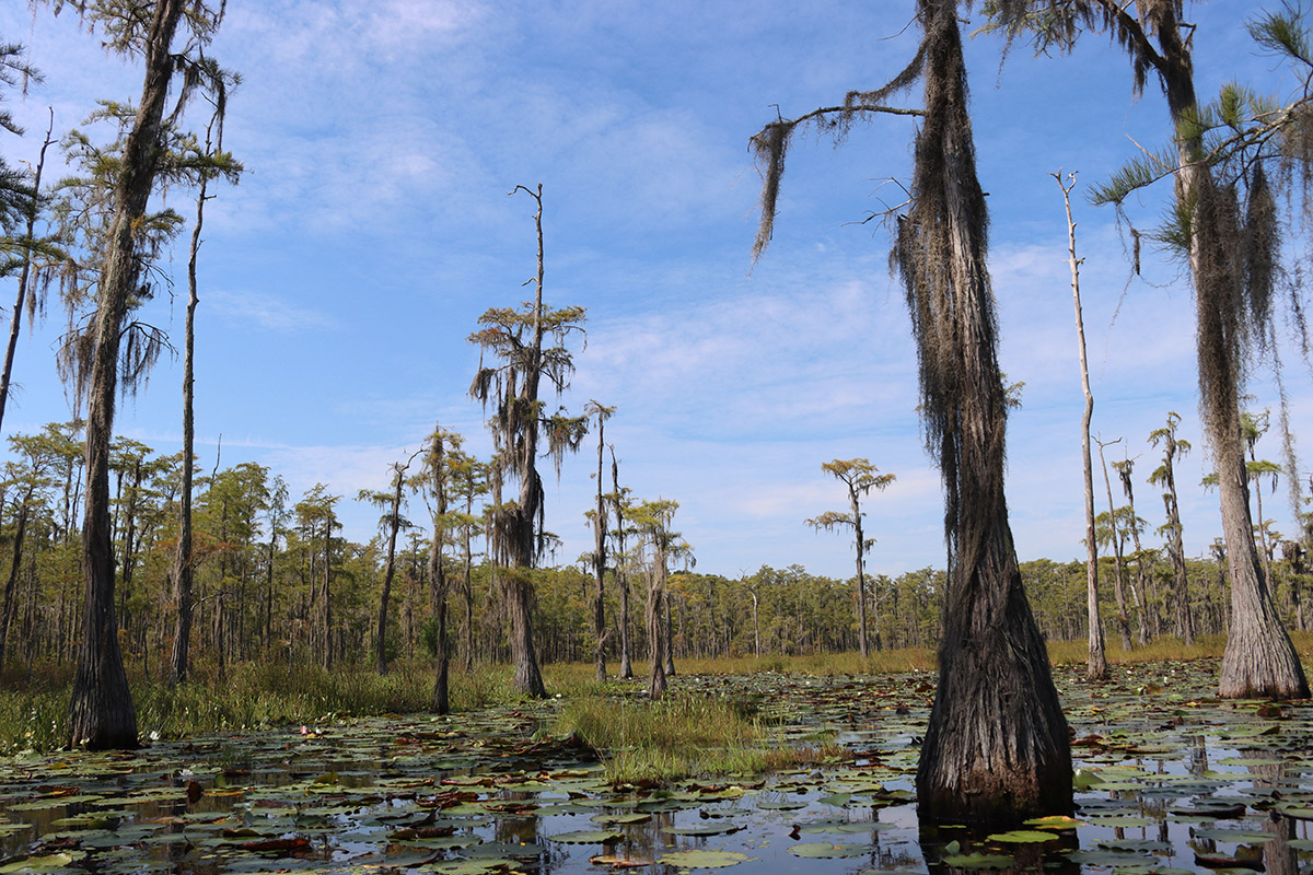
Once I wiggle free from that second grass trap, I’m in my favorite part of the trail- in the shade of a cypress swamp.
Accessing Lower Lake Lafayette from Piney Z. Lake
Maybe the rough parking area or muddy boat ramp aren’t your thing. You may put in at Lafayette Heritage Trail Park. One thing to keep in mind is that the kayak launch is a little bit of a walk from the parking area, so you’ll have to carry or cart your kayak to the water. Park at the right side of the playground, which is nearest the launch on Fishing Finger 3.
The fishing fingers were created when the lake was segmented in the 1940s. A thin dike encloses the water around the fishing fingers, but if you head straight left from the launch, there is a gate to the rest of the lake. Follow the dike to the right, and it will lead you to the Lower Lake Lafayette portage.
From the portage, it’s 0.6 miles to where the trail forks and you chose the North Branch (left) or South Branch (right). Again, you can plan for a shorter loop back by cutting across Michael’s Meander or Cypress Pond. If you opt for the full loop from Piney Z., it’s 7.8 miles. That could take the better part of a day, so plan accordingly as far as the food and water you bring.

Vegetation on Lower Lake Lafayette
The original Lake Lafayette is the most heavily altered of our area’s major sinkhole lakes. I’ve already mentioned a few things about the earthworks that have turned one lake into four water bodies. Upper Lake Lafayette contains the sinkhole, which means Piney Z. Lake, Lower Lake Lafayette, and Alford Arm don’t drain periodically as they had for thousands of years before.
Before it was partitioned, all of Lake Lafayette drew down much like Lake Jackson did over the summer. Even then, it was a grassy, swampy lake. Dead vegetative matter settled onto the lake bottom, but then it would dry in the sun when the lake drew down.
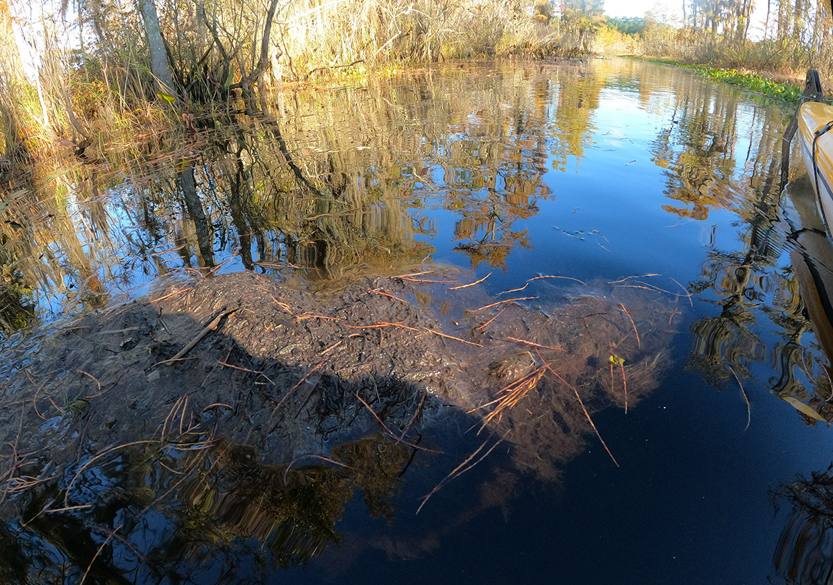
Now on Lower Lake Lafayette, that vegetative matter floats to the surface of the water in muddy clumps, and seeds grow in those clumps. I passed a few on the trail. The seeds sprout, and floating islands full of plant life, called tussocks, cover the lake surface.
The City of Tallahassee and FWC have in recent years spent millions of dollars to clear the vegetation, and make the lake navigable. Without its historic hydrology, it’s an ongoing battle to keep Lower Lake Lafayette as much a lake as possible.
It’s an altered water body, but one that provides an enjoyable experience. I saw quite a few birds, including a few migratory eastern phoebes. I imagine we’ll see more migrants in the coming weeks, including ducks. Wildflowers, cypress swamps, a little workout here and there, and never did I see another human being while on the water. Why am I telling you all about this place?