
Welcome to Part 5 (of 10) of Roaming the Red Hills, which originally aired on the April 7 episode of WFSU’s Local Routes. Through ten 3-minute videos, we’ll explore the natural soul of the Red Hills of Florida and Georgia, from the pine uplands down to its rivers, lakes, and farms. Thanks to Tracy Horenbein for creating original compositions for this video series, and to Gary Asbell for serenading us and giving us permission to include his song about the Ochlockonee River, “The River.” The series is narrated by Jim McMurtry.
Funding for Roaming the Red Hills was provided by Tall Timbers Research Station and Land Conservancy.
Rob Diaz de Villegas WFSU-TV
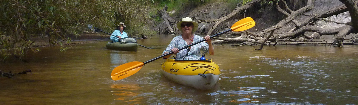
We’re only kayaking three or four miles. How long could that take? When I was planning these segments with Georgia Ackerman, then of Tall Timbers Research Station and Land Conservancy, she told me about a large, organized kayak trip down the Ochlockonee River in south Georgia planned for November. Trips like that can be fun, but I like smaller, more adventurous excursions for these videos. Then she asked if I’d want to go on the scouting mission for that trip, in September, with students at Thomas University marking and clearing impediments. I liked the idea of a trip where we didn’t exactly know what we’d see. The result is what you see above- one of the most rugged EcoAdventures I’ve ever produced.
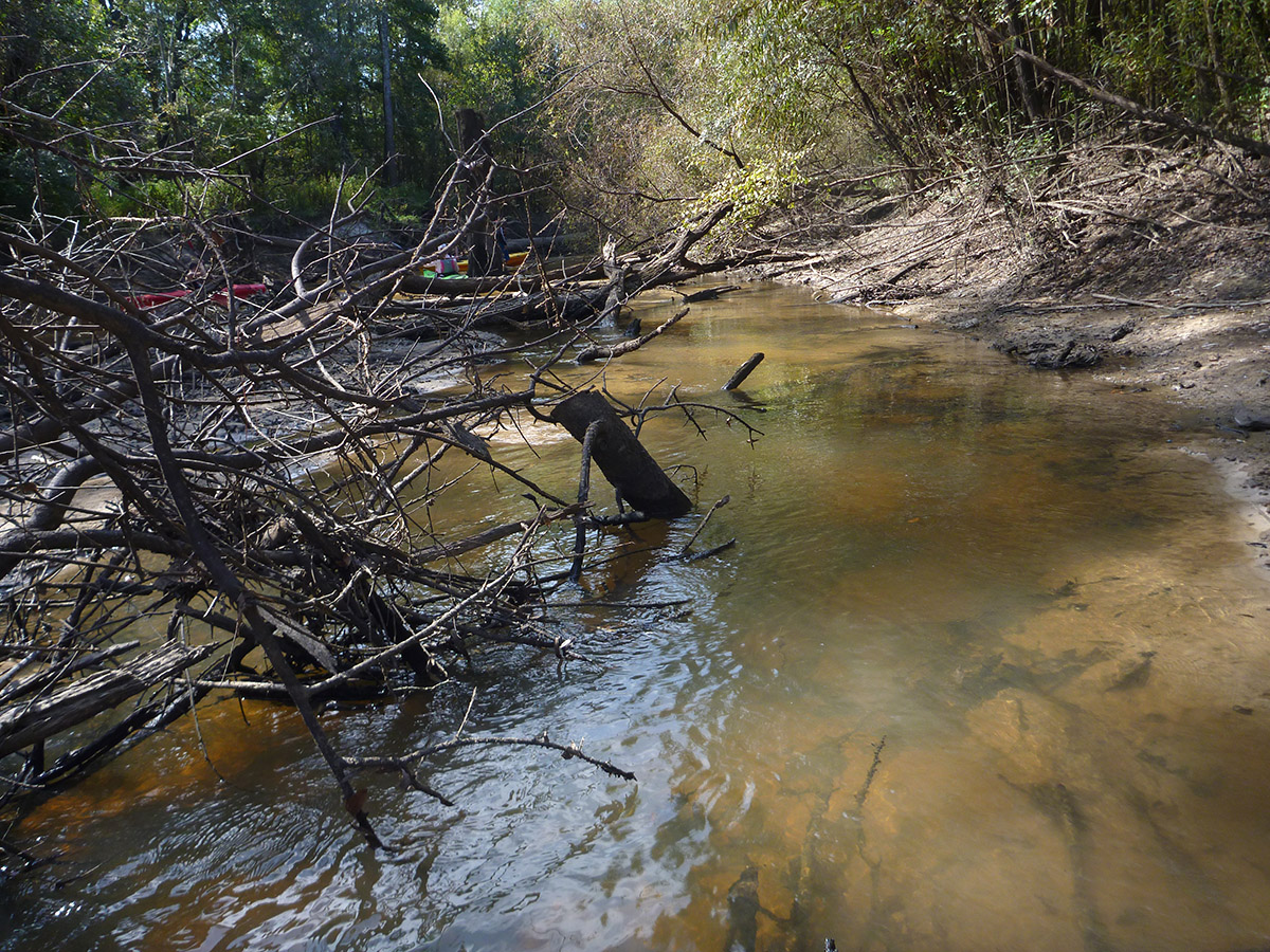
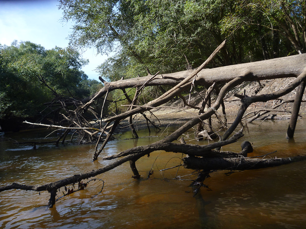
Snags choked this section of the Ochlockonee River, making for frequent stops and a little extra walking and climbing on riverbanks and sandbars.
Unlike the Ochlockonee River in Florida, the Georgia Ochlockonee is not part of a formal paddling trail system. Official trails have maps that show put-in and take-out spots, points of interest, and camping opportunities (Like this map for the Ochlockonee in Florida). This makes them easier to advertise to potential ecotourists, and it offers resources to help those paddlers plan their adventure. Margaret Tyson wants this for the Georgia Ochlockonee, and has been working to make it a Georgia Water Trail. The state of Georgia currently lists it as a Developing Trail.
For help with that Developing, Margaret has found an invaluable partner in Thomas University Assistant Professor Dr. Christine Ambrose. Christine is the Director of the Geospatial Analysis and Planning Lab at Thomas, teaching biology students to use Geographic Information Systems (GIS). As someone who loves toiling on the map graphics you see in our videos, I have a huge respect for people trained in GIS. It combines map making with data; they are often used in making trail maps, but can also be used by biologists to map information about specific species or ecosystems, or to track sources of pollution. In our video, Thomas University student Braxton Hicks was tasked with using a GPS to mark potential trouble spots on the river. He did not lack for work.
It makes for great video- obstacle after obstacle, each a little different than the last. Sometimes we were dragged under a snag, or through leaves. Often, we had to portage our kayaks around the blockage. Other times, the axes and saws came out. I worried about their trip in November. Surely they wouldn’t go through with it, with this river being so difficult?
A good rain took care of that. I got my adventure video, and the organized trip went smoothly. Sometimes it works out like that.
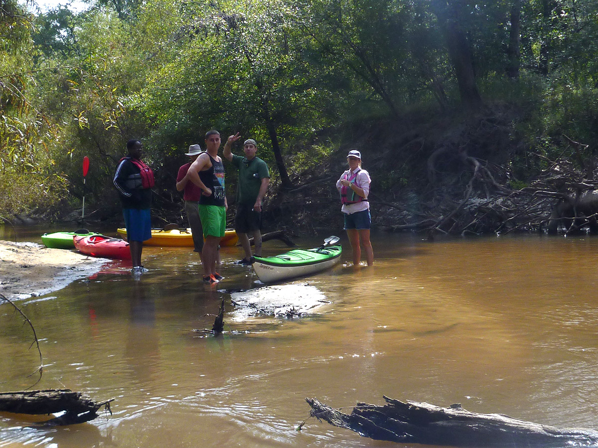
Thomas University biology students on a sandbar break.
Ochlockonee River Serenade
Our kayak had maybe moved 10 feet from the put in point when a man fishing under the old train bridge told us to “Hold on.” He ran and grabbed a guitar. After a little tuning, he belted out “The River,” a song about the Ochlockonee River.
That man is Gary Asbell, a Tallahassee attorney with south Georgia roots. He had just purchased a new Taylor guitar, and when he saw the camera he knew he had to try this song out on it. “The River is a song I had written for two friends with whom I used to camp on the Ochlockonee.” Gary wrote to me. “One of them, who was Bernie Gandy, founder and owner of Gandy Printers on South Monroe Street in Tallahassee, never heard the finished song. I actually played it in public for the first time in February 2007 at Bernie’s funeral.” His other friend, Danny Ouzts, requested that the song be played at his funeral as well. Gary did that in 2012.
I want to thank Gary for sharing and letting us use a song so personal to him, about a river that many of us enjoy.
Trouble Upstream
Once we passed the old train bridge, we didn’t see many manmade structures, aside from a boat ramp or two. And, as Christine points out in the video, we pass Red Hills plantations with conservation easements along the river. It is, as she says, “Excellent.”
 It’s a different story to the north. The Ochlockonee and many of the streams that feed it have been classified as impaired using the standards set forth in the Clean Water Act. The Georgia River Network has compiled a list of issues facing the river. Among those are 19 facilities permitted to dump wastewater into the river (as of 2008), and 1,213 agricultural users allowed to pump water from it (as of 2012). Up to 70% of the drainage basin in Georgia is planted with cotton, which is a water intensive crop.
A linked document pertaining to the fish consumption recommended a limit of 1 serving per month of fish from the Ochlockonee, as well as three other neighboring watersheds in the south of Georgia (including the Suwannee). For the rest of the state, it recommends a limit of 1 serving a week.
You can read the EPA’s collected findings on the Ochlockonee in Georgia here.
Pollutants are carried along with the water as it flows in Florida. An analysis by McGlynn Labs of data collected from two Leon County monitoring stations shows higher concentrations in Chloride (“an indicator of sewage’), nitrogen, phosphorous, nitrates, and chlorophyll were considerably higher in the north river than in the south. Many of the pollutants seem to settle into Lake Talquin, behind the Jackson Bluff Dam, making the south river cleaner. The report also notes low water conditions, especially during cotton growing season (late summer/ early fall- which is when we took our trip).
For our next adventure, we’re south of the dam as the river makes its way through the Apalachicola National Forest. We’ll be looking for critters on the Ochlockonee Bio-Blitz.
Come adventure with us in the Red Hills, Apalachicola River and Bay, the Forgotten Coast, and More! Subscribe to the WFSU Ecology Blog by Email.