
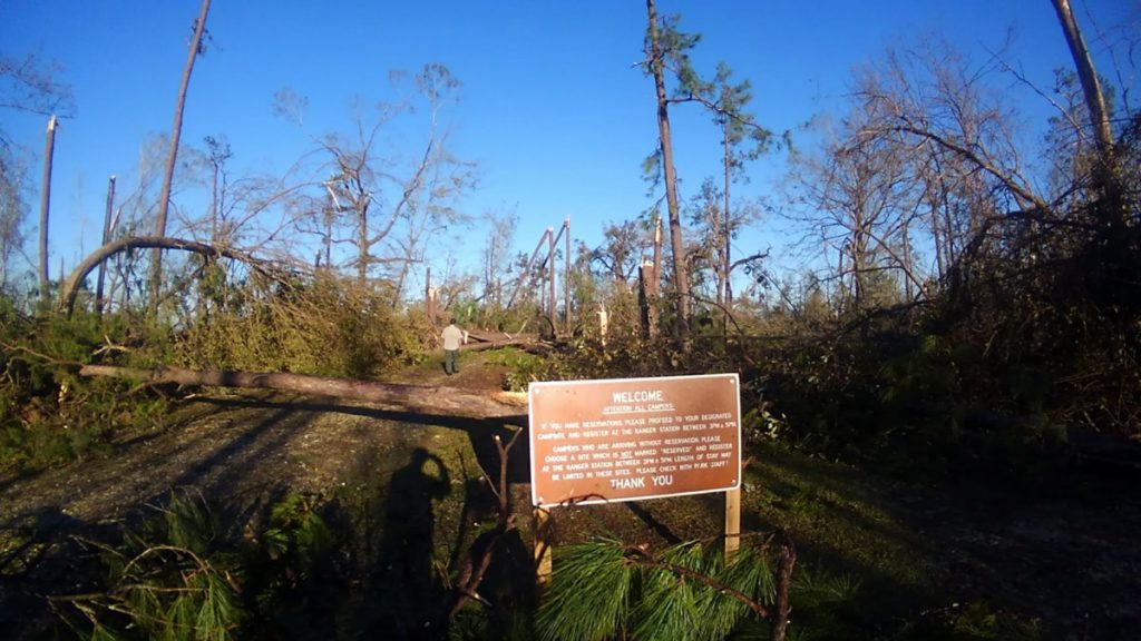
“You need to wear sunscreen to Torreya State Park now,” says Jason Vickery, “because there’s very little shade any more.” Jason, the park’s manager, is showing me a section of trail blocked by the trees that would once have shaded us. The park is in the Apalachicola Bluffs and Ravines region; these trails are Florida’s answer to the Appalachian Trail. Before last October, as you broke a sweat climbing down into ravines or up a river bluff, you didn’t have to do so under the brutality of the sun.
The shade and terrain combo here creates an ecology that is also reminiscent of the Appalachians. As we discuss below, the biological bond between these two regions traces back to the ice ages. But on October 10, 2018, Hurricane Michael tore through Torreya’s canopy, and what had come together over the course of thousands of years was altered in a few mere hours.
“This is a unique ecosystem here in Torreya.” Jason says. “It’s one of a kind. It’s never suffered something like this to anybody’s recollection. So, what’s to come is really anybody’s guess.”
A year later, I’m here to see how the park is rebounding from the storm. Like any state park, there are two aspects to consider. One is the recreational: trails, campsites, and the other amenities put here for our enjoyment. The other is the ecological, the habitats that, while we may enjoy them, we protect for their own sake. It may take over a year to clear all of the trails and open all of the campsites. But it will take decades to grow new trees, to develop a cover for those unique ecosystems on the slopes and bottoms of ravines.
October 10, 2018, and the immediate response
Jason Vickery remembers the morning of the hurricane.
“My wife woke me up at four in the morning and said, ‘Come take a look at this.’ And we were looking at the Panama City weather and saw the track. And the track was right over the Apalachicola River; Torreya State Park was close. So yeah, last second, we packed up everything and took off to Gainesville. And returned the next morning as early as I possibly could, you know, to come back to the park and check things out.
“It was devastating, you know? Because we had five hundred trees down across the road between the front entrance and the Gregory House. I had to cut a path in. I cut a path for maybe for half a mile for the vehicle, until I was just wore out. And we crawled and climbed and did the rest of the way by foot.”
Jason Vickery, Torreya State Park manager
Within two days, the Florida Park Service sent a strike team of rangers and park managers from south and central Florida to start clearing the wreckage. Within two months, the park opened, if not all of its amenities. They had cleared enough to open the picnic area and give tours of the historic Gregory House. While the trees were still bare, and many were down, visitors could still enjoy the iconic view of the Apalachicola River from behind the house.
A month after that, they reopened the main camping loop.
Yurts and New Views | Camping in Torreya
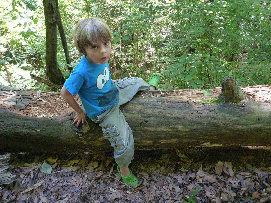
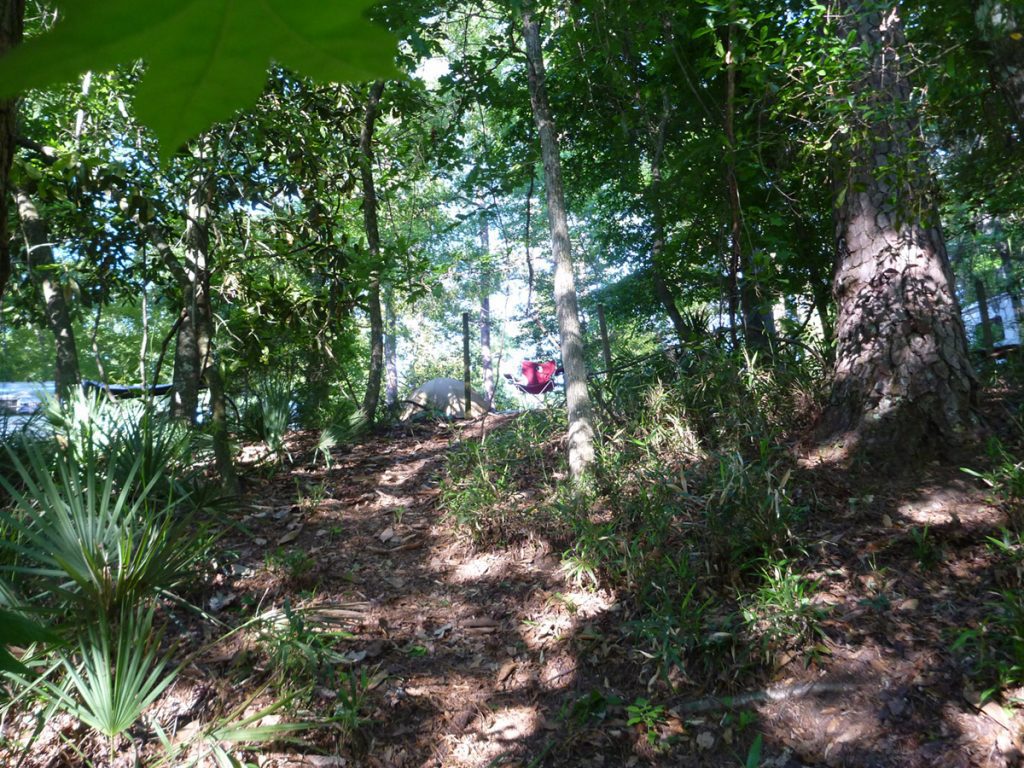
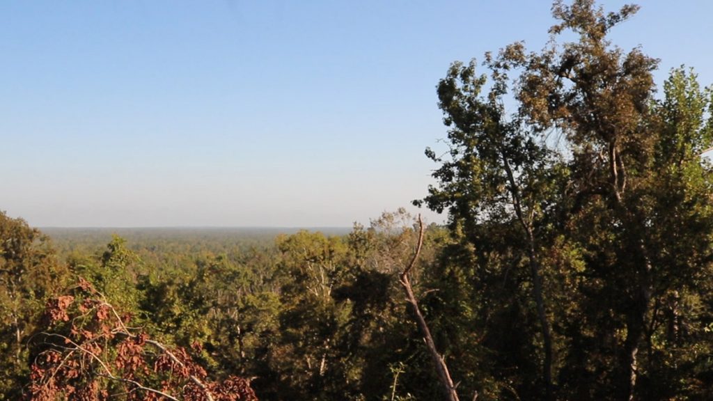
Visiting the campsite, I’m struck by how much more sunny it is than what I remember. Here are a couple of shots of what it used to look like, from when I camped here with my then four year old son.
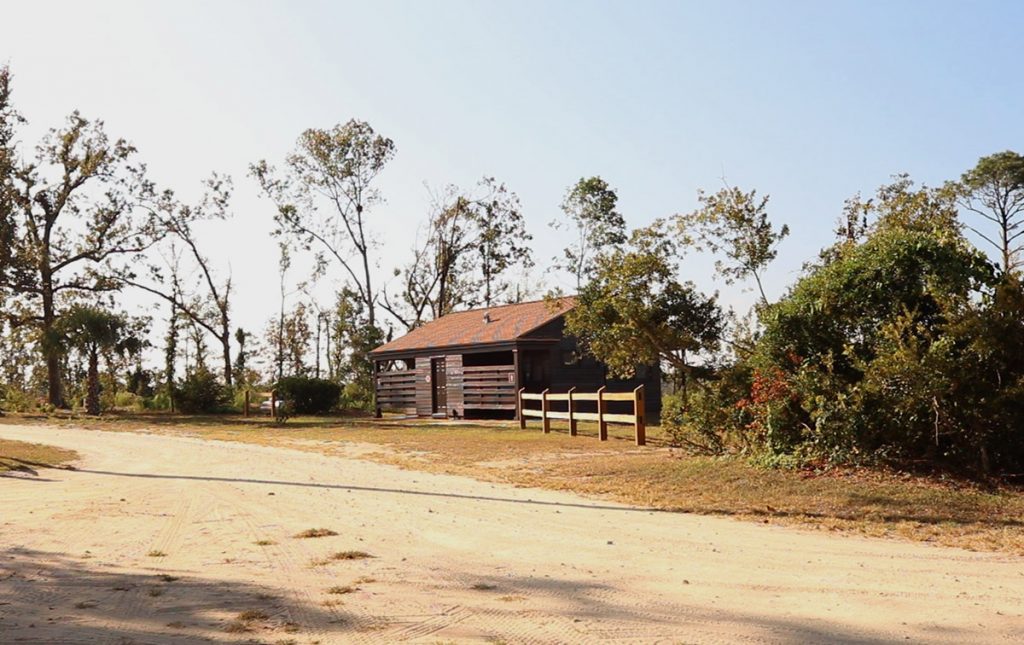
This is what the canopy looks like around the camping loop now:
Jason points out the new views from up here. The density of trees had once blocked these; now, there are spots where we can see for miles across the Apalachicola floodplain. It is an impressive sight to see from 200 feet above the river. That’s part of why the park built a new overlook at the end of the loop.
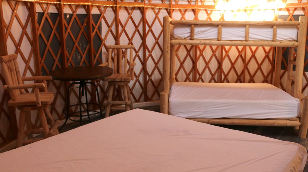
The park has also rebuilt their yurt, which had trees fall on it during the hurricane. A traditional yurt is a circular tent used by nomads in the steppes of central Asia. In the 1960s, North Americans began making a modified version of the tent (the turkic word yurt becomes an acronym- Year-round Universal Recreational Tent). The one at Torreya is air conditioned and furnished. It’s so popular with campers that not only did they rebuild the original, they’re building a second one as well.
Clearing Torreya Trails Takes “Expert-Level” Chainsaw Skill
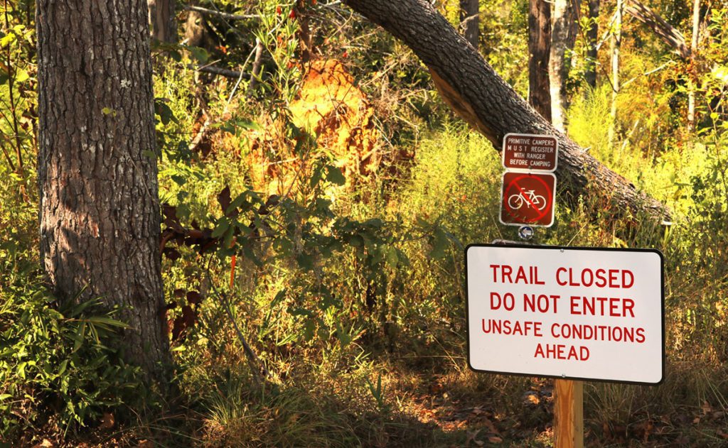
The main campground is one of five camping areas in Torreya State Park. Two of the others are the Youth Camps, which are group sites. These are currently staging areas for clean up efforts in the park. The last two are primitive campsites that you can only reach by hiking a couple of miles in either direction from the Gregory House. Neither the sites, or the trails leading in, are currently open.
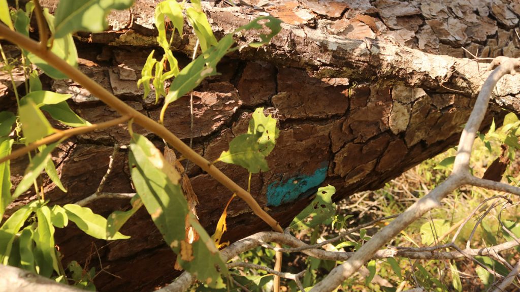
In fact, only about 2.5 of the 14 miles of trails are open. The terrain that makes this a special place also makes it difficult to do the work needed to clear trails. For one thing, there’s no way to get heavy machinery into ravines. This means hiking in with heavy chainsaws. And that’s not fast work.
There is also the challenge of finding the trail in the wreckage of trees. You can see in the video where we encounter a couple of downed trees with blue trail blazes. They don’t offer much guidance lying on the ground.
“We’ve had a lot of outreach from volunteers wanting to help clear trails,” Jason says. “But the complexity of the chainsaw work to clear these trails is enormous. It’s going to take expert-level skilled operators on chainsaw to clear a lot of this debris.”
Help is on the way, though. In November, an AmeriCorps team will work to finish clearing the trail to the Rock Bluff Primitive Camp. Jason is hopeful that by the end of winter, people can camp there along the river.
Safety | Protecting Life and Property
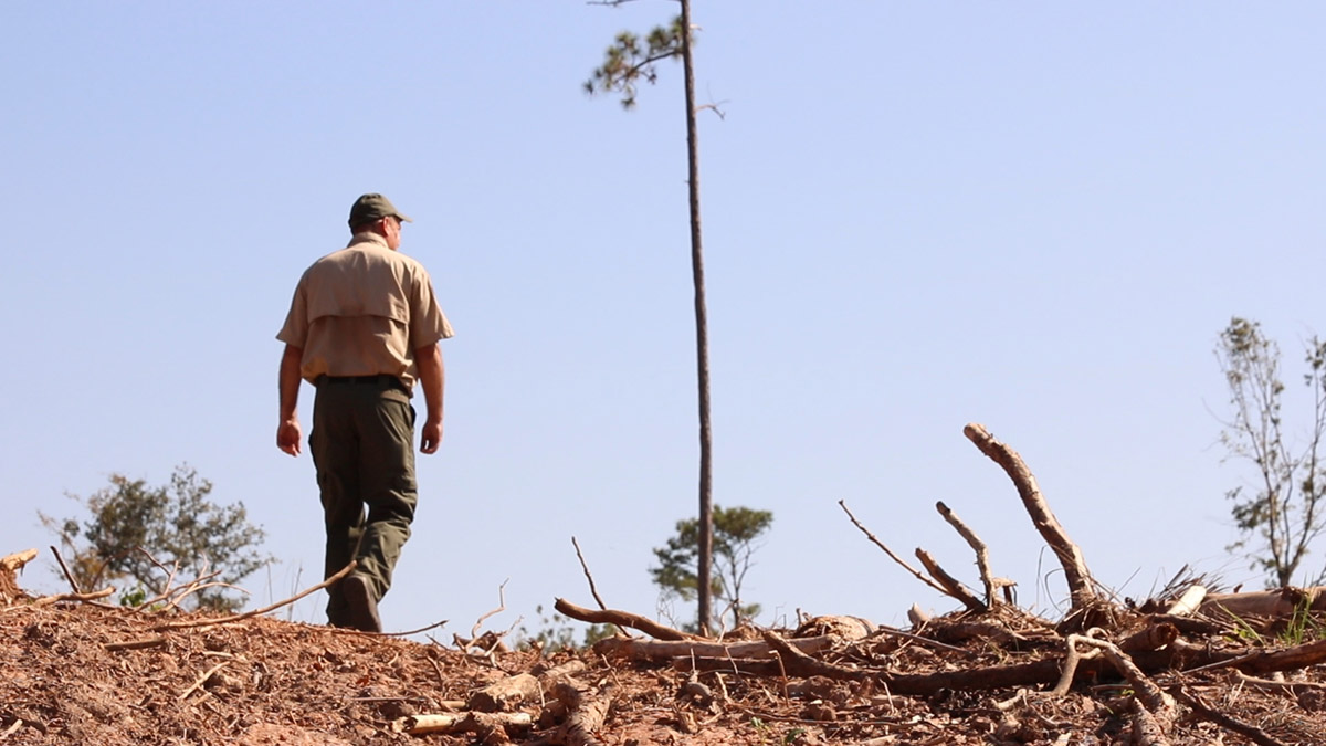
The park also has to use their manpower to make sure visitors have a safe experience. By Jason’s estimation, nearly every tree in the park was damaged to some degree by the storm. So, while they may clear debris from the trail, they also need to make sure that the trees around the trail don’t pose a risk to hikers. “These trees that are dying on our open trails,” Jason says, “we’ve been cutting trees every day for the last two months.”
Additionally, all of that dead wood on the ground is fuel for potential wildfires. With north Florida experiencing a harsh drought right now, conditions are dry and fire risk is high. This is why park staff has been clearing fire lines through out the park, and especially where the park is adjacent to residential areas. These fuel free areas segment the park, and make fires easier to manage.
“These breaks of bare mineral soil will stop fire from coming through.”
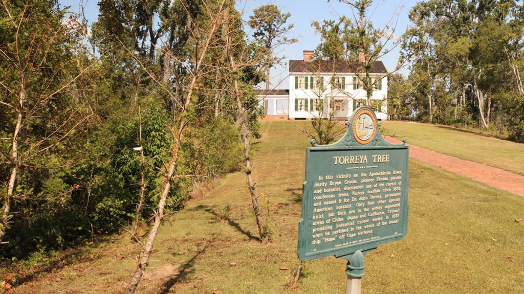
The Florida Torreya | Still Hanging On in the Apalachicola Bluffs and Ravines
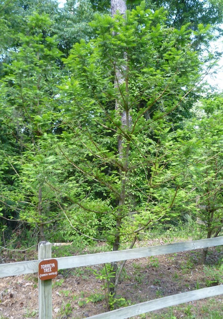
When you first arrive at the Gregory House, you are greeted by the tree that gives the park its name. On either side of the path leading up to the house are plots containing Torreya taxifolia, the Florida torreya. The trees on the left are much taller than those on the right, and that gives us a clue as to the tree’s habitat needs.
Between the heights and arrangement of the surrounding overstory trees, and their alignment to the sun, the left side finds itself in shade for more of the day. And like the other understory plants that make this area ecologically distinctive, they thrive in darker, cooler areas.

Torreya trees in front of the Gregory House, May 2015. Torreya trees in front of the Gregory House, post Hurricane Michael (October 2019).
According to the Florida Park service, there are between 200-300 wild growing Florida torreya trees in the world, all found in Torreya State Park and in the Nature Conservancy’s Apalachicola Bluffs and Ravines Preserve. These two properties sit side by side on the bluffs on the eastern banks of the upper Apalachicola. The tree’s entire range is this small area, less than 100 square miles.
In the 1950s, a fungal blight wiped out a population of about 600,000 Torreya taxifolia in the region. The Florida Park Service, Nature Conservancy, and the Atlanta Botanical Garden have been working to revive the Florida torreya, a species whose future may lie in its likely ancestral home of North Carolina, where planted trees have thrived disease free.
As I mentioned before, this small region of north Florida is, in many ways, a satellite of those North Carolina mountains. Jason Vickery mentions that hikers visit the park to train for the Appalachian Trail. The similar terrain here, tens of thousands of years ago, found itself home to Appalachian plants and animals. Their descendants are what make this place ecologically special.
The loss of tree cover after Hurricane Michael may threaten these unique Florida ecosystems.
Ice Age Migration to the Apalachicola Bluffs and Ravines
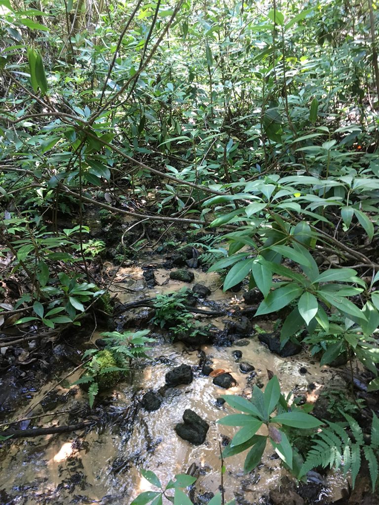
Our little pockets of Appalachia owe their existence to a geological phenomenon found only in north Florida- and Mars. I’m talking about steephead ravines. They start with small seeps in river bluffs, in this case above the Apalachicola. The cool trickles of water slowly carve narrow slices into the bluffs, working slowly away from the river. Over time, you have a slim, steep ravine several miles long. At the floor of the ravine, the seep has formed a cool stream.
During the ice ages, when the Appalachians were covered in glaciers, plants and animals slowly migrated south to a climate more suitable to them. At the time, this was Florida. And then as temperatures warmed, they slowly worked their way back north. A few, however, remained in these cool, shaded ravines that still felt like their original home.
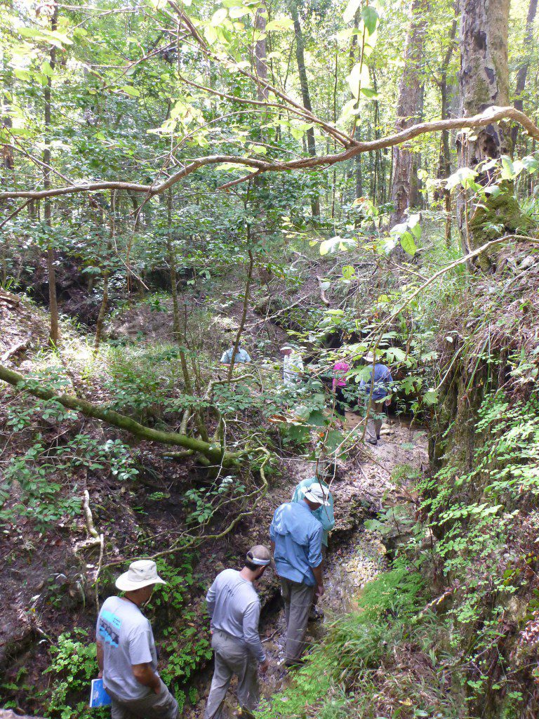
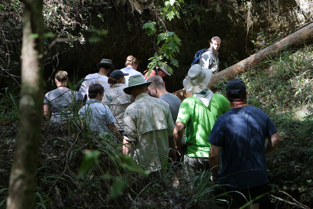
We visited a steephead for a video we produced two years ago in Torreya State Park. We were in a section of the park not open to the public; the Sweetwater Tract was purchased in part to preserve the steephead. Most of what we see of Torreya State Park on this blog has been on one of two properties not connected to the original park, which is where the bulk of visitors hike and camp.
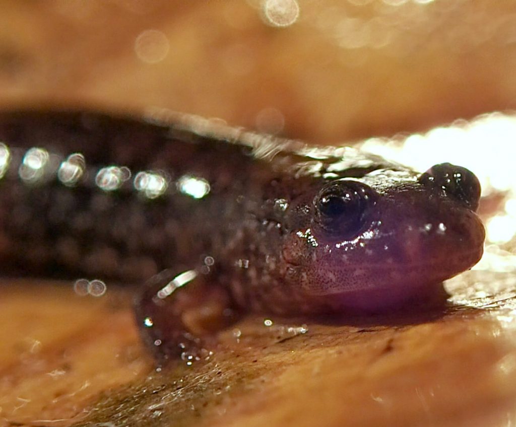
We descended into the ravine with Bruce Means, who discovered the Apalachicola dusky salamander in this region in the 1970s. The Apalachicola dusky is found in steephead streams, and is more closely related to dusky salamanders in North Carolina than to the southern dusky salamander, which is found in the nearby Apalachicola National Forest.
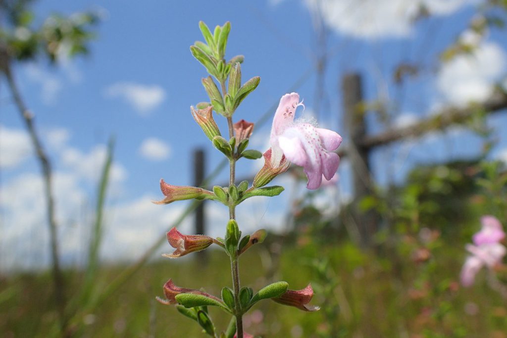
“There’s species here that are found nowhere else in the world,” Jason says, “like the Torreya tree, the ashe magnolia, Florida yew, Apalachicola dusky salamander, fireback crayfish.” As we left the ravine that day two years ago, we saw a plant found only in Liberty County, Florida. Apalachicola rosemary (Conradina glabra) typically grows on the edges of steephead ravines.
Steephead Ravine “Wind Tunnels”
Before going into the ravine, Bruce had us shoot it from a distance. He wanted us to see something. Until you get up on one, you really can’t see a steephead. As you walk up to it, the ground kind of just drops off all of a sudden, a 45 degree slope downward.
“The ravine systems, you would think, being lower to the ground, would have been safer,” Jason says. “But it was actually reverse. The winds funneled through these ravine systems and almost acted like wind tunnels.” (We later visited a hurricane damaged steephead with The Nature Conservancy)
Jason mentions that some ravines did stay more or less intact, though the Sweetwater steephead was not one of these. Torreya trees and ashe magnolias in the park fared the storm well, overall. But their shady canopy was blown away. And, with larger overstory trees having been knocked down, there are now bare, disturbed patches which might invite invasive species. Over the decades it takes for the taller trees to grow back, the sunnier understory might also invite natives better suited to other habitats. It will take decades for a full recovery.
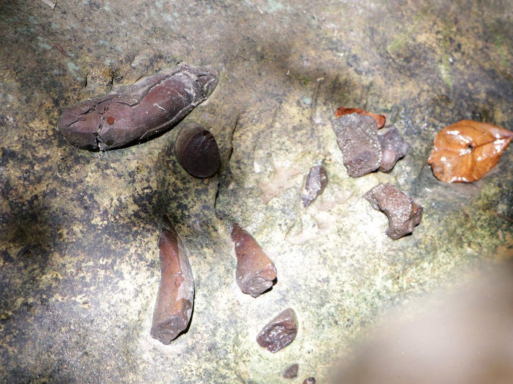
Another area in the park where we’ve shot video was hard hit by Michael. Means Creek is in the Aspalaga Tract, north of the Gregory House. In 2012, I kayaked to the creek on my first RiverTrek. Not knowing what to expect, we followed the trickling stream into a rocky ravine, and finally into a cave. In 2016, geologist Harley Means showed us dugong bones sticking out of the rock, and found an Apalachicola dusky salamander (the creek is named for the salamander’s discoverer, and Harley’s dad, Bruce Means).
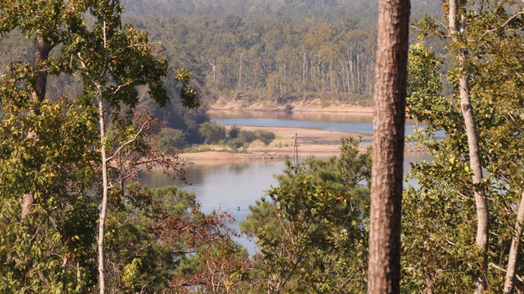
RiverTrek is actually happening right now, and they were not able to visit Means Creek on Tuesday due to the amount of debris in it. They instead explored Aspalaga Bluff, from where we see a nice view of the river in the video.
The Future of Torreya State Park
“We’re still, we’re still are battling the hurricane, even today. For sure. It’ll be probably toward the end of my lifetime where we’ll probably have some sort of shaded canopy again. But it’s definitely- I will never see what we had before in my lifetime.
Jason Vickery
Browse past stories about Torreya State Park
As we mention in the post above, we’ve spent some time exploring Torreya, and the rest of the Apalachicola River watershed. This area is one of North America’s biodiversity hotspots, boasting plants and animals found nowhere else.