Rob Diaz de Villegas WFSU-TV
Part 2 of our RiverTrek adventure is now live. You can watch it here.
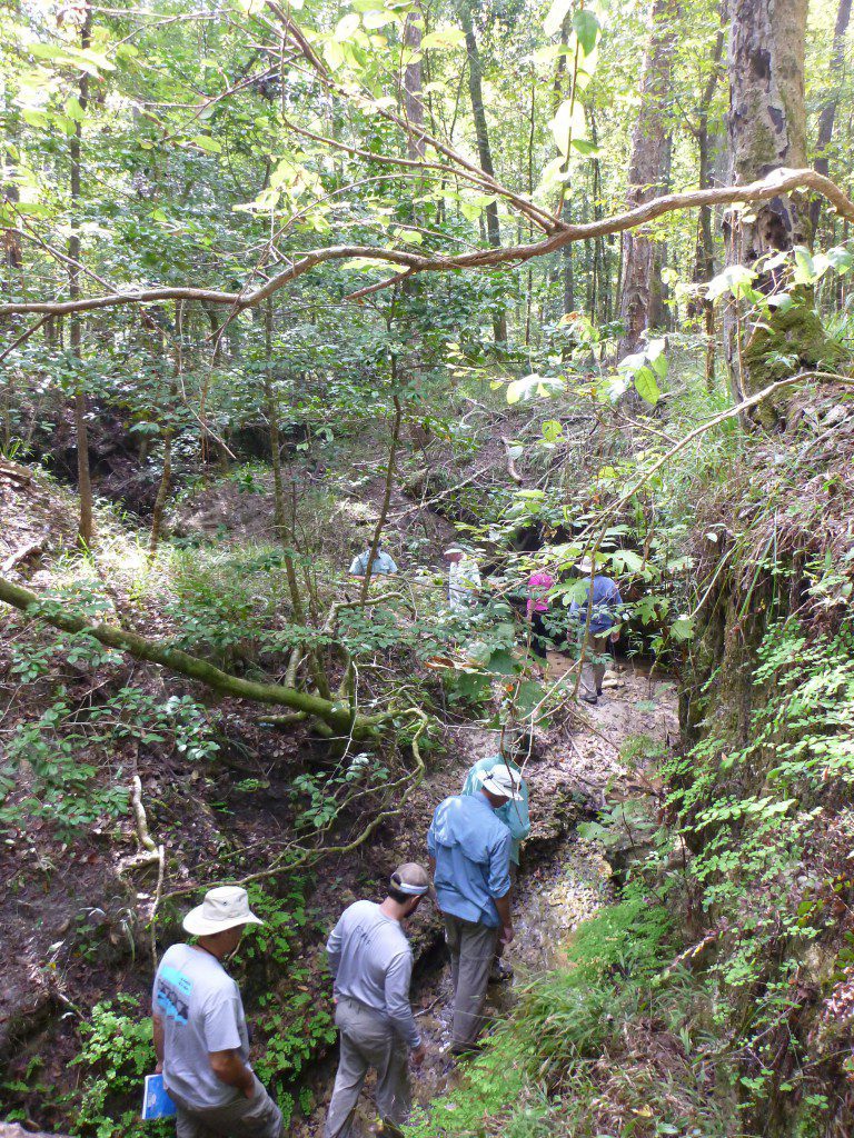
The web version of the video, which you see above, has some shots of our impromptu spelunking expedition by Means Creek that were not in the air version. I was waiting on permission to show our cave adventure, which was in a part of Torreya State Park that we were told will be opened to the public at some point in the future. I got that permission after last week’s Dimensions had been completed. You may notice that, for a video about a kayak trip, we spend a lot of time in caves, bushwhacking in the woods, or climbing up bluffs. None of our off-river excursions were in lands open to the public, but were instead near parklands that were (Means Creek in Torreya and Alum Bluff on The Nature Conservancy’s Apalachicola Bluffs and Ravines Preserve, near the Garden of Eden Trail). With those parks in the northern stretch of the river and the Apalachicola Wildlife and Environmental Area in the south, there are ample opportunities to explore the areas adjacent to the river. Those protected lands are valuable for their ecotourism potential, but they have a indirect value when it comes to the water in the river, in Apalachicola Bay, and into the Gulf of Mexico.
It has to do with clean (or cleaner, anyway) water. I wrote last week about the Army Corps of Engineers visit to Apalachicola Bay, and the meeting during which various presenters made their case for the why the river needed more water than has been flowing through the Woodruff Dam. One presentation that left an impression was that of Dr. Felicia Coleman, Director of the FSU Coastal and Marine Lab. She was showing how the water flowing from the Apalachicola River had positive effects beyond the bay, and she made an interesting contrast. She was comparing the “green river” plumes from both the Apalachicola and Mississippi Rivers, the two largest North American sources of freshwater in the Gulf. Along with the fresh water, they contribute chlorophyll and other nutrients. There is a striking difference in what each river is putting into the Gulf.
“The two sources are quite different, because one is man made, agricultural… excess nutrients are falling into the Gulf” Dr. Coleman said, referring to the Mississippi, “and the other is a natural nutrient base that’s coming into the bay,” referring to the Apalachicola. The Mississippi River drains 41% of the continental United States, along with considerable nitrogen and phosphorus such as are found in concentrated fertilizers typically used to grow crops and and keep lawns green. The areas at the mouth of the Mississippi have been heavily developed, so there aren’t the kinds of coastal ecosystems that would filter these nutrients (though as David Kimbro pointed out to me, the sheer volume of runoff from the Mississippi is greater than what these coastal ecosystems could filter). All of that nitrogen and phosphorous was of course meant to make plants grow, and a farmer can control how fertilizer is applied to get crops to grow how they want and to maximize their yield. When it runs off of farms and lawns and into the water, you can’t control what plants grow and how fast. If phytoplankton gets a super dose of nitrogen, its growth can become unchecked and it can suck the oxygen out of water. Dr. Coleman estimated that the dead zone off of the Mississippi is about the size of New Jersey.
So, that’s me taking a hike on Alum Bluff and trying to make it about the oysters in the bay. But there is a connection to the bay, and as Felicia Coleman illustrated, beyond the bay and into the Gulf. Gag and red grouper are commercially important fish that are caught in waters that are about 60 feet deep. They spawn when the green river plume is at its seasonal peak (the flow of the river is not constant). Dr. Coleman presented a map that showed the greatest concentration of grouper spawning happened within that plume. So the water flow, which is at an all time low (since people have started measuring it), is crucial to that fishery as well as to the shrimp, crab, and oyster fisheries of the bay. “If you look at rivers around the world that have had intense fresh water withdrawals,” Dr. Coleman said, “There have been some of the most spectacular fishery failures that we know about, in a global sense.”
Riverlinks
I’m not the only one publishing blog posts on RiverTrek 2012. My fellow paddler (and author) Doug Alderson wrote this post for his Visit Tallahassee blog.
The Army Corps of Engineers is updating the Apalachicola/ Chattahoochee/ Flint Master Water Control Manual, and they are taking public input. You can let your voice be heard here.
Stay tuned for Part II of the RiverTrek Adventure on Wednesday November 14 at 7:30 PM/ ET as we complete our journey to the bay.


1 comment
[…] Did you enjoy Part 2 but haven’t seen Part 1 yet? Watch it here. […]
Comments are closed.