
One of Leon County’s newest green spaces protects the aquifer and gives us a look at the beginning stages of a sinkhole lake. Also, we learn about upcoming improvements to the Fred George Basin Greenway.
Subscribe to the WFSU Ecology Blog to receive more videos and articles about our local, natural areas, and subscribe to the WFSU Ecology Youtube Channel.
Rob Diaz de Villegas WFSU Public Media
I’m off trail, following Harley Means into a hole in the ground. Maybe not so much a hole as a depression. Once at the bottom of this unremarkable looking bowl, we do something I love to do on the Ecology Blog: a little bit of time traveling. It’s the kind of thing we’d normally need a little bit of imagination to do. Or a larger graphics budget. This time, though, Harley and I have already visited the future of this place.
We’re standing in what may, one day, become one of Tallahassee’s sinkhole lakes.
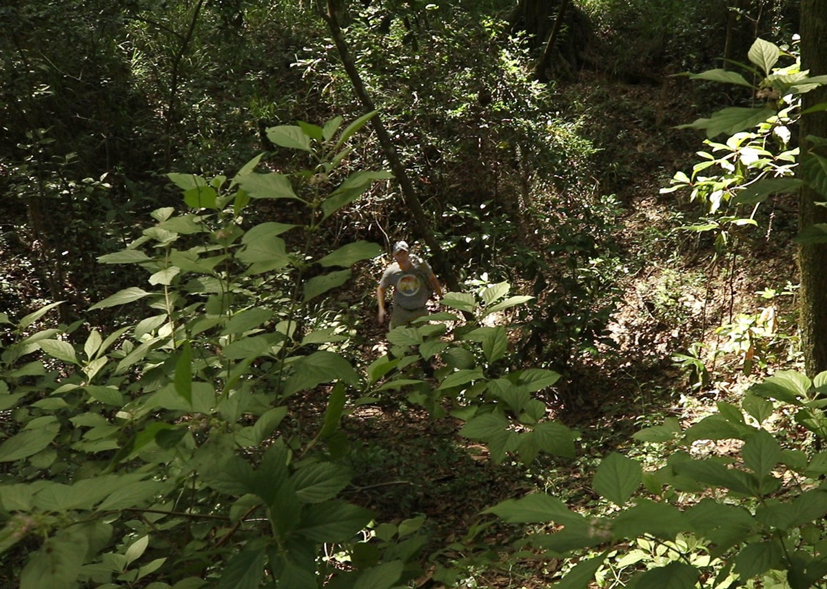
Florida Assistant State Geologist Harley Means stands in a sinkhole at Fred George Basin Greenway.
This is one of two adjacent sinkholes on the Fred George Basin Greenway. Opening in 2016, the Greenway is one of our newer public spaces. A major reason that Blueprint 2000 sought to buy the land is to protect these gateways to the Floridan Aquifer, the source of our drinking water. Dye traces have shown that water flowing into the larger sinkhole will emerge in two different City of Tallahassee water wells. The surrounding floodplain forest is now protected as a filter for that water.
In January of 2018, Harley and I visited another couple of sinkholes. These were in Lake Miccosukee, and they had just become active, swallowing up the western end of the lake. Walking over exposed lake bed, we stood at the edge of the sinkholes and watched waterfalls feed the aquifer directly.
There, we were watching the process that created the lake. Here at Fred George Basin, we’re rewinding the Lake Miccosukee sinkholes and seeing them at an earlier stage. It’s a rare chance to take processes that happen over geologic time and compress them for easy viewing.
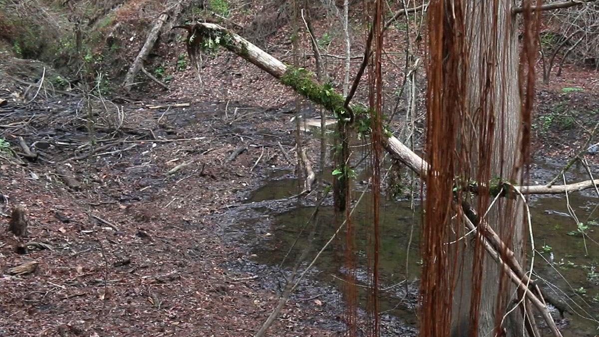
The pile of sticks and logs at the left is covering Fred George Sink. This photo is from February of 2018, about a month after we visited the Lake Miccosukee sinkholes. The video above was shot in June of 2018, when the water was higher.
Our Ever Changing Karst Landscape
If you want to do some daily time traveling in Florida, drink our tap water. That liquid refreshment comes to you from rock that was once coral and mollusks living in an ocean that covered this area over 20,000,000 years ago.
Limestone is a porous rock, and easily dissolved by water. Water flows through the rock like a hard, sandy sponge; but, in the Floridan Aquifer, it has also created large underground caves. These caves are the source of our springs, including Wakulla Spring, the largest in North America.
Because limestone dissolves so easily, the rock beneath us is constantly changing. This, in turn, changes the landscape on the surface. Harley uses the sinkhole where we’re standing to describe the process.
“To a geologist, this is activity,” He says. “To see the very steep slat-sided slopes, to see there’s some subsidence going on here, there are some trees leaning into the feature- you know that this is active.”
Harley explains why. “Underneath us, there is limestone, and over time that limestone slowly dissolves, leaving a void space.”
At some point, and it could have taken millions of years, the void became too large to support the earth above it, and that earth sank in. The ground in here is dry now, but the bottom of this dimple in the earth does take water into the aquifer. As that water passes through, it will continue to shape, and possibly deepen, the hole.
Map of Fred George Basin Greenway. The sinkhole is at the north of the property. Zoom out to see the greenway’s proximity to Lake Jackson.
How Sinkholes Become Lakes
Let’s go back to Lake Miccosukee. In January of 2018, it hadn’t rained much. Short term rainfall affects the level of the lake above, and long term rainfall affects the level of the underlying aquifer. At that moment, conditions were just right for a phenomena that, every few years, we see in our area’s lakes.
“When the water levels in the underlying aquifer drop sufficiently,” Harley said, “and you’re not getting enough rainfall in the (lake) basin to continue to fill the basin up, then you can have more water focus through the sinkholes. And then at some point, something triggers, and the sinkholes completely open up.”
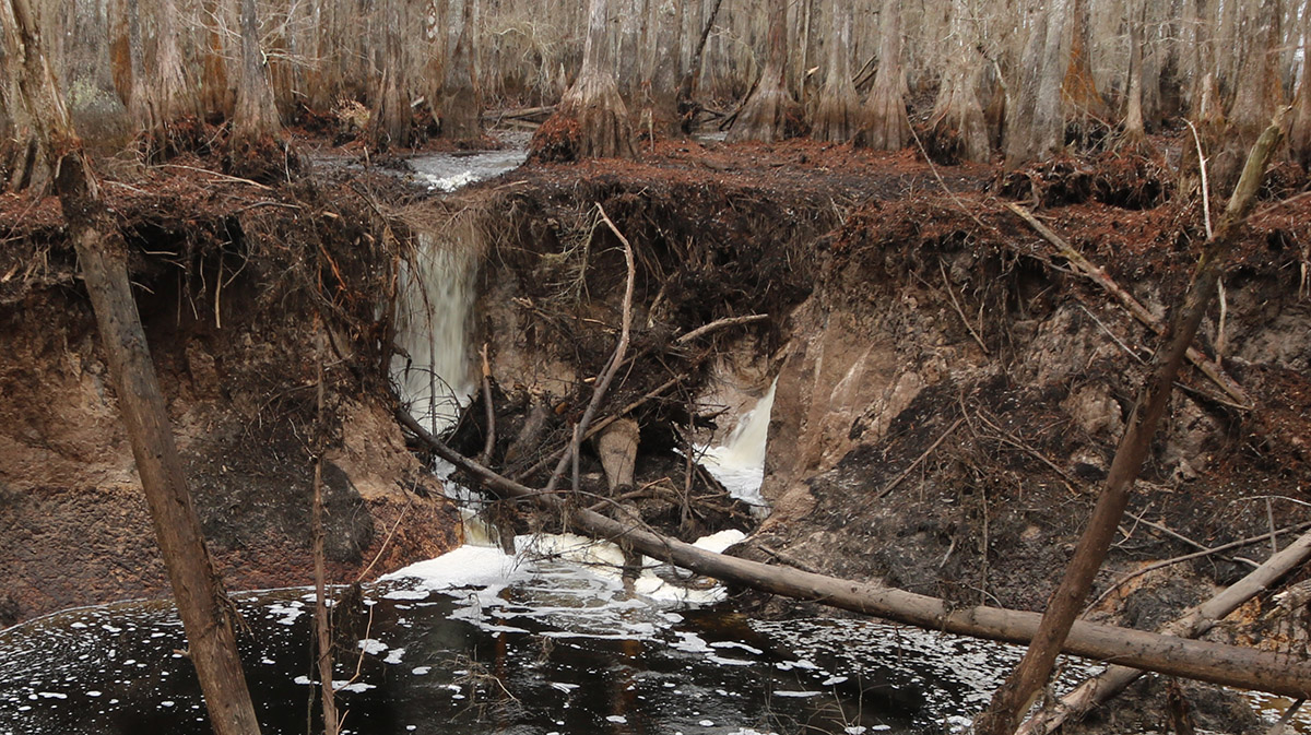
Sinkhole at Lake Miccosukee, with two waterfalls. Note the trees leaning into the sink.
An active sinkhole means more than water gushing in. Harley pointed out the trees leaning into them. Every time he’d visit, more trees had fallen in. He also warned me to stay away from the edge of the sinkhole, because it wasn’t stable. The land itself was getting swallowed up, and the sinkhole was getting bigger.
Back at Fred George, we walk to the second, larger sinkhole, called Fred George sink. Here, a small stream flows into the side of a hill, where it disappears under a pile of logs.
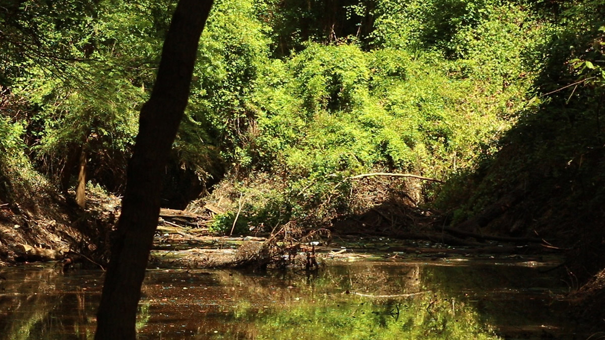
Fred George Sink in June of 2018, after more rainfall.
Harley once more points out trees leaning over around the sink. “This is a classic example of how uplands get eroded over time by sinkhole activity. The sinkhole we just climbed out of is probably going to merge with this one, and this is going to become a bigger and bigger ravine.
“This will create a larger basin, which might ultimately become a lake, and at some point might ultimately merge with Lake Jackson.”
The Red Hills Region has four major sinkhole lakes: Lake Jackson, Lake Miccosukee, Lake Iamonia, and Lake Lafayette, which has been artificially divided into four water bodies- Piney Z. Lake, Alford Arm, Lower Lake Lafayette (home to its own wood stork rookery), and Upper Lake Lafayette (home to a sinkhole). Each was created by sinkholes that are still active.
Where does this constant (but very slow) expansion of lake basins end? “Eventually, the basins may converge and the Tallahassee Hills will no longer be hills – we may be one large, flat plain like Payne’s Prairie!” Of course, we can’t really know what other factors will come into play over geologic time. To really find out, Harley says “Get back to me in a million years!”

Wetland on Fred George Basin Greenway.
Preserving the Fred George Greenway
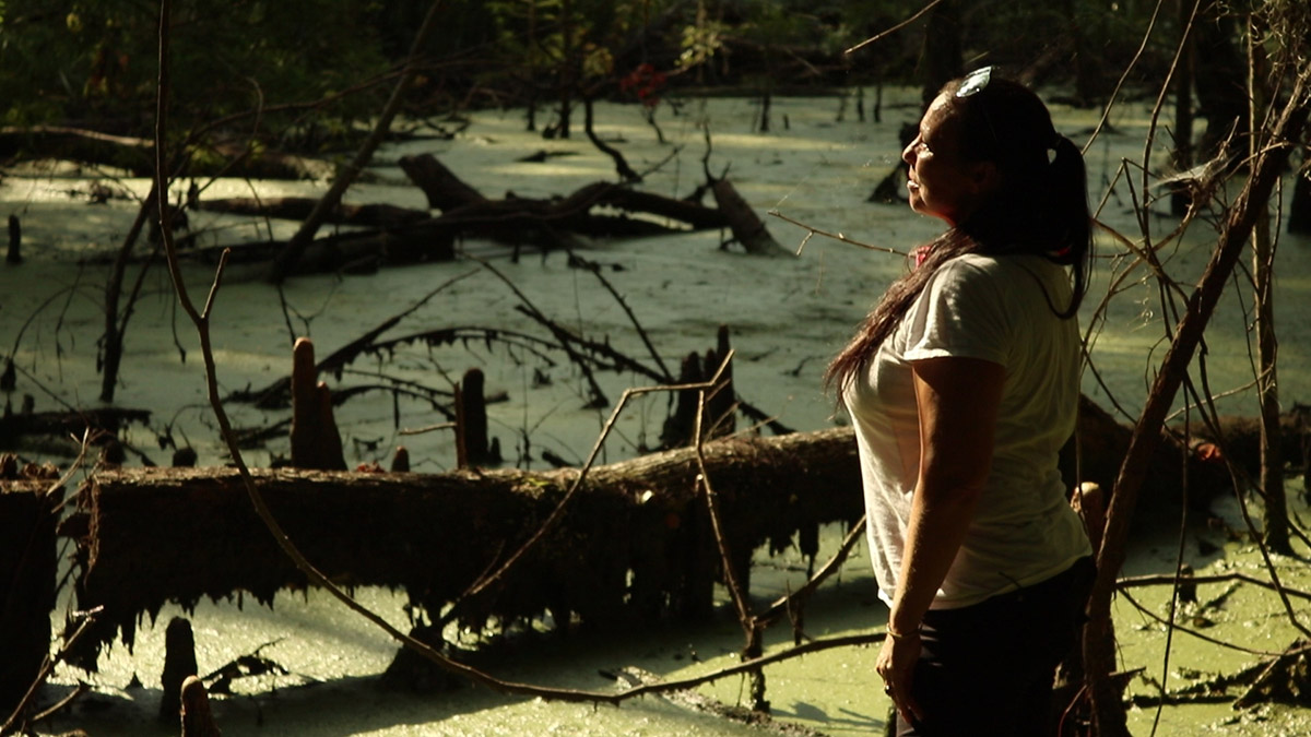
Fred George Basin was Misty Penton’s childhood playground. A one time farm, the land sat mostly unused for decades. A nearby cypress swamp houses a wood stork rookery, and Misty found those large white wading birds foraging in wetlands and old cattle ponds on the property. The sinkholes, pastures, forests, wetlands, and that rookery gave her neighborhood a natural, rural quality.
Right around the mid 2000s, both the rookery and the old farm looked like they might be sold and developed. In 2007, retired Florida State Parks biologist Jim Stevenson bought the swamp, which was behind his house. We visited the rookery with Jim and Misty when wood storks were nesting. He manages it as a nature preserve for the storks and numerous other animals that make use of the habitat.
Misty took a different approach to protecting the old farmland. She petitioned the Florida Division of Administrative Hearings to reconsider proposed rezoning of the land for residential use. In 2006, the Leon County Board of County Commissioners voted to acquire the land. While 150 of the 175 acres would be kept for conservation, the county also wanted active recreational amenities. This means a baseball and a football field, and a playground.
“It really offers a lot for families with a variety of interests,” Says Leigh Davis, Director of Leon County Parks and Recreation. “Those that are interested in the more traditional, formal team sports, there’s an opportunity for them. But for those that want an opportunity to get out in nature, there’s an opportunity for them as well.”
Misty remains heavily involved with the greenway through the Wildwood Preservation Society, about which we’ll learn more below.
Managing the Natural Side of Fred George Basin Greenway
The areas we explored in the video are in the 150 acre “passive recreation” part of the greenway. But don’t let the word passive fool you. Leon County is actively managing it for both the plants and animals and the people who enjoy the habitat.
The following is a list of habitat improvements on the property. After that, we list planned improvements for those of us who like hiking the greenway.
Habitat Enhancements
Wood Stork Habitat. As we covered in our wood stork rookery segment, wood storks spend a couple of months nesting and caring for hatchlings. After that, parents and juveniles spread across town in search of foraging habitat.
Being so close to the rookery, the county felt that “we had an extreme interest in wood stork habitat.” We’re interviewing Leigh by what was once a cow pond. “We worked with US Fish and Wildlife to make sure that the pond was designed appropriately for that habitat.”
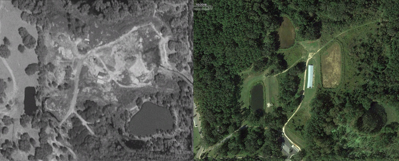
Google Earth images of Fred George Basin Greenway in 1994 (left) and 2019 (right). You can see that today, the cow pond (the water body on the lower left) is surrounded by vegetation, compared to 1994. Additionally, the natural wetlands in the southeast corner are surrounded by more tree cover than before.
Rehydrating the wetlands. To keep their farmland from flooding, previous owners of the property changed the land to drain water away from pastures and the wetlands we see on the south edge of the property. According to the Master Plan for the greenway, “channelization of existing streams, filling, and the construction of berms” (page 6) increased flooding around Fred George sink. And it also increased the amount of unfiltered stormwater runoff into the sinks from surrounding roadways.
To restore the hydrology of the greenway, Leigh says, “and this is not the technical term, but (the county will) punch holes in the berms … to return this land to its native state.”
The master plan also calls for managing invasives and encouraging native plants in the bottomland forest, which will better filter the water flowing into the sink.
Restoring the upland forest. While much of the greenway is a wetter, bottomland forest, there is some upland forest. This is longleaf pine/ wiregrass habitat. The county has used prescribed fire here to manage invasives and encourage native plant growth. And “we actually have done an additional planting of longleaf pine, and some wiregrass plantings as well.”

Picnic pavilion near a pond at the south side of Fred George Basin Greenway.
Enhancing the Natural Experience
Here is a link to a map of Fred George Basin Greenway. It shows existing trails, so you can plan a walk out to Fred George sink. It also has a few features we won’t see if we go hiking there today, but that we should see in the future.
Observation decks. There will be two spots where you can get a good view of the landscape at the greenway. “One at the sink that is looking at the northern part of the property.” Leigh says. “And one at the water body at the southwest corner of the property.” This will be a good place to observe wading birds.
Boardwalks. In the video, Misty shows us a watermark on a tree that is just over her head. If we get serious rain, many of the trails on the greenways aren’t usable. “The other thing that we are looking at are segments of boardwalk, because there’s multiple parts of this park that are in low lying areas.” The new boardwalks would allow hikers to enjoy the floodplain even when water is high.
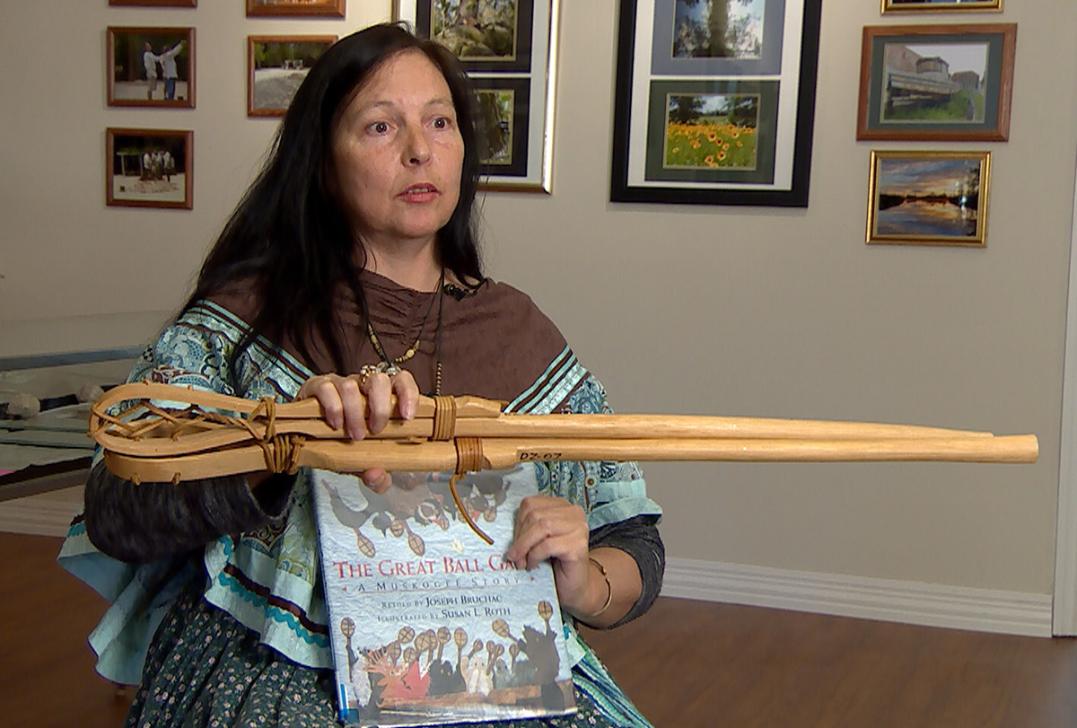
Misty Penton, holding a pair of Muscogee ball game sticks at the Fred George Basin Greenway museum.
The Wildwood Preservation Society
“Part of our land management plan,” Leigh says, “we do have a partnership with Wildwood Preservation Society. They run the museum and education program for us.”
Over on the “active use” side of the greenway, you’ll find a museum that Misty helps run. We featured this space in our video on Muscogee Shell Carving. The museum celebrates native culture in our area, and native connection to nature. Once a month, WPS hosts talks on native culture, ecology, and archeology. To stay up to date with museum events, you can follow Wildwood Preservation Society on Facebook.
In addition to their education and outreach work, WPS helps maintain the property. “They also do volunteer days for us and help in terms of clean up or invasive plant control.”
Misty alludes to this at the end of the video. “You understand what you have. You have to protect it, it’s your gift. And protecting it means you’ve got to get in there and get your hands dirty sometimes.”
As I mentioned in our previous post, Misty has joined the WFSU Education and Outreach team. Stay tuned for more content on native culture in our area, and the native connection to nature.
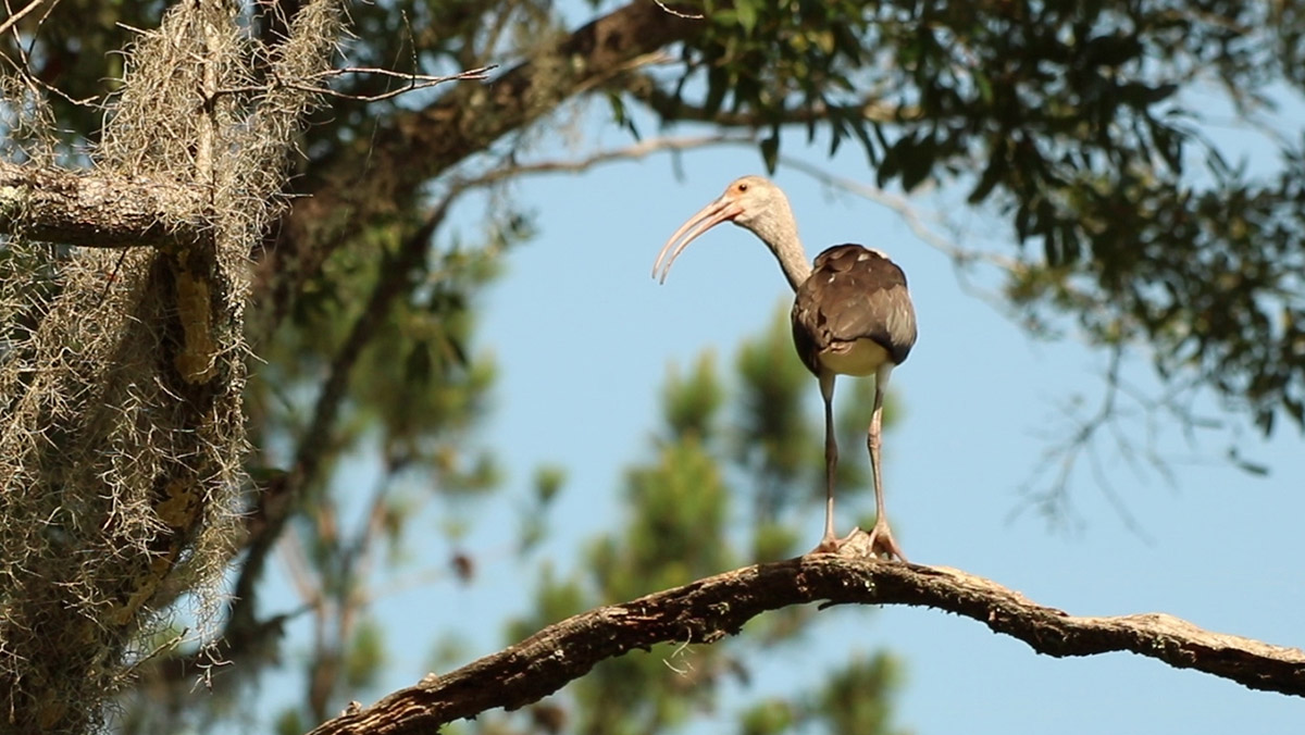
Juvenile white ibis roosting in a tree alongside a pond.