
Video: We travel down the Aucilla River, the eastern boundary of the Red Hills region, the dark water of which preserves some of the nation’s oldest archeological sites. It’s also a challenging kayak and canoe trail.
Rob Diaz de Villegas WFSU-TV
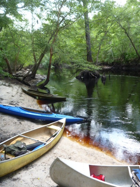
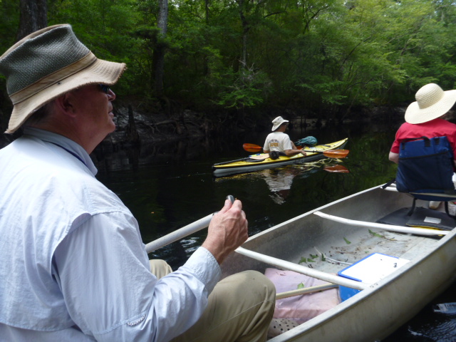
Until paddling the Aucilla River during the production of this video, I had never had to portage on a river. For non-paddlers, portage is when you take your canoe or kayak out of the water to navigate around an obstacle. And on that day, there were plenty of obstacles. The Aucilla River Paddling Trail Guide recommends the river be paddled by those with intermediate to advanced skills. Fallen trees and river bends, sometimes in a tricky proximity, had us pivoting at sharp angles. This was less of a challenge for the three kayakers on our trip, but David Ward and I each ferried a photographer on heavier canoes. If you’re looking for a Florida river on which to peacefully coast, this isn’t it. This is a more adventurous river; and one with thousands of years of human usage.
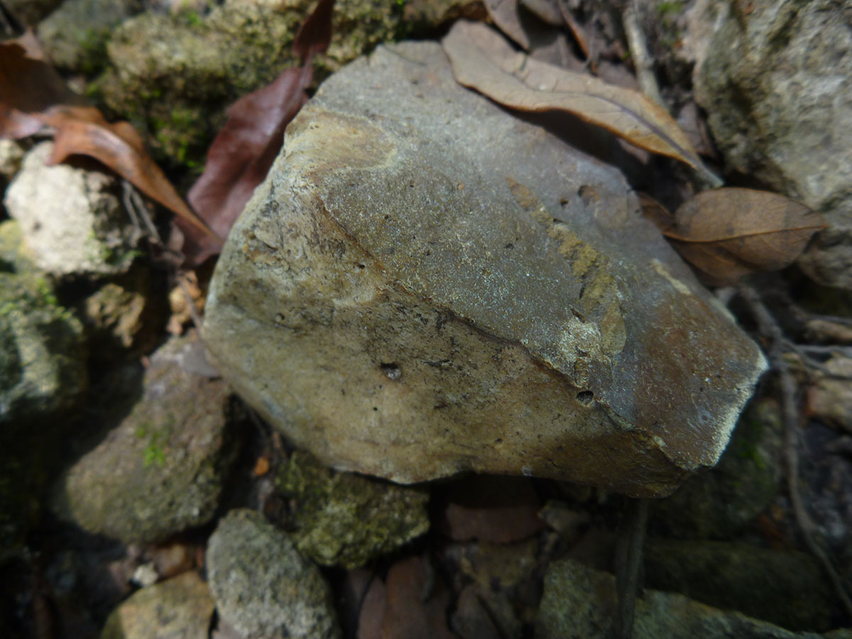
Native peoples living around the Aucilla would knap chert into tools and spear points. According to local historian David Ward, this site along the river had been used as long as 10,000 years ago.
We were out on the river with David, the president of the newly formed Aucilla/ Wacissa River Group and a local historian. That group is in the process of joining the Waterkeeper Alliance as a Riverkeeper organization, like the Apalachicola Riverkeeper. In his canoe was Anne Holt- author, Executive Director of Main Street Monticello, and one of the Tallahassee Democrat’s 25 Women You Need to Know. David spoke to us of the people who have made use of the river over the millennia, from the paleolithic men and women who made tools at the chert outcropping where we stopped, to the Apalachee. I had noticed that the Apalachee territory and the Red Hills plantations that succeeded them in the 1800s were both bound by the Aucilla on the east and Ochlockonee River on the west. David and Anne touted the fertility of the red clay soil there; it made the well-fed Apalachee taller than other native Floridians and it attracted northern settlers after the Apalachee were driven out of the state.
David grew up in Jefferson County; the Aucilla was a childhood place to play. Doug Alderson doesn’t have that same connection to the river; but if you’re going to go on any Florida river, there aren’t many better people to have along. Doug’s an experienced paddler and guide, and as Assistant Chief of Florida DEP’s Office of Greenways and Trails, he has a hand in exploring and designating state trails. Twenty-seven miles of the upper river are designated as one such trail. The trail has multiple put-in and take-out options (eight total), has access to public land for camping opportunities, and runs parallel to the Florida National Scenic Trail for a few miles before the river goes underground. This is where multiple other recreational options become available, but I’ll get to those in a second. For now I want to focus on the river.
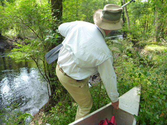
David portages his canoe.
The first full blockage occurred just after we passed the Cody Escarpment, a mass of red clay that sits atop our limestone aquifer in north Florida. Our descent off of it was marked by small rapids, which as you see in the video shot us forward through them. Contrast this with the Apalachicola, where the river stays more or less level as you move off of the Cody Scarp, but bluffs swell up around you and then taper off after the red clay Estiffanulga Bluff. After the rapids, we came around a bend to see a downed tree blocking our path. How would we get around it? Floodplain forests can be dense, so the first order of business was to find an opening where we could wedge our watercraft. The bank was muddy and slick, but once that first person was up on the bank, they could help pull the canoes and kayaks up. There was no easy path to the other side, but there was a clearing where the tree had been. Pushing through the tangle on the other side, there was a small dip in the bank where we lowered our boats and launched again.
The second tree that blocked our way was lower and had less branches, so Doug had us move our kayaks and canoes parallel and jump out onto it. Then we pulled our boats over and hopped back in.
David had scouted the way for us a couple of weeks earlier. At that point, we’d had regular rain for a few weeks. According to the Suwannee River Water Management District’s gauge at the 27 bridge, the water was just over 52 feet above sea level when David first went. It was below flood level (54), but slightly above the Paddling Guide’s recommendation (which is 52). David said the flow was strong and that he barely had to paddle to move. Since he scouted, the rain stopped and the water dropped to 49.29 on the gauge, a couple feet lower. More snags were exposed, and it’s possible that some new trees had fallen. Those first two blockages were fairly close together, and we had no way of knowing how many more lie ahead. Once or twice, it seemed like we had arrived at another one, only to see an opening along the river bank. Sometimes that meant a sharp pivot from the back of a canoe with a full grown man in the front who wasn’t paddling. You see the result of one such turn early in the video. I got a slightly better feel for the weight distribution of the canoe as the trip went on, and snags decreased.
Our trip took us from the US 27 bridge in Lamont (Access Point 2 on the Guide) to the Old Railroad Bridge Launch (Access Point 4), a trip of 11 miles.
Creating an Aucilla/ Wacissa Riverkeeper
David’s group is currently working on completing the application process to join the Waterkeeper Alliance. Much like the Apalachicola Riverkeeper fights to for more water to flow from Georgia and Alabama, the Aucilla/ Wacissa group has a struggle that has pulled together community members. From what David told me (over the phone this morning, as they organized the day after we shot), they’re focused on a 160 acre lot containing old-growth cypress trees. A timber company is planning on logging this wetland forest, and, according to David, it’s threatening lawsuits to a local homeowner’s association that’s denying the company road access to the tract.
As David told me, it’s part of a problem the river has faced over the last fifteen years. “Timber companies, and they’re always out-of-state timber companies, have bought property and timbered in the river, and caused a lot of damage”
The group is hoping to convince the Suwannee River Water Management District to purchase the 160 acre lot. Also of interest to the group is protecting the many archeological sites along the Aucilla and Wacissa rivers, and to further expose people to a relatively unknown north Florida river.
Robert Daniels,a retired Florida Fish and Wildlife officer who kayaked with us, is the vice president of the AWR Group and would be the Riverkeeper (it’s both the name of the organization and a specific role within it).
Continuing the Adventure in the Aucilla/ Wacissa Watershed
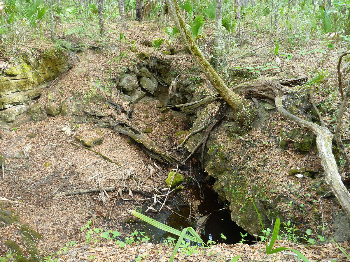
As the limestone aquifer beneath dissolves, it swallows the ground and exposes the submerged Aucilla River.
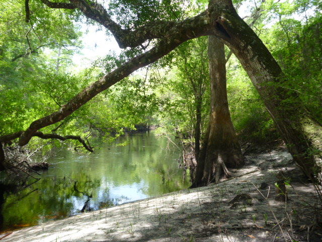
The Aucilla River Paddling Trail ends where the river goes underground. The 89 mile river, which originates near Thomasville, Georgia, rises again to the south. It ultimately meets with its main tributary, the Wacissa River, and flows into the Gulf of Mexico. While you may not be able to paddle it straight through, like the Ochlockonee or Apalachicola; there is the potential for a different kind of combined paddling and hiking trip. The river goes under right next to Goose Pasture Road. Across that road, the Florida National Scenic Trail continues it’s path along the river, following it both underground and in the thirty or so appearances it makes before permanently reemerging. As we covered in an early EcoAdventure, the Aucilla Sinks is one of the most scenic segments of the Florida Trail. With planning and car coordination, you could hike the trail to where the Aucilla meets Slave Canal near US 98 and resume paddling to the coast.
Another option would be, if you left a car at the final access point of the upper Aucilla, to drive down to Goose Pasture, a campsite along the lower Wacissa. From there, you could paddle down Slave Canal. Slave Canal, which we paddled in 2013, is a canopied river that can be as challenging as the upper Aucilla. It can be difficult to find the entrance to the Canal; consult the Wacissa Paddling Guide for more information.
I’m not sure that many people try this kind of combo trip. But when I see all of these compelling adventures so close together, I get to wondering. These are remote waterways and trails, and they can all be challenging on their own. Coordinating cars at multiple access points would take serious logistical planning; it would be easier if you got yourself a support team. It could be plenty difficult to do, but it could be a spectacular journey as well.
WFSU Loves Local Music
Whenever a local musician is generous enough to share their music with us, it means a lot to me. The track that you hear as we make our way down the river was provided by Port Saint Joe musician Brian Bowen. He was even nice enough to give us versions of his songs with vocals and without, as instrumentals give us more flexibility with editing. I first met Brian in 2013 at Save the Bay Day, the rally that preceded the Bill Nelson/ Marco Rubio special senate session in Apalachicola. His song, Salt in the Blood, captured so well the problems faced by the men and women who work Apalachicola Bay, and was a perfect accompaniment for the video I produced about that day and the upcoming RiverTrek paddle. While the song we used in this video was not about the Aucilla, it’s a north Florida product performed by a very good group of musicians (I recognize a name or two in his liner notes who had performed on WFSU’s outloud program). The more local music in our pieces, and local musicians featured directly in WFSU programing, the better. On that note, music folks, my e-mail is at the top of the page.