
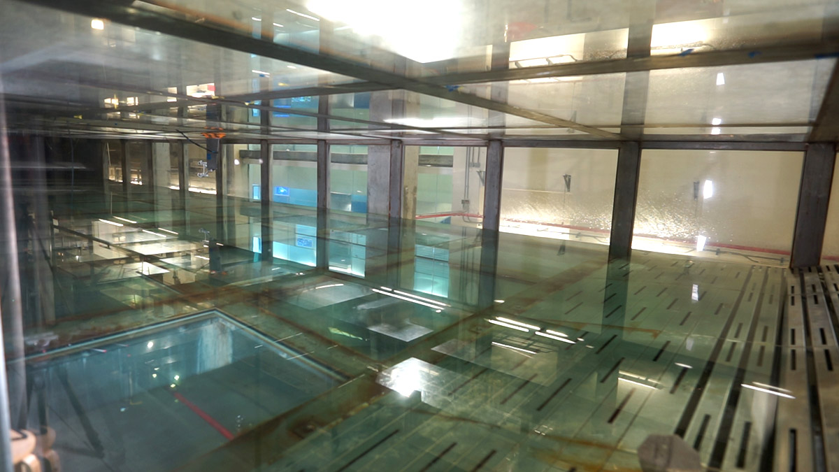
I was looking out at a Category 5 hurricane, and not for the first time. But unlike during Hurricane Andrew, over thirty years ago, this time the glass didn’t break. I was visiting the University of Miami’s SUSTAIN Lab, where they make hurricanes- up to cat 5, safely contained within a box. Within that box, the lab tests barriers they hope will one day protect our coasts from strong storms and specifically storm surge.
A few weeks before my November visit, we had a reminder of why SUSTAIN is doing this work. In October, Hurricane Ian devastated southwest Florida. It had only been four years since Michael hit the panhandle. That’s one Category 5 (Michael) and two Category 4 storms(Irma and Ian) hitting Florida over a five-year period, causing over 200 billion dollars of damage.
Strong storms are becoming more frequent. When Andrew hit Miami in 1992, it had been decades since the last Category 4 or 5 storm hit Florida, and over a decade before the next (Charley, Category 4). Every time one inches towards the Gulf of Mexico, all of Florida nervously tracks its cone.
However, as SUSTAIN director Dr. Brian Haus says, much of the damage from hurricanes comes from storm surge, which affects areas outside the cone.
“People tend to focus on the cone, which is all about wind speed and did not pay enough attention to the fact that even three days out [from Hurricane Ian], there was supposed to be basically seven feet of water over Sanibel Island…I mean, there was significant storm surge [that] had been forecast, even if the storm had gone to Tampa Bay.”
An interdisciplinary approach to hurricane preparedness
In the short term, hurricane preparedness is understanding the strength of a storm, the conditions it may cause, and where it is going. In the long term, preparedness is designing communities that can best withstand whatever storm comes their way.
The SUSTAIN Lab is looking to improve preparedness on both fronts.
Its full name is the Alfred Glassel Jr. SUrge-STructure-Atmosphere INteraction Laboratory, at the University of Miami Rosenstiel School of Marine, Atmospheric and Earth Science. There’s a lot going on in that name, just as there is a lot going on in the lab.
To solve the many parts of the problem, they’ve assembled an interdisciplinary team of researchers. Oceanographers, marine physicists, and meteorologists model the motion of waves and the conditions that create waves that cause harm to human structures. Civil engineers work with biologists to protect those structures, combining manmade components and natural systems.
“I’ve been working a lot with ecologists, social scientists, a lot with architects,” says Dr. Landolf Rhode-Barbarigos, a civil engineer. As he describes, the first challenge is to have everyone learn to talk to each other. “There is a language barrier in a sense. We need to learn the proper terminology… and once we actually cross-pollinate each other, I think that’s where the real value is and that’s where we’re making progress.”
First line of defense (a): barrier islands
Let’s start at the point of impact: our coasts.
As a barrier island protecting the mouth of the Caloosahatchee River, Sanibel bore the initial brunt of Ian’s storm surge. Over the last few decades, people have flocked to Florida’s barrier islands as vacation destinations. And especially in South Florida, these thin strips of sand can become crowded with human structures.
“Over the pre-settlement times in Florida, the barrier islands were natural,” says Dr. Haus. “They basically served the function of protecting the mainland from storms and things like that. I mean, there’s a reason Henry Flagler’s Railroad didn’t go through Miami Beach and was built inland on the ridge where it was higher and away from the water.”
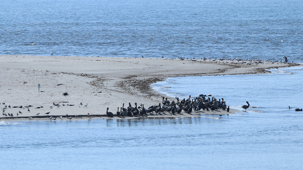
Barrier islands and peninsulas on the Forgotten Coast, in the Florida panhandle, are less developed, allowing us to see how coasts used to absorb storm surge. And they’re always changing shape, as Florida State University oceanographer Dr. Jeff Chanton explained to us on a visit to St. Vincent Island, a barrier island at the mouth of the Apalachicola River. They lose sand in one place (erosion), which lands in another (accretion).
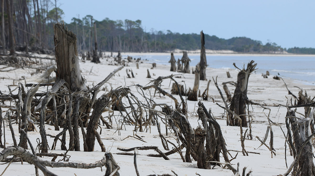
This movement happens, hurricane or not. But when Hurricane Michael hit Saint Vincent and the rest of the Florida panhandle, we saw how dramatically water can alter a coastline.
Hurricane Micheal and the Forgotten Coast
In March of 2020, I went with Jeff Chanton to the Gulf side of St. Vincent Island. The beach was littered with the wreckage of trees. It turns out they had been recently unearthed. As I shot video of this decapitated forest, Dr. Chanton said to me, “Along here where you’ve been taking pictures was the top of a dune. And that’s all where the dune was, all those roots.”
As on neighboring St. George Island and Saint Joseph Peninsula, many of St. Vincent’s dunes were flattened by Hurricane Michael. And at the thinnest point of Saint Joseph Peninsula State Park, Eagle Harbor, the hurricane broke through in two places. While not an island, the peninsula functions similarly as a barrier and was formed along with the neighboring islands at the end of the last ice age.
Barrier islands take a punch. But they also heal. The gaps on St. Joseph Peninsula filled with sand within a couple of years. Sand dunes, too, heal and reform over time. But this is a process that takes decades. With an increase in strong storms, combined with sea level rise, there’s no guarantee dunes will reform as they had been.
Waves are always reshaping barrier islands- gradually every day, and more dramatically during storms. It’s a marvel of nature, but a challenge for the engineers who build on them. How can we protect buildings on a coast that changes shape?
First line of defense (b): coastal ecosystems
Where barrier islands take a punch, ecosystems on and near the coast can disrupt waves, and slow them down. Like barrier islands, these too have been replaced by human-built structures in much of Florida.
“Natural systems like salt marshes, seagrasses, oyster reefs, coral reefs, even mangroves,” said Rhode-Barbarigos,” They all kind of protect us, but they all need time and space. And I argue we don’t have that.”
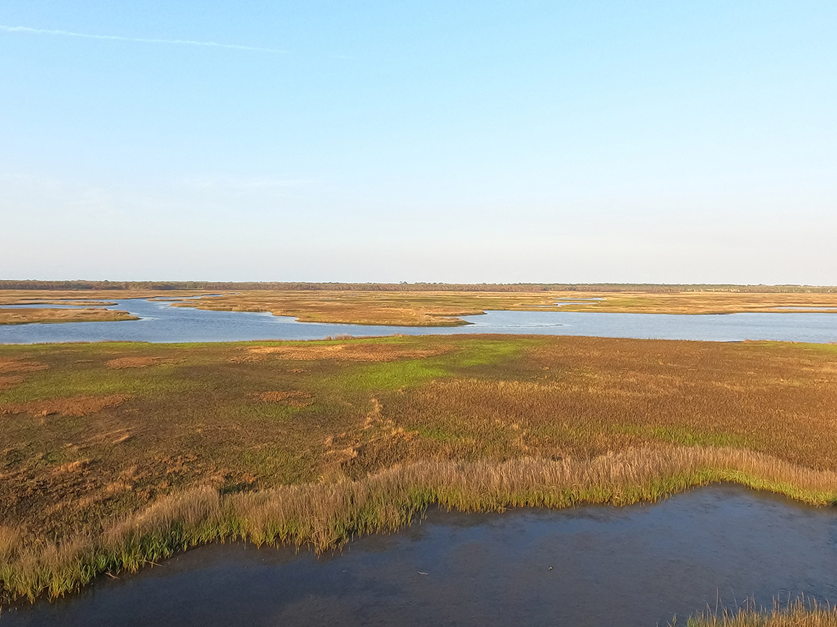
Again, the Forgotten Coast is in contrast to much of the rest of Florida’s coast. Below is a map of the area between Bald Point and the Flint Rock Wildlife Management Area. Zooming in, we see extensive marsh habitat. Zoom into the mouth of the Ochlockonee River, off Bald Point, and you can see oyster reefs that become exposed at low tide.
Below, you can see that the mouth of the Caloosahatchee is an urban landscape. This replaced the dominant coastal ecosystem in central to south Florida: mangroves. When Landolf Rhode-Barbarigos says “we don’t have time or space” for coastal habitats, you can kind of see what he means. It would take years to establish habitats here, and where would they go?
Understanding the physics of waves
Here’s the conundrum, in Florida and across the country. People live in the very places that had previously provided a buffer from storms. Not only are those places vulnerable, but inland communities are less protected as well. And while high wind speeds grab our attention, storm surge causes most of the damage at the coast.
To help protect these communities, SUSTAIN has to first understand the motion of waves, and how to disrupt them.
Waves (and the bubbles within them) transmit energy
With a few keystrokes, Peisen Tan started the waves moving. “This is a monochromatic wave with seven-centimeter amplitude, which is like a rough wave in the ocean.”
Tan is a graduate student with a background in oceanography. One focus of his research is white caps on waves, the bubbles that top a wave when wind speeds get high. “These bubbles contain energy. And that’s part of my research. How will these bubbles and sea sprays contribute to a hurricane when the air is blowing over the water?”
Might bubbles make hurricane waves worse? Drinking seltzer as I write this, I can see where it might be hard to believe. But the trapped air has weight. And the weight of water, when it gets moving, transmits energy.
That energy can be destructive.
“Wind is pushing against that water and adding energy to the water, energy, and momentum.” Said Dr. Haus. “So as that wave continues to propagate and grow, all that wind energy is going into those waves and they grow and can become very large.”
Activating the hurricane simulator’s 1460 horsepower fan, Tan next created a simulation of those very large waves.
The weight of water
The tank is 23 meters long and 6 meters wide. While the wind speed exceeds 150 miles per hour, the tank can’t accommodate full-sized ocean waves, so the structures they test in it are scaled down proportionately.
Looking through the clear acrylic sheet, we could see the violence of Category 5 waves. To understand their capacity to wreck a coastline in our full-sized world, we must take into account the weight of water.
“One cubic foot of water is 64 pounds,” said Landolf Rhode-Barbarigos. “If we take four cubic feet of water, it’s basically the average weight of an NFL player. Now, imagine an NFL player running into you and basically tackling you. Now, imagine a sea of NFL players coming to you and then coming again and again.”
Basically, water is heavy, and when it moves fast, it hits hard. In many places, human-built structures sit directly on the coast with no barrier between them and repeated multi-ton assaults. How does one begin to design a barrier to defend coastal communities?
Disrupting an organized wave motion
Traditionally, engineers have countered the weight of waves with strength. Tall, heavy walls of concrete make a shoreline look like a fortress against the might of waves. But do they work?
“Traditional construction of things like sea walls,” said Dr. Haus. “[A] sea wall doesn’t take any energy out. It bounces energy off.”
A sea wall reflects a wave outward but keeps its wave motion intact. Added Rhode-Barbarigos, “Sometimes this also worsens the conditions in nearby areas.”
For an alternate approach, SUSTAIN looks to the ecosystems which had traditionally buffered coasts.
“The key thing for waves is they go into things like salt marshes, oyster reefs, seagrasses, mangroves,” said Dr. Haus, “they disrupt the motion of the water. They break down its organized wave characteristics into smaller scale turbulent structures that cause dissipation.”
Friction and dissipation
What happens when those organized waves roll over billions of blades of grass or the crags of intertidal oyster reefs? It creates friction, and the waves lose momentum and become less organized.
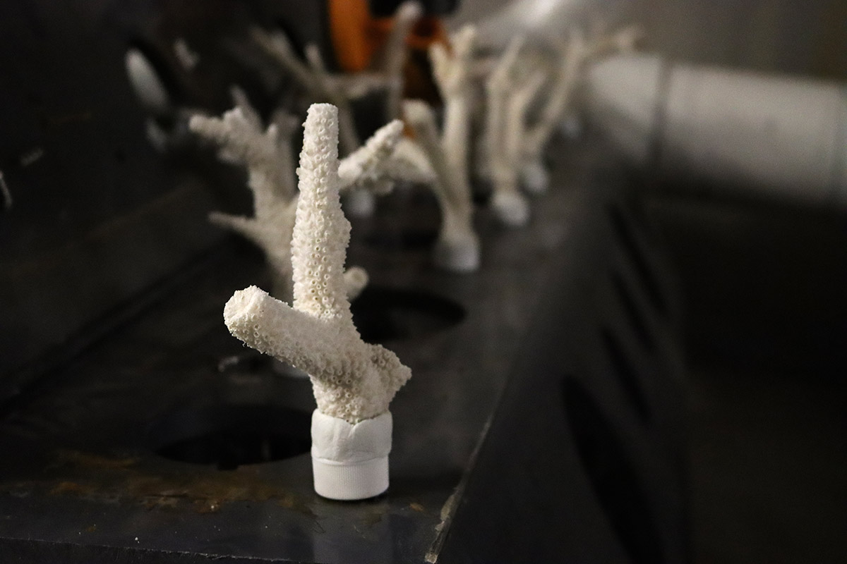
The troughs of large waves can scrape against ecosystems just below the surface of the water- coral reefs, seagrass beds, and subtidal oyster reefs. “Corals create friction or dissipate the energy by breaking the waves of turbulence,” said Dr. Rhode-Barbarigos, “and if you do it on the right locations, when they arrive at the shoreline, you have less impact.”
SUSTAIN was looking for a solution that could be installed quickly and compactly- manmade, but mimicking the effects of natural systems, and possibly incorporating them as well.
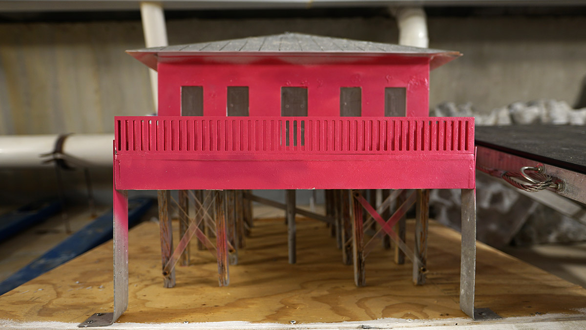
SEAHIVE- a hybrid barrier against storm surge
The image above is a SEAHIVE module.
“The SEAHIVE is a way to replace a traditional sheet pile sea wall with something that is perforated,” said Dr. Haus. “Something that can dissipate more energy locally, as opposed to just reflective, which is what happens at the sea wall.”
It’s made of concrete like a traditional sea wall, but its holes create the kind of friction which dissipates wave action. The hexagonal shape allows them to stack the modules on a slope, and the holes can be used to plant mangroves or corals. These provide additional friction as well as habitat for fish and other marine species.
“So, create kind of like a living shoreline,” said Dr. Rhode-Barbarigos, “a hybrid system that we can adapt.”
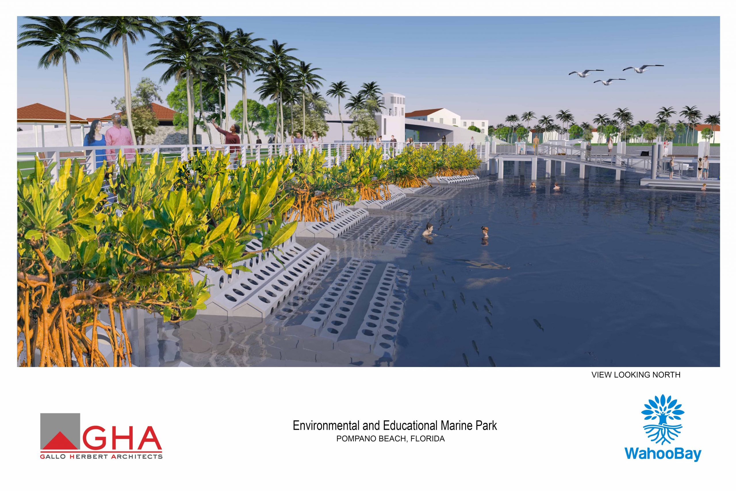
The first modules were installed last month (March 2023) at Wahoo Bay in Pompano Beach, Florida. In June, the Wahoo Bay website goes live, with webcams to let viewers watch the sea life that gathers around the SEAHIVE.
The SUSTAIN Lab will monitor the habitat and survey the species that make use of it over time. “Eventually what you want is nature to take over.” said Rhode-Barbarigos, “So you want to show that there’s a positive trend and then basically you let the ecosystem develop.”
Protecting vulnerable populations from storm surge
While they’ll be able to measure SEAHIVE’s effectiveness as a habitat right away, there’s no telling if or when it will be put to the ultimate test. SUSTAIN hopes to install SEAHIVE at other locations in the coming years, increasing the likelihood that it will one-day face storm surge from a hurricane.
Landolf Rhode-Barbarigos feels the urgency of their mission. Strong storms have been landing more frequently in recent years, and communities need to be protected.
“I would say with climate change and rising temperatures, the desertification of the coastlines, I mean, it’s almost kind of like the perfect catastrophe scenario for the communities,” he said. “Luckily we have been doing better in terms of preparation, in terms of our codes, in terms of construction. But there [are] always vulnerable populations and regions.”
This segment was produced in collaboration with NOVA. NOVA’s Weathering the Future premieres on Wednesday, April 12 at 9 pm ET on WFSU-TV. Major funding for WEATHERING THE FUTURE and the CLIMATE ACROSS AMERICA Science and Society Project is provided by the Corporation for Public Broadcasting. Additional funding is provided by the GBH Planet Future Fund.