The WFSU Ecology Blog
  • Home
    • About
    • EcoAdventures
      • Kayak and Canoe Adventures
      • Hiking
      • Wildlife Watching
    • WFSU Public Media Home
  • Documentaries
    • EcoCitizen Show | Seasons in South Tallahassee
    • Red Wolf Family Celebrates First Year at the Tallahassee Museum
    • Roaming the Red Hills
    • Oyster Doctors
    • Testing the Ecology of Fear
    • EcoShakespeare
    • Stories from the Apalachicola
    • Classic WFSU Ecology Documentaries
  • Habitats
    • Estuaries
      • Oyster Reef
        • The Effects of Predators and Fear on Oyster Reefs
        • Apalachicola Oyster Research
        • Animal Species in a North Florida Intertidal Oyster Reef
        • Oyster Reef Ecology | On the Reef
      • Salt Marsh
        • In the Grass- Salt Marsh Biodiversity Study
        • Plants and Animals of a North Florida Salt Marsh
        • Salt Marsh Ecology | In the Grass
      • Seagrass Bed
        • Predatory Snails, and Prey, of the Bay Mouth Bar Seagrass Beds
      • In the Grass, On the Reef Glossary
    • Waterways Big and Small
      • Apalachicola Basin
        • Apalachicola Bluffs and Ravines | Virtual Field Trip
        • The Age of Nature Screening & Discussion | The Future of the Apalachicola
        • Apalachicola RiverTrek | Kayaking, Camping, & Hiking the River Basin
        • Apalachicola River and Bay
      • Aucilla/ Wacissa Watershed
    • Longleaf Pine & Fire Ecology
  • Backyard Habitat
    • Backyard Blog
      • The Backyard Bug Blog 2018
      • Backyard Blog January 2019
      • Backyard Blog February 2019
      • Backyard Blog March 2019
      • Backyard Blog May 2019
      • Backyard Blog April 2019
      • Backyard Blog June 2019
      • Backyard Blog July 2019
      • Backyard Blog August 2019
      • Backyard Blog September 2019
      • Backyard Blog October through December 2019
      • Backyard Blog January 2020
      • Backyard Blog February and March 2020
      • Backyard Blog April 2020
      • Backyard Blog May 2020
      • Backyard Blog June 2020
      • July and August 2020 Backyard Blog
      • Backyard Blog September/ October 2020
      • Backyard Blog November/ December 2020
      • Backyard Ecology Blog | 2021
    • Backyard Flora and Fauna
      • Bees of North Florida and South Georgia
      • Woody Vines of North Florida
    • Florida Friendly Seasonal Planting Guide
    • Pollinator and Gardening Posts
    • Gardening Web Resources
Kayak and Canoe Adventures
Chipola River Paddling Trail | The Ovens and...
Kayaking Bald Point | Adventure on a Living...
Wacissa Springs Adventure | Kayaking a Wild Florida...
A Geologist’s View of the Apalachicola River |...
Upper Chipola River Kayak Adventure | Ghosts &...
Tate’s Hell & the Apalachicola River Delta |...
Kayak Scouting Mission on the Ochlockonee Water Trail
Merritt’s Mill Pond | Kayaking and Spring Caves
Kayaking the Apalachicola River with my Four-Year-Old Son
Canoeing the Aucilla: A Red Hills River Steeped...

The WFSU Ecology Blog

  • Home
    • About
    • EcoAdventures
      • Kayak and Canoe Adventures
      • Hiking
      • Wildlife Watching
    • WFSU Public Media Home
  • Documentaries
    • EcoCitizen Show | Seasons in South Tallahassee
    • Red Wolf Family Celebrates First Year at the Tallahassee Museum
    • Roaming the Red Hills
    • Oyster Doctors
    • Testing the Ecology of Fear
    • EcoShakespeare
    • Stories from the Apalachicola
    • Classic WFSU Ecology Documentaries
  • Habitats
    • Estuaries
      • Oyster Reef
        • The Effects of Predators and Fear on Oyster Reefs
        • Apalachicola Oyster Research
        • Animal Species in a North Florida Intertidal Oyster Reef
        • Oyster Reef Ecology | On the Reef
      • Salt Marsh
        • In the Grass- Salt Marsh Biodiversity Study
        • Plants and Animals of a North Florida Salt Marsh
        • Salt Marsh Ecology | In the Grass
      • Seagrass Bed
        • Predatory Snails, and Prey, of the Bay Mouth Bar Seagrass Beds
      • In the Grass, On the Reef Glossary
    • Waterways Big and Small
      • Apalachicola Basin
        • Apalachicola Bluffs and Ravines | Virtual Field Trip
        • The Age of Nature Screening & Discussion | The Future of the Apalachicola
        • Apalachicola RiverTrek | Kayaking, Camping, & Hiking the River Basin
        • Apalachicola River and Bay
      • Aucilla/ Wacissa Watershed
    • Longleaf Pine & Fire Ecology
  • Backyard Habitat
    • Backyard Blog
      • The Backyard Bug Blog 2018
      • Backyard Blog January 2019
      • Backyard Blog February 2019
      • Backyard Blog March 2019
      • Backyard Blog May 2019
      • Backyard Blog April 2019
      • Backyard Blog June 2019
      • Backyard Blog July 2019
      • Backyard Blog August 2019
      • Backyard Blog September 2019
      • Backyard Blog October through December 2019
      • Backyard Blog January 2020
      • Backyard Blog February and March 2020
      • Backyard Blog April 2020
      • Backyard Blog May 2020
      • Backyard Blog June 2020
      • July and August 2020 Backyard Blog
      • Backyard Blog September/ October 2020
      • Backyard Blog November/ December 2020
      • Backyard Ecology Blog | 2021
    • Backyard Flora and Fauna
      • Bees of North Florida and South Georgia
      • Woody Vines of North Florida
    • Florida Friendly Seasonal Planting Guide
    • Pollinator and Gardening Posts
    • Gardening Web Resources
Aucilla/ Wacissa WatershedFloridan Aquifer: Springs, Sinks, and More

Hiking the Aucilla Sinks | Geology of the Floridan Aquifer Uncovered

by Rob Diaz de Villegas February 18, 2021
by Rob Diaz de Villegas February 18, 2021 0 comment

Click to subscribe to the WFSU Ecology Blog

North Floridians are drawn to the Aucilla Sinks because they’re unlike almost anything else in Florida, and a little mysterious. A trail winds past rocky pools and short streams lined with tall walls of limestone. What we’re seeing is bits and pieces of the Aucilla River. The river runs aboveground to the north and to the south of here, but I wonder- what happened to it in the middle? I wanted to know, so I invited geologist Harley Means for a hike.

We don’t associate Florida with large rocks. What Harley revealed to me, though, is that the Aucilla Sinks are in fact uniquely Floridian. It’s the Florida beneath us, exposed.

Harley is the Assistant State Geologist for the state of Florida. Our state’s geology is almost entirely under us- a large, limestone aquifer that provides our state with abundant water. In our previous adventures with Harley, we’ve gone where groundwater interfaces with the surface. It’s in these places where we can start to visualize the many pathways- big and small- through which water makes its way into our taps, and into our remarkable springs.

One of the Aucilla River Sinks.

Aucilla Sinks Trail at a Glance

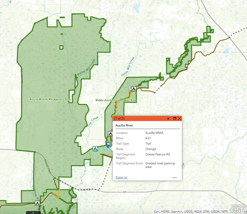
The Aucilla Sinks segment of the Florida National Scenic Trail is 4.21 miles long.

The trailhead is located on Goose Pasture Road (link to marker in Google Maps) in the Middle Aucilla Wildlife Management Area. You can also enter from a parking area at the other end of the segment.

Here’s a link to the trail segment from the Florida National Scenic Trail segment map. It’s not a map PDF or basic web page like I usually link to. It’s a GIS (Geographic Information System) map, which is interactive, but might take some getting used to if you haven’t used one before.

The trail is best enjoyed over the winter. I did find a few ticks on me after our January hike, but I found many more after hiking the trail in late March (not to mention the mosquitos then).

The Aucilla River Goes Under

When you get to the Goose Pasture Road trailhead, you can go in one of two directions. One leads you south to the sinks, while another leads you north to the Aucilla River. If you plan for a longer hike, you can follow the Florida Trail along the river and all the way to, well, the Everglades. With access points and campsites every few miles, you can plan a Florida Trail hike of a couple of hours, days, or months.

But back to the Aucilla.

Harley Means stands where the Aucilla River goes underground.

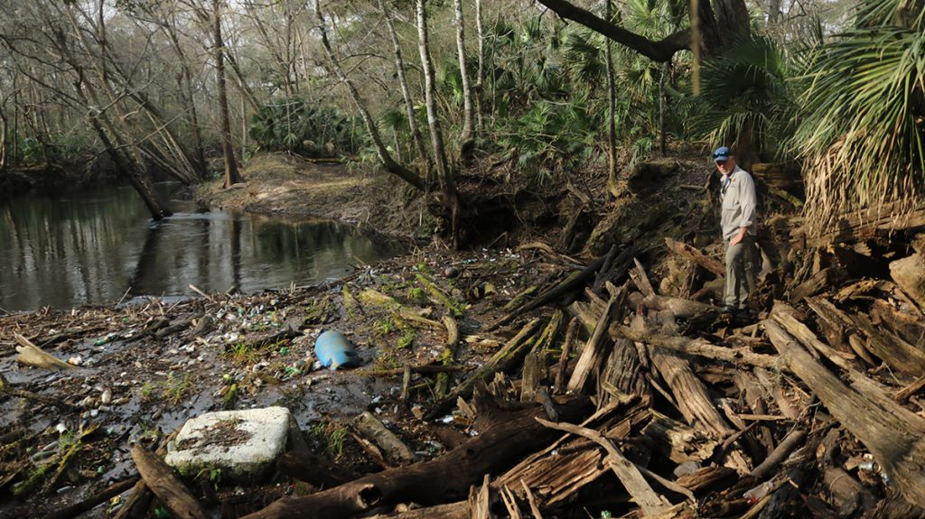
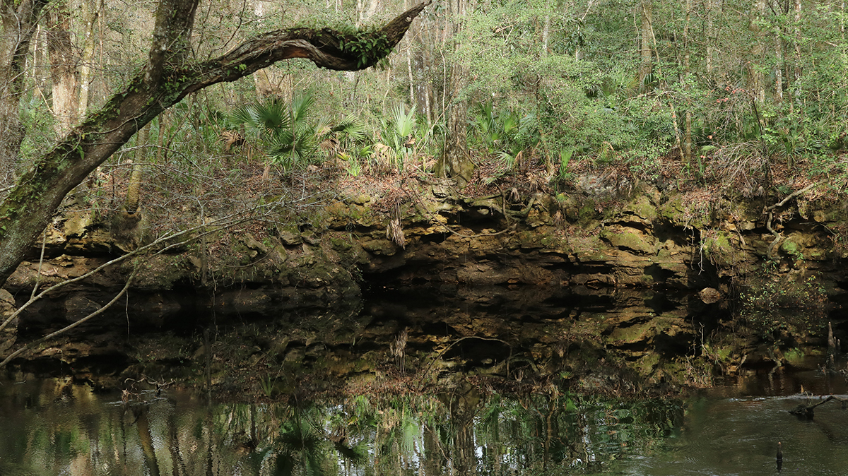
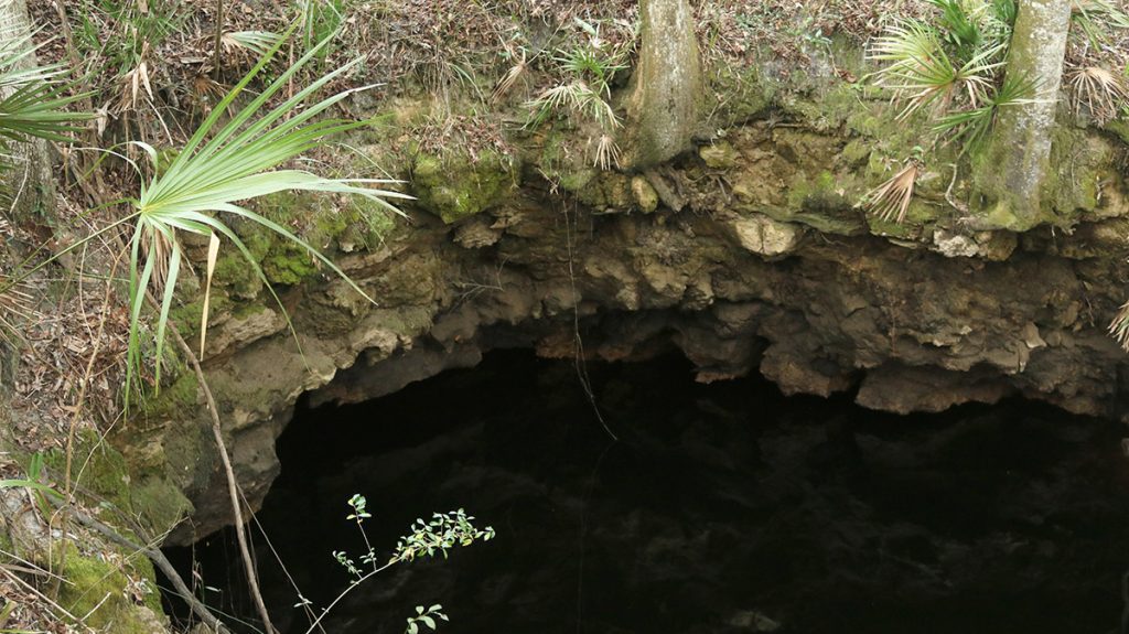
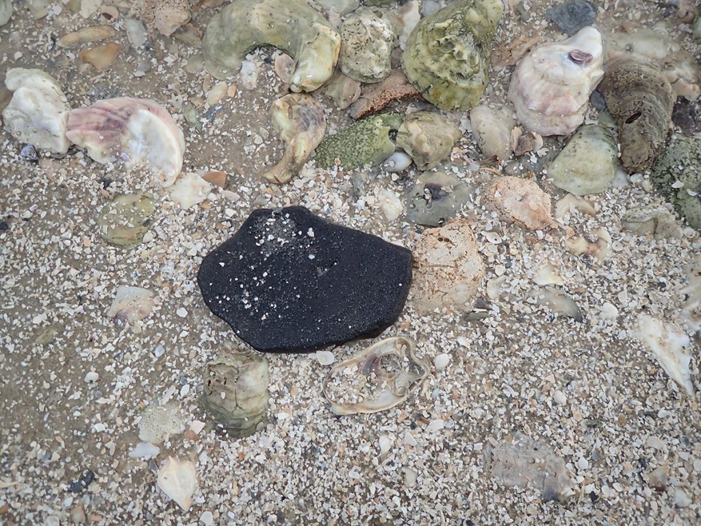
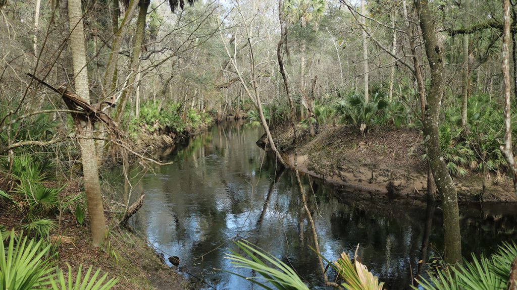
After a few minutes of walking, you can reach the river where it goes under. Everything carried by the river ends up in a pile over the swallet, from trees and branches to every piece of trash to fall off of a boat or get washed into the river.

Turning back from the river and crossing Goose Pasture Road again, you see the river rise and fall periodically, into and out of the ground. These are the Aucilla Sinks. If you look at the sinks on an aerial map, they follow more or less a singular path, like a single stream that finally emerges at Nutall Rise, and continues to the Gulf aboveground.

It looks like an underground river, but it isn’t really.

“Let’s sort of get that out if the way real quickly,” Harley says. “The concept or idea of a river flowing underground is not quite what geologists would call it. And what you’re seeing here is, you’re seeing the ancient conduit system that was sculpted by groundwater over many, many thousands, and probably even millions of years, Rob.”

Oyster and clam shells surround a pottery shard on Saint Vincent Island beach.

Seashells and Limestone | Florida’s Ancient History Beneath Your Feet

When the river went under, it entered the maze of water that is the Floridan Aquifer.

“This is an interconnected pipe of all kinds of porosities, and cave systems, and little tunnels where once that water gets into the underground aquifer, it has the ability to flow quite volumously.

“But this is the kind of thing that exists under almost the entire state of Florida.”

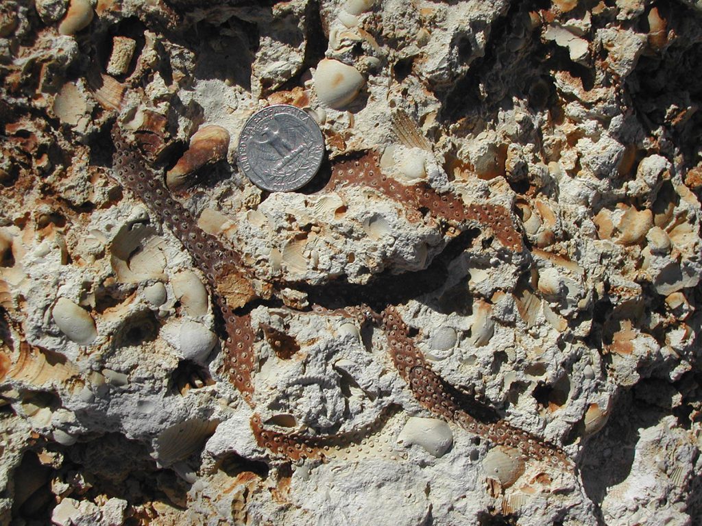
In this limestone, we can see Florida’s relationship with water over tens of millions of years. Our state is known for its coasts- the beaches, yes, but also those intertidal ecosystems that serve as nurseries for so many marine animals.

Next time you’re at one of those beaches, or enjoying oysters, take a look at the shells. Mollusks like conchs and whelks, scallops and clams- when they make their shells, they’re making what may one day become rock.

South Florida limestone with oyster shells embedded within it. Photo by Harley Means.

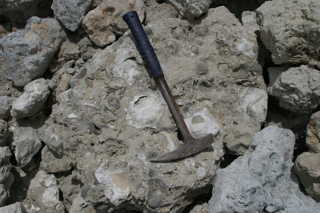
“Limestone is comprised primarily of the mineral calcite,” Harley says. “But sometimes the calcite can come in different forms. Some of the marine organisms that you’ll find fossils of in here, actually you’ll find the molds of them because they dissolved away. But those marine animals make their tests, or their shells, if you will, out of either aragonite or calcite. And aragonite is a little less stable form of calcium carbonate.”

Imagine a Florida of thirty million years ago, entirely under the ocean. It wouldn’t have looked too different than what’s off our coast today. The salt water creatures from back then are responsible for the fresh water we enjoy today.

Limestone from Pasco County, Florida. Here, you can see where a coral has dissolved among clam shells. The different marine organisms that become limestone dissolve at different rates, creating gaps. Photo by Harley Means.

Limestone, Always Dissolving Away

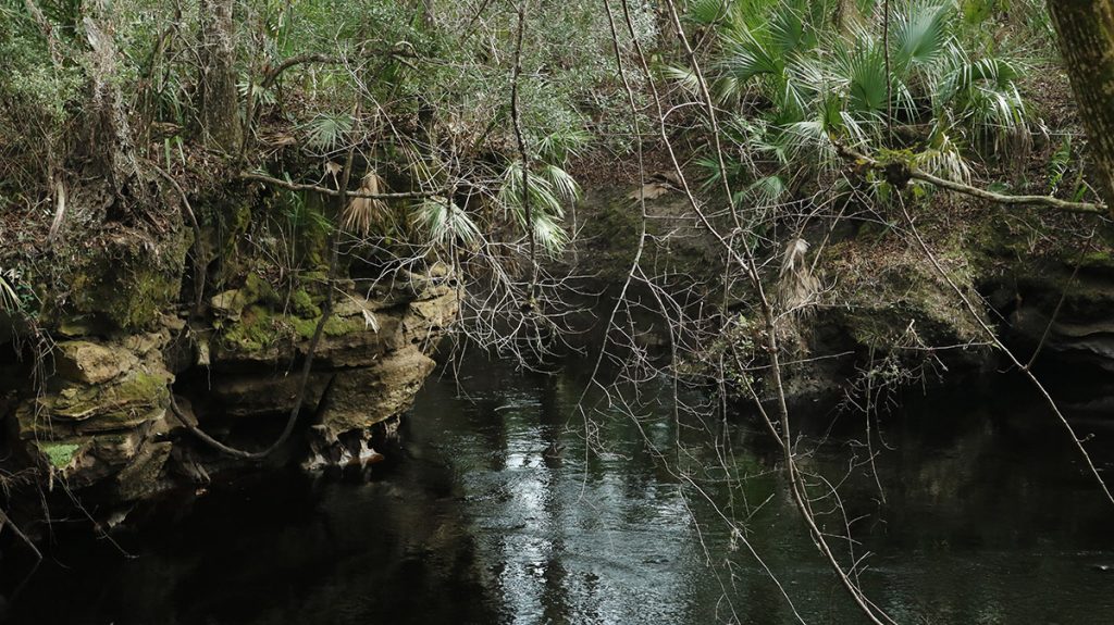
Limestone is often described as a sponge; it’s porous, and water can soak into the tiny spaces within it. Over geologic time, water enlarges those spaces.

“Rainwater is naturally acidic,” Harley says. “Once rainwater gets into and percolates into soils and sediments, it can pick up additional acidic things like tannins and other kinds of organic acids, and it turns the water black.”

That acid eats away at the limestone.

A fractured limestone wall along the Aucilla Sinks.
A limestone wall lining one of the sinks. Note the fractures and holes. In the limestone beneath us, these would become passageways for water. Over time, the acidity of the water would continue to enlarge the passages.

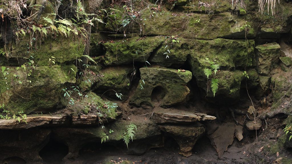
Limestone lets water in, and lets it move. Over time, that moving water increases the limestone’s capacity to carry it. You can see holes in the rock walls at Aucilla Sinks, as big as a marble, or a baseball, or a football. Those become little tunnels. Eventually you get cave systems like in the Wakulla Springs System, or at Merritt’s Mill Pond.

When those large openings are near to the surface, they might cave in and become sinkholes. At Lake Miccosukee, Harley showed us how sinkholes become active and continue to grow. At Fred George Basin Greenway, he showed us a sinkhole in the process of caving in, and we see that along the Aucilla Sinks trail.

As Harley has shown us, the processes that created this topography are still at work, and the landscape continues to change.

Some sections of the Aucilla Sinks look like smaller river runs.

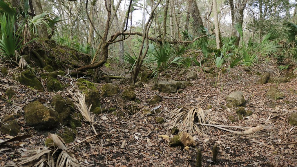
Geology in Action on the Aucilla Sinks Trail

This is a good trail to hike slowly, and enjoy the views. There are places where you can climb down off the trail and take a closer look at a sink. Like any river, the Aucilla goes through dry/ flood cycles, and the sinks can flood as well. Be aware that the area around the sinks might be mucky (I may have taken a tumble).

There are a couple of spots where you can see the land slope down into a bowl, or series of bowls. Here, the sinks haven’t caved all the way in. In the future, they may open up and carry water in a different direction.

A sinkhole in the making, just off of the trail at the Aucilla Sinks.

I follow Harley into one of these sinks-in-progress. He points out that it’s actually a row of depressions. “You can clearly see there’s a linear trend here.” This is from a long fracture in the underlying limestone. “That’s important, because once that fracture is created in the limestone, now you’ve got a preferential path for water to flow.”

And, again, once water starts flowing into it, the passageway enlarges. Over time, this could be another open sink with water flowing in a new direction. In another spot, Harley points out where two flowing channels come together. It reinforces the notion that, once it enters the aquifer, it’s not a single flowing stream.

The Aucilla River, flowing in two different channels that come together here.
The Aucilla River, flowing in two different channels that come back together here.

The Aucilla Sinks are not only visually fascinating, but the geology that created it, and that continues to shape it, is equally fascinating. It’s a highlight among highlights in our geologic region of Florida.

Water in the Woodville Karst Plain

Throughout north central Florida runs an ancient coastline called the Cody Escarpment. It’s a geologic feature that ends up in a lot of my ecology stories, because it has a huge influence on our area’s biodiversity.

“Now the headwaters of the Aucilla River are up in south Georgia.” Harley says. We’ve visited one of those headwaters, Thomasville’s Lost Creek. “So we get a lot of surface water that flows as the Aucilla River, over the Tallahassee clay hills until it goes over that feature we call the Cody Escarpment. And then once that water reaches the Woodville Karst Plain, in fairly short order, you start to see the river disappear through these karst features, through these tunnels if you will.”

On the Woodville Karst Plain, a thin layer of sand covers the aquifer. Water enters more freely here. The Saint Marks River also goes underground and reemerges. In the Munson Sandhills, porous spots in the aquifer form ephemeral wetlands, which fill and empty depending on the fullness of the underlying aquifer. And then there are springs, including North America’s largest, Wakulla Spring.

Springs feed the Aucilla’s main tributary, the Wacissa River. The clear Wacissa flows entirely from aquifer, originating just south of the Cody Escarpment. The dark Aucilla flows down out of the Red Hills before entering the aquifer.

My son Max solo kayaks for the first time on the Wacissa River.

Enjoying the Aucilla and Wacissa Rivers

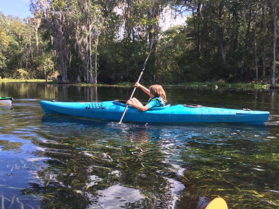
Both rivers, and the area around them, are a natural playground. Harley says he learned to swim in the Wacissa, and my own children have enjoyed swimming and jumping off the rope swing at the headwaters. We’ve also had family canoe trips with friends here, exploring the spring runs just off the river. When they’r a little older, I’d love to take them on the Slave Canal, which connects the Wacissa to the Aucilla. And I’d really love to bring them here to the Aucilla Sinks Trail.

Each river shows us something a little different about the Florida beneath us.

“It’s a beautiful area,” Harley says. “A great place to hike. But what you’ll really take away from it is the dramatic geology that was etched by water. And not only that, you can envision that this series of rises and falls of the Aucilla River is just once example that’s near enough to the surface, where you can see it, of all the plumbing that’s going in the deep subsurface beneath us.

“And it’s one of the reasons Florida is such a unique state, and we are blessed with an abundance of water in our state. It’s because we live on this giant sponge.”


The Florida National Scenic Trail at a Glance

The Florida Trail is the only National Scenic Trail contained entirely within one state. With proper planning, you could hike from the Everglades to Pensacola.

The US Forest Service’s Trail web site says it’s approximately 1,500 miles long. The reason the length is approximate is that there are alternate trails, and segments are rerouted from time to time.

The trails runs through public land as much as possible. Sometimes, the Florida Trail Association and USFS come to an agreement with a private landowner. As a last resort, the trail follows a roadway.

In 2017, we hiked a section that had been rerouted from a roadway, and into the Nokuse Planation along the Choctawhatchee River. The Florida Trail passes through some exceptional natural wonders of our area. This includes the Bradwell Bay Wilderness, the Cathedral of Palms, and the St. Marks National Wildlife Refuge.

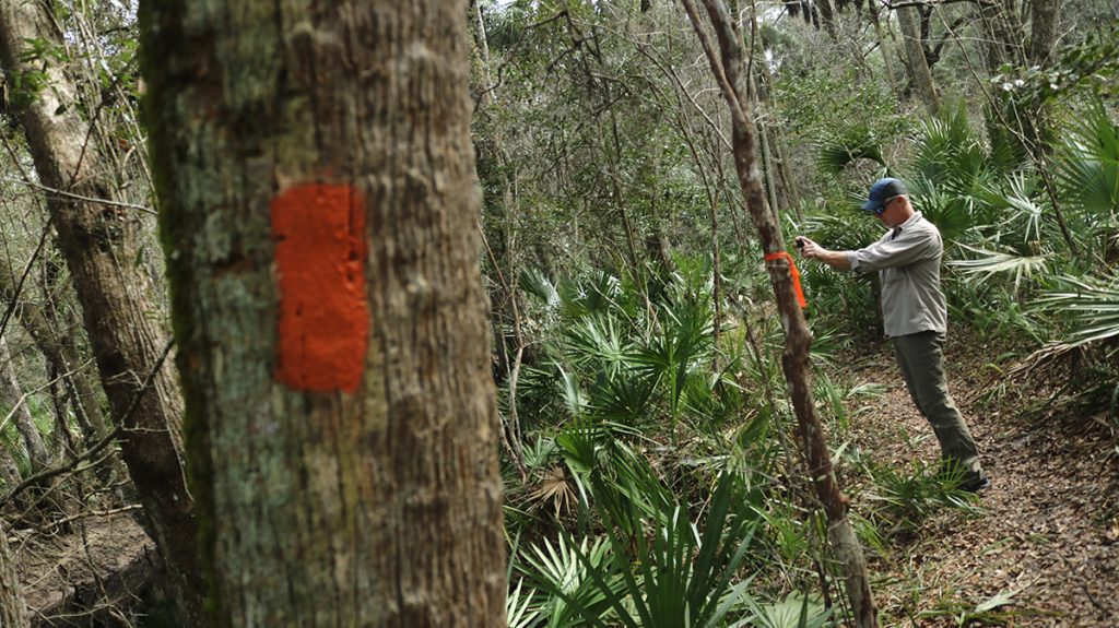
Orange blazes mark the Florida National Scenic Trail.

Click to subscribe to the WFSU Ecology Blog

Facebook Comments
Aucilla RiverAucilla SinksFlorida National Scenic Trailhikingkarst topographyWFSU News
0 comment
1
FacebookTwitterGoogle +Pinterest
Rob Diaz de Villegas

Rob Diaz de Villegas is a senior producer for WFSU-TV, covering outdoors and ecology. After years of producing the music program OutLoud, Rob found himself in a salt marsh with a camera, and found a new professional calling as well. That project, the National Science Foundation funded "In the Grass, On the Reef," spawned the award winning WFSU Ecology Blog. Now in its tenth year, the Ecology Blog recently wrapped its most ambitious endeavor, the EcoCitizen Project. Rob is married with two young sons, who make a pretty fantastic adventure squad.

previous post
New WFSU Ecology Intern To Help Out at Lake Elberta

Related Posts

Are Sinkholes Making Lakes at Fred George Basin...

July 18, 2019

Striped Newts and Ornate Chorus Frogs in the...

January 27, 2017

Lake Miccosukee Sinkhole Hike: Floridan Aquifer Exposed!

February 8, 2018

A Song of Protection for Wakulla Springs: EcoShakespeare

February 11, 2015

Underwater Archeology | Excavating the Wacissa River

October 22, 2015

Lake Report 2016: Leon County’s Cleanest and Dirtiest...

December 8, 2016

Climate, Coral Snakes, and Striped Newts in the...

March 24, 2020

Adopting an Ephemeral Wetland | Kids’ Adventures in...

June 8, 2017

Seeing the Ice Age Wacissa Through Artifacts and...

November 2, 2017

Lost Creek: Hiking an Ancient Forest

April 7, 2016

Search

Subscribe

Subscribe to receive more outdoor adventures, and an in depth look at our local forests and waterways by Email.

If you do not receive a verification e-mail, check your spam folder.

Category

Florida milkvetch

Florida milkvetch (Astragalus obcordatus) in the Munson Sandhills

When I test out a new camera, I usually head to a random spot in the Munson Sandhills and take a series of videos and photos. This small flower caught my eye, as almost nothing was in bloom. I identified it as Florida milkvetch (Astragalus obcordatus) in iNaturalist, and it was confirmed.
I then saw a photo of this plant in a Facebook group for native plant enthusiasts. It turns out this is kind of a rare plant, and one botanist went so far as to classify it as imperiled. It pays to keep your eyes down by your feet when walking in the sandhills.

WFSU-FM Environmental Stories

  • Florida House Plan Targets Flooding, Sea Level Rise
  • Lawmakers Look To Fund Environmental Projects Despite Budget Shortfalls
  • Florida Forest Service Warns Panhandle Communities Of Wildland Fire Threat
  • Controversial Wastewater Project In Wakulla Gets Public Hearing
  • FWC Considers Banning Commercial Sale Of Tegus, Green Iguanas

2021 Backyard Blog update- migratory birds and invasive plants

Cedar waxwings eating glossy privet berries.

Cedar waxwings eating glossy privet berries.

Twitter

Tweets by wfsuIGOR

iNaturalist

iNaturalist became a part of the WFSU Ecology Blog during the EcoCitizen Project in 2019.  Since then, we’ve used it to help identify the many plants and animals we see on our shoots.  And on the Backyard Blog, we show how it can be used to identify weeds and garden insects, to help figure out what’s beneficial or a possible pest.  Below is the iNaturalist profile belonging to WFSU Ecology producer Rob Diaz de Villegas.

iNaturalist.org

Thumb
View robdv’s observations »

Most Recent

  • Hiking the Aucilla Sinks | Geology of the Floridan Aquifer Uncovered
  • New WFSU Ecology Intern To Help Out at Lake Elberta
  • Florida and Georgia Head to the Supreme Court — Again — In Fight Over Water
  • The Case for Weeds, Our Unsung Florida Native Plants
  • Shorebirds in the Misty Morning | Surveying the St. Marks Refuge

Archives

February 2021
M T W T F S S
1234567
891011121314
15161718192021
22232425262728
« Jan    

WFSU Ecology YouTube

  • Facebook
  • Twitter
  • Instagram
  • Flickr
  • Youtube

@2017 - PenciDesign. All Right Reserved. Designed and Developed by PenciDesign

test title

this is the info in my test popup.