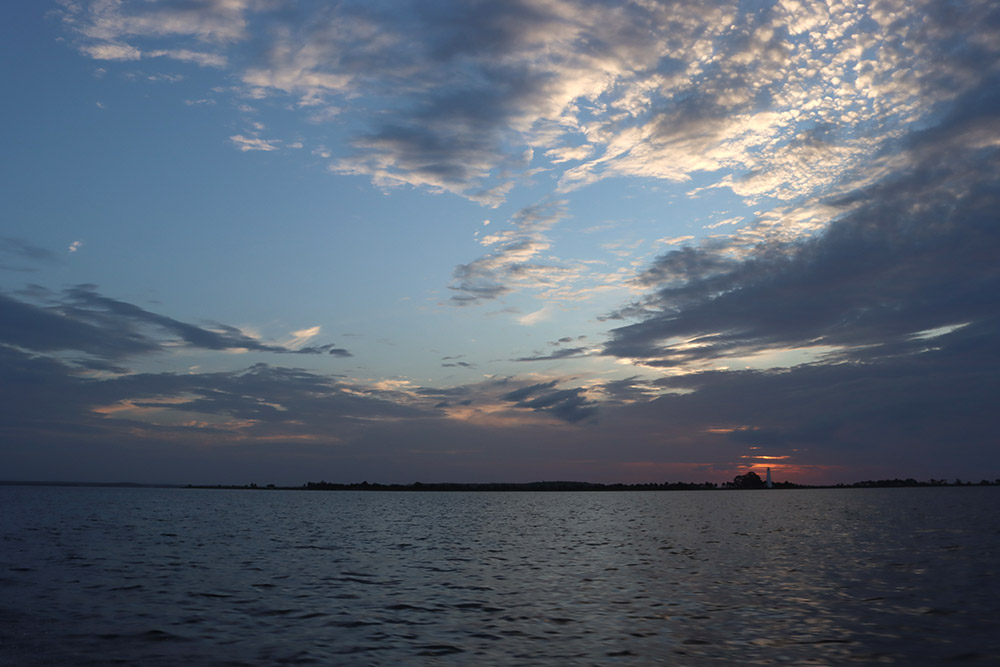
The boat slams down on a wave, sending a shock up my spine. We’re moving inland slightly from our first spot, towards the St. Marks Lighthouse, where the chop is less intense. If we’d planned this as a fishing trip, we’d have called it off. But Dr. Morgan Smith has work to do.
He’s scanning the bottom for signs of human habitation.
Yes, signs of human life beneath the surface of Apalachee Bay, though it wasn’t Apalachee Bay when people lived there. Up until a few thousand years ago, Morgan says, “this was all dry land. So, everything you’re looking at… indigenous peoples could have and did use it. And it was just like any other part of Florida: rivers, springs, streams, trees, grasslands.”

He has his work cut out for him. Like the river sites we’ve visited with Morgan, an offshore site might contain nothing more than a few stone tools and/ or flakes, and animal bones. These might be buried or half-buried among rocks and bits of shell that look a lot like stone tools and bone fragments.
Dr. Dominique Rissolo, an Associate Research Scientist at UC San Diego’s Cultural Heritage Engineering Initiative, understands the challenge. Searching for prehistoric sites offshore, an archeologist is “trying to find something left behind by people who lived thousands of years ago, people who… were not building monumental architecture and were not building bridges and roadways. How are we going to find evidence of their life on Earth?”
Finding the First Floridians
WFSU’s newest documentary digs into the sediments beneath Florida’s abundant waterways. Here, archeologists are finding prehistoric sites, some of which are older than many had previously thought would be possible in Florida. Florida is an epicenter of submerged prehistory, and the last decade or so has seen a renewed effort to excavate sites.
- Chapter 1: Florida’s Ice Age Landscape
- Chapter 2: Rising Seas and Flowing Rivers
- Chapter 3: Prehistoric Cultures Adapt to Change
Here, you can see the large shallow area in the Gulf of Mexico. This is the Florida platform. When sea level was lower, this was dry land, and people lived out there.
Relocating Previously Discovered Sites
Where does one start to look?
Today, Morgan is trying to relocate sites found in the 1980s and 90s. Archeologists at that time had started adapting techniques used on land to the sediments beneath rivers and sinkholes. During the last ice age, those river channels continued out onto the Florida Platform. That’s the continental shelf, which we can see in a Google satellite image of the Gulf of Mexico. If you drained the bathtub a little, this shallow area would be above sea level.
“Fifteen thousand years ago, when the first people came to Florida, the climate was a lot different,” explains Florida State University oceanographer Dr. Jeff Chanton. “It was the end of the Pleistocene, the glacial epoch. At the end of the Pleistocene, there is a lot of glacial ice. This transfer of water from the oceans to the land surface resulted in sea level being about 300 feet lower than it is today.”
At the time, Florida had almost twice as much landmass as it does currently. The submerged landscape offshore is potentially full of undiscovered sites, and a substantial record of Florida’s earliest human settlement.
Paleo-River Channels off the Florida Coast
That potential drew Dr. Michael Faught from Arizona. “In 1986, I flew out on my own nickel and met Jim Dunbar, who’s a famous archeologist here in Florida. And we went offshore for three days in little boats… and we found three quarry sites and a paleo-channel out on the offshore. So, immediately there was success.”
The channel they found was the Paleo-Aucilla, a continuation of the modern-day Aucilla River into what is now the Gulf. This is where Morgan has taken me today.
“We’re cutting across both the St. Marks and the Paleo-Aucilla channels to try to figure out where those channels would have been and map sites off of them. There was a big confluence out here, which is really good because those kinds of confluences are obvious physiographic features that prehistoric peoples would have mapped onto. I don’t think there’s a single river confluence in Florida that’s not an archeological site.”
Upstream on the modern Aucilla, the river meets the Wacissa River. Right next to that confluence is a sinkhole containing the Page-Ladson site, which Dr. James Dunbar excavated in the 80s and 90s. Page-Ladson established a new timeline for people in the Americas, a timeline that started over a thousand years earlier than previously thought. Sites in the Gulf are equally promising, and archeologists are tackling the challenges of finding and excavating them scientifically. In trying to find sites out there, it makes sense to look for places that resemble quality sites on land.
Finding Paleo-Channels and Springs
“It’s fun to think about. The same features that attract us to places today hold true,” says Dr. Ryan Duggins, the State of Florida Underwater Archeologist. As he and his crew excavated the Simpson’s Flats site in the Itchetucknee River, kayakers passed us by. “As you rewind the clock through time, and as we go back a couple thousand years, or more thousand years, we keep finding that freshwater sources are places of human activity. They also happen to provide some great preservation.”
We’ll get to preservation in a moment.
For his 2012 dissertation at Florida State University, Ryan mapped “predictive river channels” on the continental shelf. Note that he used the term predictive. As sea level rose over the land, Gulf water moved sediment over it. Currents, waves, and storms move the sand beneath the waves, but the landscape retains evidence of the twists and turns of a river winding its way to wherever the coast was at a point in time.

We can follow the Paleo-Aucilla into the Paleo-St. Marks, which, as you see on the map, first joins with the Paleo-Ochlockonee River. From this confluence, we follow the Ochlocilla to where it joins the Paleo-Carrabelle River about 15 miles south of St. George Island. After another 15-20 miles, it meets the Paleo-Fenholloway before it flows off the edge of the continental shelf.
Along the way, this Ochlocilla River gathered water from channels that originated on the continental shelf. These channels potentially flowed from springs, places where humans, mastodons, mammoths, and all the rest might have gathered for water. As we see in the map below, some of the springs are fairly close to where the coast would have been 15,000 years ago.

Sinks and Springs in Ice Age Florida
Michael Faught excavated one of those sites in the 90s: Ray Hole Spring, located 20 miles offshore. The site yielded artifacts, oysters, and a live oak tree that he dated at over 8,000 years old.
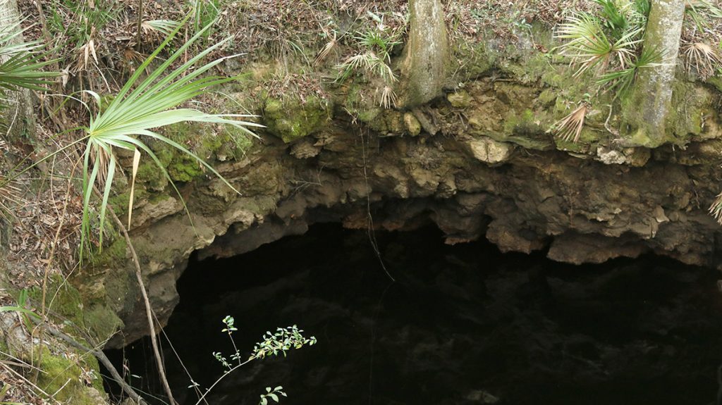
That tree dates to around the time the Wacissa River started flowing. Before rivers flowed regularly, sinks and springs would have been isolated sources of fresh water. Nick Bentley, a PhD candidate in archeology at Texas A&M University, compares Florida’s Pleistocene rivers to the Aucilla River Sinks. Here, the Aucilla enters the aquifer, appearing in a series of limestone sinkholes that we can follow to where the river reemerges just north of Page-Ladson. In a dry Pleistocene landscape, such water sources would have attracted man and beast alike. So, too would the springs that today feed the Wacissa River.

The water table was lower during the last ice age, which means humans and animals would have had to climb down to drink their water. Rivers didn’t flow regularly, but there would have been storms and rainy stretches. When rivers did flow, both Jeff Chanton and Dr. Bruce Means describe how, since the water table was lower, the water would have cut deeper river channels with higher banks.
It would have made for a more dramatic landscape, one which may have proved advantageous for early hunters.
“When sea level was lower, those rivers that flowed in clays and sands and gravels would have down-cut deeply into their beds,” Bruce says. “And we had places like the Aucilla River, where there are ten-foot or fifteen-foot high vertical banks with a creek in the middle of it. And you could run the elephant off into that and just spear it at your luxury.”
Each green dot and blue line on the map above may contain mastodon bones in proximity to stone tools; another Page-Ladson or Guest Mammoth site.
Mapping coastlines
So far, we’ve talked about freshwater resources and large, meaty game animals. But there would potentially have been another robust food source, one for which modern Florida is famous. Following a river to the coast, an early Floridian might well have collected fish, crabs, scallops, clams, and possibly oysters. To find out if they did, archeologists must first find the locations of coastlines over time.
Earlier this year, I spent a day in the field with Ryan Duggins and Dr. Melissa Price, who are both with the Florida Bureau of Archeological Research. When I asked about coastlines, they mentioned something called the “bathtub model.” The idea is that if you drained the Gulf bathtub by a certain amount, as the water conformed to the shape of the current Gulf bottom, it would show you where the coast was when, say, sea level was 100, or 200 feet lower.
Looking at the Gulf as an empty bathtub is a start, but as I mentioned earlier, the shape of that basin would have changed somewhat since it was dry land.
“We’re very curious about where the coastline was at a given point in time,” Melissa says. “And how do you determine that? We’ve got bathymetric data, sure. But a lot of those models are based on dating of specific types of materials.”
Those materials can be the very things that would have drawn people to the coast.

Oysters and Mangroves
The discovery of a live oak tree at an archeological site may not sound like a big deal. If the site is twenty miles offshore, though, it tells us a story. The tree tells us that this was dry land at some point, and because this tree had enough organic material to radiocarbon date, we know that point was about 8,000 years ago.
The tree is a marker fossil. It marks Ray Hole Spring as having been a terrestrial site. Other plant and animal species mark a site as coastal, or offshore. Some of those markers can be delicious.
“Knowing the taxa of shellfish is important because it can tell you whether or not the shellfish were in a marshy region or if they were closer to the sea,” says Nathan Hale. He and his wife, Dr. Jessica Cook Hale, have excavated offshore sites where humans harvested oysters.
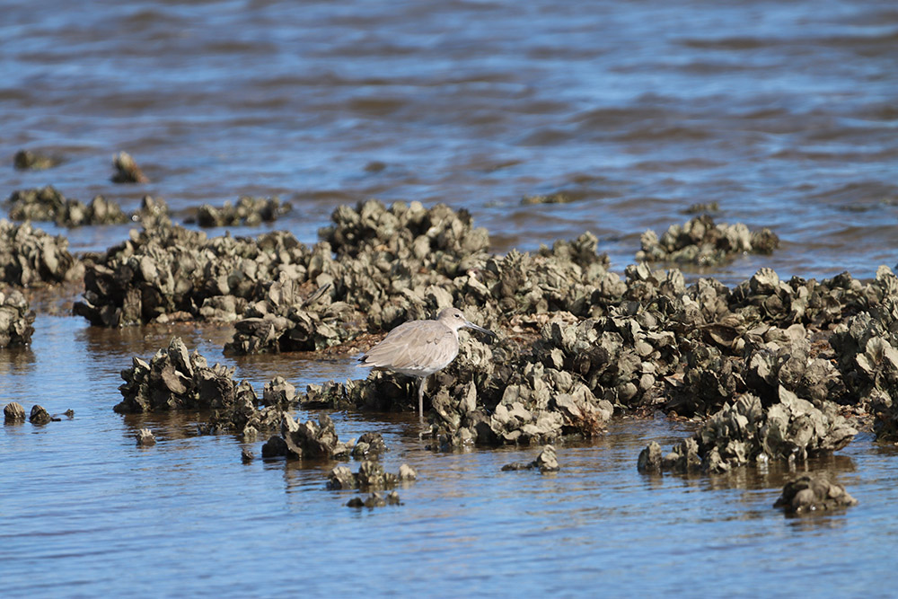
Oyster reefs form where fresh water meets salt, typically at the mouths of rivers, in protected bays. Different species of clams grow closer or further from the coast. Further south in our state, mangroves grow along the coast. Identifying these species at a site can help place it in time, and it also refines what underwater topography (bathymetry) tells us about the movement of the coast over time.
This is what Shawn Joy did for his Master’s thesis at Florida State University. We met Shawn in 2017 as he helped Morgan Smith excavate the Guest Mammoth and Ryan-Harley sites. In 2019, he published a study of paleo-coastlines that used fossil oysters, mangroves, and corals to mark the location of coastlines over the millennia.

Harvesting Oysters From an Unstable Coast
The map above shows fixed coastline positions at 1,000-year intervals. It took over 15,000 years for the world’s glaciers to melt, and the coastline would have been constantly on the move. “People that lived on the coastal plain of Florida were probably experiencing sea level rise at a pretty rapid rate,” says Jeff Chanton. “So anybody that lived at the coast would be rapidly moving inward over their life span.”
“Those environments would not have been entirely stable,” says Jessica Cook-Hale. She and Nathan excavated a site on the Paleo-Econfina River, just upstream of where it meets the Paleo-Aucilla. The Econfina Channel site, as it is called, is five kilometers offshore, in Apalachee Bay, and was examined by Michael Faught at different points in the 1980s and 90s.
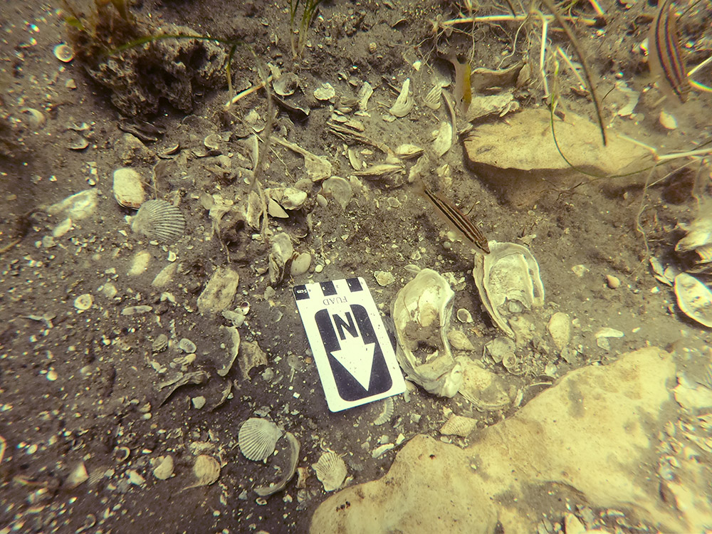
The site is an oyster midden, a common form of prehistoric trash heap where people would toss oyster shells and other food waste. Jessica and Nathan also found stone tools there. They radiocarbon dated some of the oyster shells, and the older part of the site dates to 5,465–3,546 years ago. This places it in the Middle-Holocene.
“So, there’s some things that we know that we didn’t know 50 years ago,” Jessica says. “One of them is that people were harvesting shellfish in great quantities at a time when the sea level was not stable. Okay. So that throws out the window the idea that people didn’t bother to use the coastline until it was stable.”
Jessica would like to push further into the Gulf, to see if there are older sites where people harvested oysters. She mentions Ray Hole Springs specifically, which is 20 miles further out and also has oyster shells. Perhaps there are sites on older coastlines.

Why is Florida a Prehistory Hotspot? Preservation.
Florida’s springs and sinks, whether in the Gulf or on land, are the reason Florida has become a prehistory hotspot.
“This is the epicenter of submerged prehistory on the planet,” says Morgan Smith. “From, say, the Wakulla (River), east to the Suwannee, is the densest concentration of submerged prehistoric sites anywhere in the world.”
Between Tallahassee and Ocala, the earth can barely contain the Floridan Aquifer. This region is home to more magnitude-one springs than anywhere in the world; the largest of these is Wakulla Spring. Rivers are swallowed and regurgitated, and our largest natural lakes periodically swirl down sinkholes.
As Ryan Duggins said, these features both attracted humans and animals, and preserved the remains of their encounters in saturated sediments. “Water is not necessarily the great preserver of organic material,” Ryan says, “but it’s the inorganic layers of sediment that exist below the water that create pretty much an ideal stasis-like condition that can preserve delicate organic materials for thousands and thousands of years.”
Beneath wet sand and mud, bones and artifacts are sealed and protected. That’s in any waterway. In sinks and springs, though, there’s an extra, chemical layer of protection.
“We have found sinkholes are an excellent place to preserve fossils, whether they’re wet or dry,” says Dr. Richard Hulbert, retired head of the Division of Vertebrate Paleontology at the Florida Museum of Natural History. “One of the factors that harms bones are natural acids that form as plant remains decay. As the groundwater passes through humus and decaying leaves and things, it will naturally pick up some of that acid. But being in a sinkhole environment, that limestone just acts as a natural buffer.”
“Geology determines so much about what we can ever know about people in the past.”
Limestone defines Florida. The Florida Platform, the shelf upon which our state sits, is made of limestone. The history of that spongey rock layer dates back to a period when it was a shallow sea. For 130 million years, corals, shellfish, and plankton continuously deposited calcium carbonate shells on the ocean bottom. Starting 30 million years ago, when Florida started building land, sediments covered a massive limestone aquifer, the source of our drinking water and springs.
Perhaps the density of sites here is due to the abundance of freshwater sources. When the world was cold and dry, Florida was merely cool, and had no shortage of places to get a drink – even if one had to work for it.
Whether Florida had more or fewer people, evidence of the earliest Americans is better preserved in our limestone sinkholes and springs than anywhere else on the continent. It’s an irony that underwater archeology took so long to be taken seriously when those sites best preserve evidence of the first people to call this continent home.
“Geology determines so much about what we can ever know about people in the past,” says Dr. Jessi Halligan, who led excavations at Page-Ladson in 2012-13 as a PhD student at Texas A&M. A decade later, she still returns to work in north Florida and the Aucilla River. “This is just a unique and completely unique geological situation that gives us a chance to look out what it would have looked like everywhere.”
Finding the First Floridians was commissioned by the Archaeological Research Cooperative, and funded by a grant from the Florida Division of Historical Resources.
