Rob Diaz de Villegas WFSU-TV

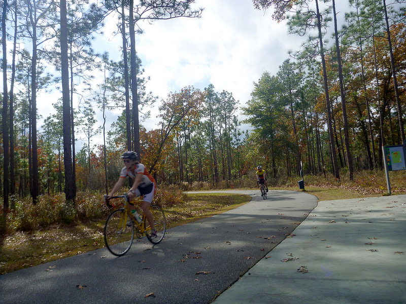
Cyclists round the bend at the Trout Pond Trailhead. They regard the two mile trail, which terminates at a quiet lake with camping facilities, as a hidden treasure. Over the next decade, it will become part of a 120 mile network of multi-use trails connecting Tallahassee with the coast.
I’ve often described our EcoAdventures as a glimpse of unpaved Florida, so this video is somewhat of an anomaly. The Capital City to the Sea Trail is a twelve foot wide paved “multi-use” trail that will connect towns and outdoor destinations in Leon and Wakulla County. Pedestrians can walk or run it, and its width means that slower cyclists (such as children or me when I finally get a bike) can share the space with faster bikes. As you see in the video above, two cyclists going one way can pass two cyclists going the opposite way. It’s off of the main road, so it’s a safer way to get to the coast than to ride on the highway. Or it will be, anyway. Most of the trail has yet to be built.
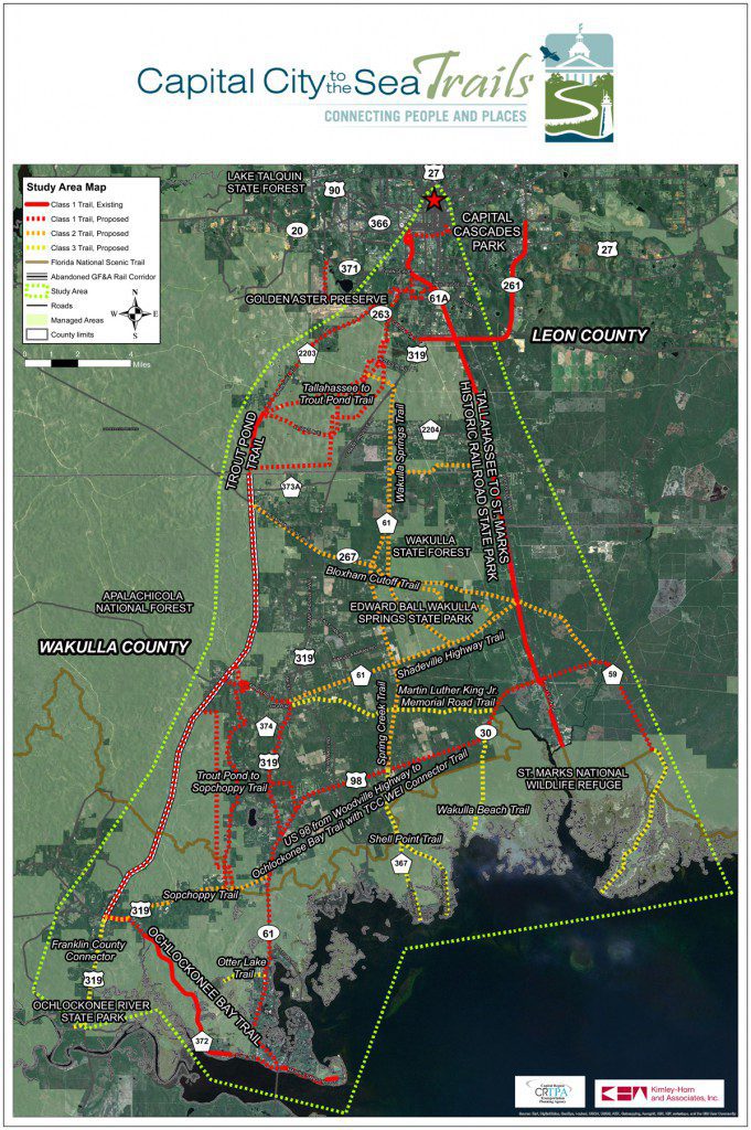
Plans for the CC2ST have gone through a process of public meetings, where citizen feedback has directed priorities for segment construction, and in some cases, redirected the trail itself. Project Managers Jon Sewell and Jack Kostrzewa took us along the planned route. It takes existing stretches, such as the popular St. Marks Trail (between Tallahassee and St. Marks), the Ochlockonee Bay Trail, and the Trout Pond Trail, and connects them with the St. Marks National Wildlife Refuge, Wakulla Springs (not originally planned but added after citizens requested it), Panacea, Mashes Sands, Sopchoppy, and Capital Cascades Park in Tallahassee. When it is completed, there will be 120 miles of the CC2ST forming a loop between Tallahassee and the coast.
The trail is more complex than shown in most of the map graphics in the video. Here is a current map of the proposed trails. This plan will be finalized and presented to the public in March of 2014.
Jon hopes to begin construction in the next two to three years, with the trail not likely to be completed for at least a decade. That’s a lot of waiting. And it won’t be cheap. I have a few notes on the potential cost and economic benefits, as well as a few other tidbits about the trail. I also want to note that I have recently become part of this process as a member of the Florida Greenways and Trails Council. I’ve been finding the process through which trails get made and connected together interesting. The goal is to connect as many trails as possible and give people options for both shorter or multi-day outdoor adventures. Anyhow, my notes on CC2ST:
- Florida DEP’s Office of Greenways and Trails (OGT) estimates that every mile of multi-use trail costs about $550,000 to construct. There is a cost for the design of a project, as well as for determining environmental impact. In some cases property needs to be bought. A lot of the time, the trail is built on public land.
- Let’s use the two segments that would complete the Ochlockonee Bay Trail as an example. Two parts of this trail already exist, but two more segments totaling 2.95 miles are needed to form an uninterrupted trail between Mashes Sands and Sopchoppy. An estimated $368,750 is estimated to be needed to acquire land for the trail, $295,000 for the design (the contour of the land and roadways it crosses need to be traversed), and $1,475,000 for construction. That’s a rough ratio of one million dollars to 1.5 miles of completed trail. The good news in this case is that the Florida Department of Transportation is funding these segments. Which brings me to…
- The money for the CC2ST will likely come from many sources. DOT works with the OGT on state trails as they are an alternative form of transportation. Also, many proposed trails run along roads, so they can be incorporated into road construction projects. Private donors will be sought, and many might be businesses along the trail.
- A recent study on Orange County trails by the East Central Florida Regional Planning Council estimated that their trails system accounted for $42.6 million in revenue and 516 jobs for 2010. The trails studied totaled 35.9 miles (they are in the process of expanding). The study cites spending by cyclists at businesses such as restaurants, hotels, and bike shops, an increase in real estate revenue around the trails, and cyclists returning to areas they liked to purchase goods. Jon shared one such example:
- Jon
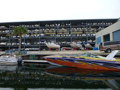
 has worked on some projects with Chuck Shields, longtime mayor of St. Marks and owner of Shields Marina. Shields has told Jon that many of the marina’s clients learn about it through the St. Marks Trail. They ride down, see the marina, and when they want to buy a boat, they come back. In theory, more trail equals more opportunity for businesses to be seen.
 - When completed, this will be Florida’s largest multi-use trail. The CC2ST team believes that this will make it the top Florida cycling destination.
- One of my concerns, when I saw that the trail would run along US 98 in Wakulla, is how it would interact with the marshes on the side of the road. As you head south of Panacea on the way to Ochlockonee Bay, there are considerable marshes on either side of the road. They’re an attractive feature, and a productive ecosystem. Jon says that in those places, the trail will run along the land side of the highway on a raised boardwalk. They are designing it with the view from the road in mind, as they don’t want to block the scenery.
- Now that the plan for the CC2ST has gone through three public workshops and all feedback has been collected, Kimley-Horn and Associates will finalize it and present it in March of 2014. We’ll keep you posted on day and time when we know.
A few notes from the recent meeting of the Florida Greenways and Trails Council:
- Liz Sparks is now the Paddling Trails Coordinator at the OGT. She had held a similar position with the Florida Fish and Wildlife Conservation Commission (during which she took us out on the Apalachicola WEA and Slave Canal). One of her main projects is finding campsites along the Chipola River to facilitate multi-day kayak camping trips. We recently wrote a piece on the Apalachicola Blueway Guide; there would likely be a similar resource for this. And, as the Chipola joins with the Apalachicola, there would be more opportunity for mix-and-match paddle adventures.
- Her other big project is to close gaps in the Florida Circumnavigational Saltwater Paddling Trail. A gap is defined as a stretch of over 20 miles with no campsite. Locally, there is a stretch of about 30 miles near Tyndall Airforce base where she’s looking to find a site to designate. As Liz tells us, people are currently having to make arrangements to travel inland to camp, which takes away from the coastal adventure feel. (Watch our video on the FCSPT Forgotten Coast Segment)
- One mission of the council is to create ecological corridors as well as trail corridors. Tom Hoctor presented his recommendations for the Florida Ecological Greenway Network. The idea is to preserve or create corridors of undeveloped land to give animals such as panthers and bears space to roam. Another interesting goal of the FEGN is to provide a corridor into which coastal habitats can retreat as sea level rises. Locally, a big priority is the St. Marks National Wildlife Refuge area. They are looking at establishing a corridor along the Wakulla or Aucilla Rivers and in the Red Hills area around Tallahassee. The idea is to give some space for salt marshes, oyster reefs, and seagrass beds to move along with the receding intertidal zone. In the Grass, On the Reef, Right In Your Front Lawn.
Well, that’s it for us in 2013. This has been our busiest year on In the Grass, On the Reef. I feel we found a nice balance between exploring our natural areas through EcoAdventures and deepening our understanding of our coasts through Randall and David’s research. While the oyster crisis in Apalachicola Bay seemed to dominate our focus at times, we still hit up oyster reefs and salt marshes from St. Marks to Choctawhatchee Bay. I’ll be working on a year-in-review post soon. As for next year, people have already begun coming to us with new EcoAdventure ideas. And we’ve started editing the second In the Grass, On the Reef documentary, which will air this spring. I’ll have much more information on that soon. Until then, have a Happy New Year!
Music in the piece by Airtone and Tigoolio.

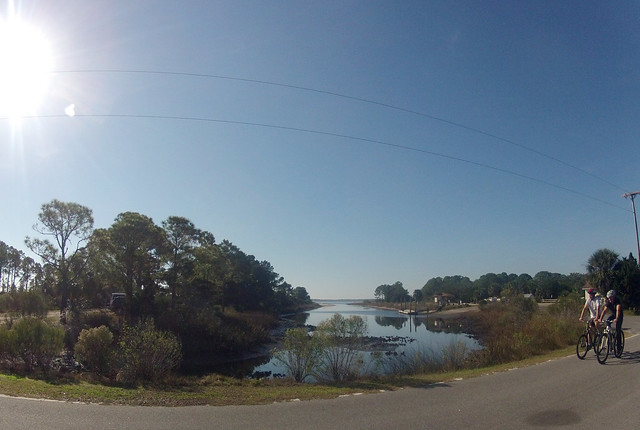
Jon Sewell and Jack Kostrzewa on the Ocklochonee Bay Trail. On In the Grass, On the Reef, even videos on bicycling have oysters and marshes.


