The state of Florida is looking at existing trails, abandoned railways, and local, state, and federally owned lands with the goal of creating an ever expanding system of regional trails. Under recent legislation, these will be combined into the newly-legislated, statewide SUN Trail system. WFSU producer Rob Diaz de Villegas, who was appointed to the Florida Greenways and Trails Council in 2013, looks at what recent developments mean for local trail users.
Rob Diaz de Villegas WFSU-TV
A couple of years ago, we had a cycling EcoAdventure to preview the Capital City to the Sea Trail, on which work is currently being done in Tallahassee. Existing paved “multi-use” trails like the St. Marks Trail and Trout Pond Trail (in the Apalachicola National Forest) would be connected to each other and to the St. Marks National Wildlife Refuge, Wakulla Springs, and various other points in Wakulla and Leon Counties. The thinking is that longer trails connect more communities, increasing economic opportunities and property values along their corridors. Within the next decade or so, a Panacea resident should be able to bike to St. Marks or Tallahassee without slowing traffic on Highway 98 or Crawfordville Highway.

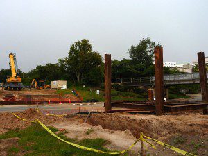
Construction has recently begun on a bridge to connect Capital Cascades Park to a trail being built along FAMU Way. The FAMU Way connector will close the gap between Cascades Park and the St. Marks Trail. The 24 mile Coastal Trail, which will connect the St. Marks and Ochlockonee Bay trails, is scheduled to be completed in 2016/17. While progress is being made on individual segments, it will be at least a decade before the full 120 mile Capital City to the Sea Trail system is complete.
Now, let’s zoom out. This regional network of trails is one of many being built in our state, with the ultimate goal that they will all be united into what the recently passed state budget has termed the SUN (Shared Use Non-motorized) Trail Network. The budget for the next fiscal year has allocated $25,000,000 towards the completion of this network, with the goal of creating a world class ecotourism attraction. Amendment 1 also mandates that a separate allocation is made to the state trail system (of which the SUN system is one component), though as of yet the amount is undetermined. The vision is that, one day, you could ride this network of trails from Pensacola to Key West.
The system is overseen by the Florida Department of Environmental Protection Office of Greenways and Trails (OGT). Trails are designated and land acquisitions approved by Florida Greenways and Trails Council, a group consisting of local, state, and federal land managers, a representative from the Florida Department of Transportation, and citizens who use trails and greenways (I’m a gubernatorial appointee as a trail user). While these bodies exist to guide the process, neither OGT or the Council design the trails. The process begins at a local level, with hundreds of smaller potential trails of varying lengths being submitted to OGT to be included in what is called the Opportunity Map. The Office of Greenways and Trails grades the submissions, working with municipal and county governments to determine the readiness of the individual segments. Then, OGT pares down the trails into a Priority Map, which includes the trails that are in best position to be built and that offer the best options for regional connectivity. Both the Opportunity and Priority Trail maps were last updated in 2012.
What happens next? The Florida Greenways and Trails Council votes to approve priority maps and designate trails. Usually, these steps were mostly an endorsement for each trail system, one which would make them more marketable and aid in raising funds to complete them (occasionally there were allotments for land purchases, including a little over a million dollars in 2014 and 2015). Last year, the Florida Department of Transportation funded $18,800,000 to complete priority trail segments, but a lot of trails were funded locally from a combination of public and private sources. The Florida Greenways and Trails Foundation also works to raise funds for priority trails. The system is made up of a multitude of entities finding money from a multitude of sources. However, the recent legislative session has changed fundraising for paved trails in a major way.

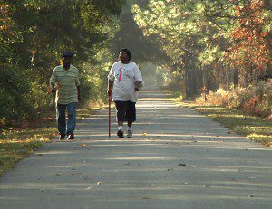
The St. Marks Historic Railroad State Trail is an excellent example of a paved multi-use trail. It is twelve feet wide, which is enough space for two pairs of bikes to pass each other. It is an abandoned railway, like many proposed trail segments. And a good portion of it is on public land, running along the Apalachicola National Forest.
Two weeks ago, the state budget passed with a little publicized allocation of $25,000,000 to the Department of Transportation towards the completion of the SUN Trail Network. The state passed legislation to make this an annual budget item. Meeting last week at Weeki Wachee State Park, the Council hadn’t yet fully wrapped its collective heads around the surprising news (The SUN Trail name had never been used prior to its appearance in the budget item). FDOT and OGT will be meeting to prepare recommendations for when the Council next meets on October 1 (location to be determined). Between now and then, the public has a chance to weigh in and help guide the process.
Open houses will be held in seven locations across the state, giving the public a chance to inspect the opportunity maps as OGT looks to update them. During the early planning stages of the Capital City to the Sea Trail System, one such meeting produced a connection that planners hadn’t presented as an option. Noticing that the main trail loop crossed Bloxham Cutoff on both the existing St. Marks Trail as well as on a proposed segment along Springhill Road, citizens proposed a trail segment along the Cutoff to bisect the loop. The new connection will allow trail users to walk or bike to Wakulla Springs State Park on a trail separated from street traffic. If you have an interest in trails, I recommend attending an open house to voice your opinions:
September 1 | Orlando | Florida Recreation and Parks Association
September 3 | Panama City | Camp Helen State Park (23937 Panama City Beach Pkwy, Panama City Beach, FL 32413)
September 7 or 8 (not confirmed) | Hollywood | Location to be determined
September 14 (not confirmed) | Sarasota | Manatee MPO Conference Room (7632 15th Street East, Sarasota, FL 34243)
September 17 | Winter Garden | City Hall (300 W Plant St, Winter Garden, FL 34787)
September 23 | Tallahassee | Southwood, Department of Revenue (Tentative)
September 24th | Jacksonville | The Ribault Club
Most meetings will run from 4 pm- 6:30 pm. As you see, dates and locations aren’t 100% locked down. We’ll update this post as details become available. If you can’t make a meeting, you can make comments to the appropriate regional coordinator.
Nuts and Bolts
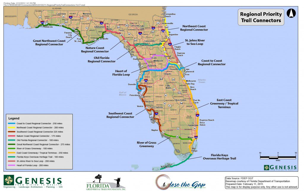
- At last week’s meeting, Foundation Executive Director Dale Allen presented a new concept in the organization of the Priority map. With a focus on regional connectivity, smaller trail segments were grouped into larger systems and branded. The new alignment (which is, at this point, solely a recommendation of the Foundation’s) would consist of 14 regional connectors which would include current projects-in-the-works such as the Capital City to the Sea Trail system (120 miles) and the Coast to Coast Regional Connector (250 miles) along with new alignments like the Nature Coast Regional Connector (which would connect the Tallahassee area to the north-central coast). This streamlines the Priority map, and having 14 named connectors will create new marketing opportunities. The downside is that existing priority corridors not in these groups would become de-emphasized. This includes a loop trail around Lake Okeechobee. This doesn’t mean that these projects won’t get done, they just wouldn’t have the kind of branding the Regional Connectors would have.

This map, pulled from the Florida Greenways and Trails Foundation website, differs slightly from the map given out at the Florida Greenways and Trails Council meeting. We’re working to get an electronic version of that map, which includes an additional 3 Regional Connectors and includes priority trails not grouped into Regional Connectors.
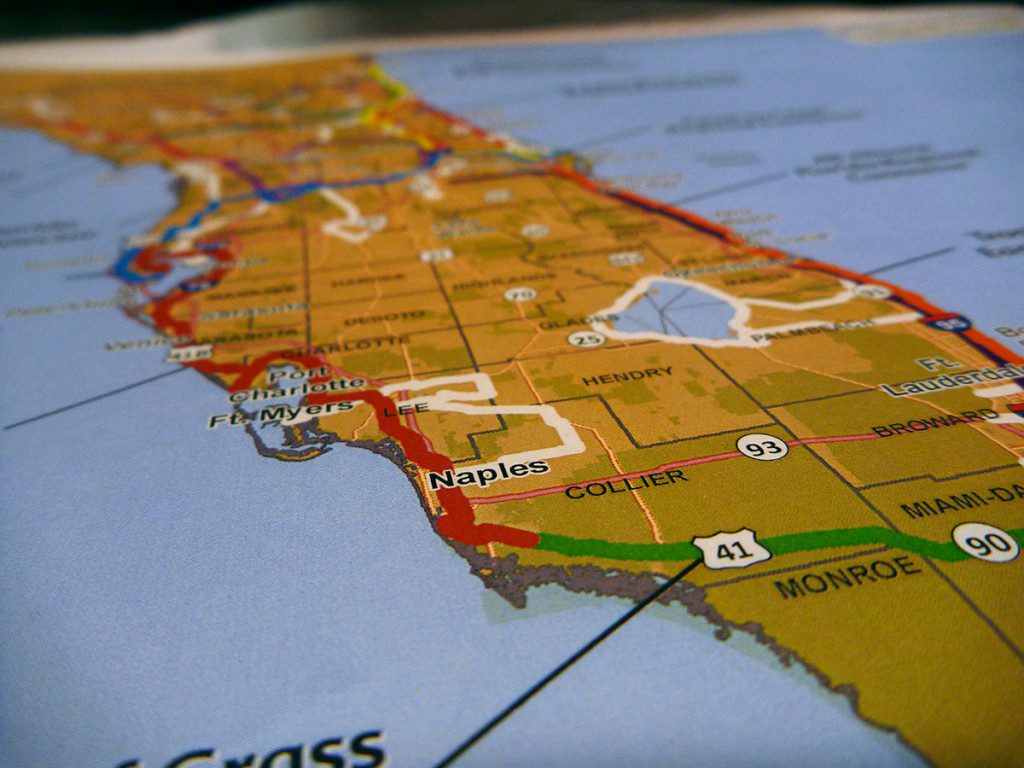
- The south central part of our state is not especially well represented on the Opportunity or Priority maps. There are some smaller Priority sections in this region that were not grouped into Regional Connectors in the Foundation’s new alignment.

While the color coded Regional Connectors tend to provide cross-coastal access and would connect the state’s diverse regions, the other priority trails have potential as well. The south Florida Trails marked in white, if built, might provide an incentive for county and municipal governments between them to seek a way to close the gap.
- So how much trail does $25,000,000 buy? OGT estimates that every mile of trail construction costs $550,000. While every effort is made to construct trails on public lands, sometimes land has to be purchased to fill the remaining gaps, and those costs would of course vary. Additional costs include the design of the trail and environmental reports. An example I used in the 2013 post for a section of the Ochlockonee Bay Trail estimated that $1,000,000 would buy 1.5 miles of trail, which included $368,750 in land purchases and $295,000 in design costs. These prices would vary, but you can see that it’s an expensive process.
- Land owners don’t always agree to sell their land, or agree to the price. Last year, several landowners along the Chipola River could not come to agreements with OGT as it looked to buy land for the Chipola River Greenway. Many had an asking price that was too high, and one owner was unwilling to sell. The parcels they were able to purchase still had some value even if a contiguous greenway couldn’t be completed. According to Chuck Hatcher, Council member and Director of Parks and Recycling for Jackson County (which would manage the greenway), since the land is adjacent to the river, it has ecological value and offers campsite locations for paddlers on the Chipola River Paddling Trail.
- The 2015 land acquisition cycle is currently under way. The Office of Greenways and Trails is accepting proposals through August 31, 2015. The OGT website has more specific information.
- In addition to the paved multi-use trails specified in the FDOT budget, The Council designates unpaved trails, greenways, and paddling trails. Council Vice-Chair Peggy Matthews, as an equestrian, uses unpaved trails and greenways. She recommended that, as the FDOT funds could only be used on paved trails, that unpaved trails and greenways get extra consideration for Amendment 1 funds, once they become available.
- The Greenways and Trails System also includes an Ecological Greenways Network. This looks to establish linkages between habitats, create corridors for animals such as black bears, and create a path for coastal habitats to retreat inland as sea level rises. This is similar to the goal of the Florida Wildlife Corridor Expedition. The Office of Greenways and Trails helped coordinate FWCE’s recent Glades to Gulf Expedition. FWCE Executive Director Mallory Lykes Dimmitt made a presentation at last week’s Council meeting which featured stunning photos and videos of their 1,000 mile voyage from the headwaters of the Everglades through the Florida panhandle.
- Here is a link to the Paddling Trails Opportunity map. To be designated state paddling trails, it’s preferred that rivers and lakes are long enough for multiple-day trips, offer camping opportunities, and connect to parks and trails. State Paddling Trails we’ve featured on EcoAdventures include the Aucilla River, the Apalachicola Blueway, and the Wacissa River/ Slave Canal. OGT also oversees the Florida Circumnavigational Saltwater Paddling Trail, of which the Forgotten Coast segment was our first EcoAdventure back in 2011.
- When the Office of Greenways and Trails contacted me about joining the Council, I was intrigued. Would it be a conflict of interest to have a member of the media participate? Seeing how the process worked from the bottom up- starting with local governments and with the opportunity for citizen input, I liked the idea that I could better inform people about the state trail system. However, it doesn’t feel right as a member of the media to have a part in deciding how to spend millions of taxpayer dollars. Whether I abstain from votes regarding the spending of funds or leave the Council altogether, I have to reexamine my involvement.
