A photo of a dimpled trout lily set me on a path. For years, I’ve been seeing photos of rare plants at the Angus Gholson Nature Park in Chattahoochee, and I’d been wanting to wander through it with a camera. And now, here was a photo of a spring ephemeral in my feed, one of the first wildflowers to bloom in our area. A rare plant for our area, too. It occurred to me- why not make my first trip to the park now, and then return every few weeks as new flowers bloomed?
Gholson Nature Park is located in Chattahoochee, Florida, not far from where I’ve embarked on several RiverTrek adventures down the Apalachicola River. Chattahoochee was the birthplace and home of the park’s namesake, Angus Gholson. Gholson was a forester who managed the Lake Seminole Preserve for the Army Corps of Engineers. He spent decades helping researchers study the plants of the area, and became a renowned botanist after his retirement.
Aside from his time serving during World War II and attending the University of Florida, Gholson lived his whole life in Chattahoochee, at the mouth of the Apalachicola. This is the upper edge of the Apalachicola Bluffs and Ravines region, a biodiversity hotspot with the highest diversity of tree species in North America. It’s also home to many rare and highly localized plant species. Not a bad place for a botanist to spend a life.
One reason for the high plant diversity is the area’s ravines. Gholson Park doesn’t have steephead ravines like Torreya State Park or the Apalachicola Bluffs and Ravines Preserve (ABRP). Instead of a steephead stream, it has a small, spring-fed creek flowing through it. We start by heading for the source of the stream.
February 5, 2025: the lay of the land, and the first trout lily blooms
I’m always down to explore a new place, and I don’t mind getting lost. I get lost often. Luckily, though, when I first arrive at Angus Gholson Nature Park, I’m greeted by a Bob Farley. Bob is a steward for the park, a volunteer with the Magnolia Chapter of the Florida Native Plant Society. The Park is owned by the City of Chattahoochee, and maintained by the Magnolia Chapter. Bob lives nearby, and is here today to remove an invasive chinaberry tree. Invasive plants are a major problem, he tells me. Unlike Torreya or ABRP, this is a city park surrounded by neighborhoods. There are many vectors for invasives to enter the park.
Waving his hands over the large map by the parking area, he gives me a few highlights and recommendations. The most important piece of information is that some of the further off trails depicted in the map have not been passable since Hurricane Michael. He also notes that since Michael, the trout lily population has expanded, perhaps due to a more open canopy in parts. That’s one hypothesis, anyway.
The first highlight Bob shares is a little bit of Chattahoochee history, and so I’m off in search of ruins.
Spring-Fed Swimming Pool
In the 1930s, the Civilian Conservation Corps built a bridge across the Apalachicola River. Part of that bridge remains near the current highway 90 bridge across the river.

To cool themselves off after hard days at work, they built a pool to capture the stream of a magnitude four spring in town. A small opening in a concrete wall around the pool allows the spring water to flow back into its run, a small creek that flows through the park and into an Apalachicola River floodplain forest.

As you can see, the pool is not currently swimmable, and their ruins add ambience to the trail.
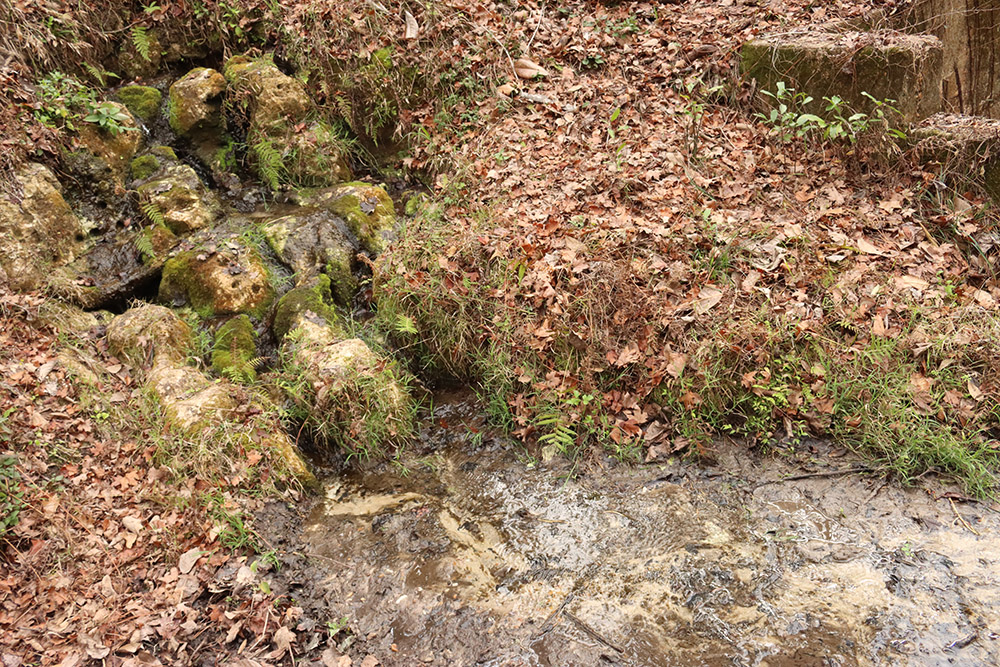
Here is a closer look at the small spring trickling out from limestone rocks.
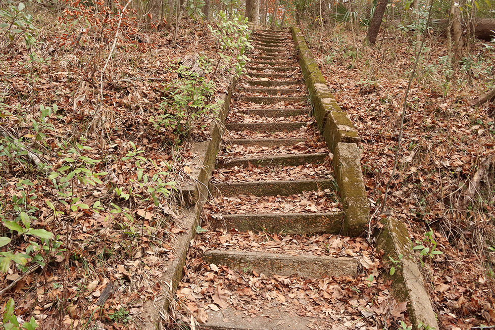
To the left of the spring, a stone staircase leads up, but there is no trail to follow up there. After I spend a little time by the spring, I double back and follow the creek.
A narrow trail at Gholson Park
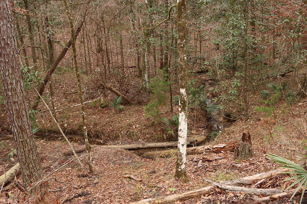
The trail follows a small, winding creek. It’s so small that I can’t always see it past the edge of the steep slope, in its creek bed. The slope, though, is the attraction. Years ago, the Florida Natural Areas Inventory reclassified the habitat description for slope forests. This description used to encompass all hardwood forests around ravines, pockets in the Florida landscape where we find plants common in the Appalachian mountains. Many of those plants migrated to our area during ice ages; when glaciers melted, they slowly migrated north, but populations remained behind in our area’s ravines.
A few years ago, FNAI changed the definition of a slope forest to include only those in the Apalachicola Bluffs and Ravines Region. While we have similar forests in Tallahassee, only a slope forest will have Torreya tress and Florida yew trees. These are the two rarest trees in North America. Slope Forests are home to a host of rare plants and animals, and species that are otherwise only found in the Appalachians.
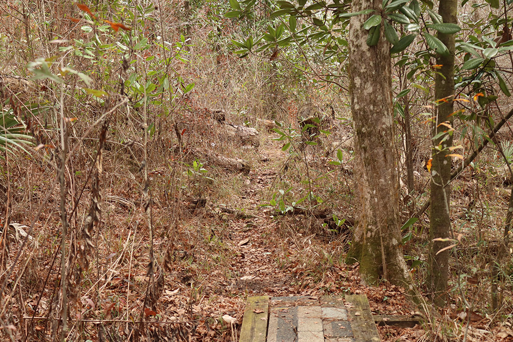
Look at this trail. You can barely see it in the photo. I love it. It’s narrow, and there are places where it’s hard to see where the trail leads. I get a sense that it was designed to disturb the ground as little as possible.
Trout lilies and trillium
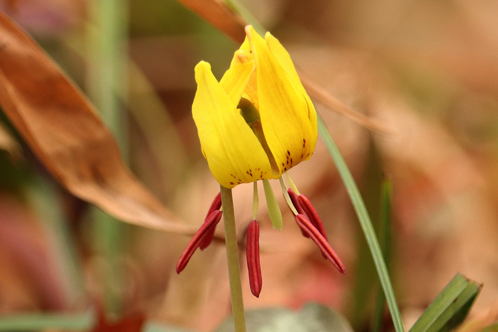
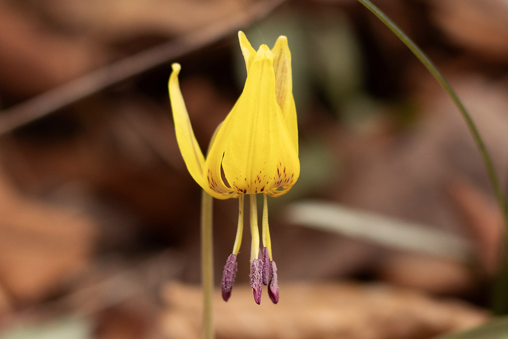
It’s not hard to see why, when dimpled trout lily leaves grow from the edge of the creek up to trail edge, continuing above the trail. When I put my camera bag down to change lenses, I have to be careful to place it at the center of the trail to not disturb these state-endangered wildflowers.
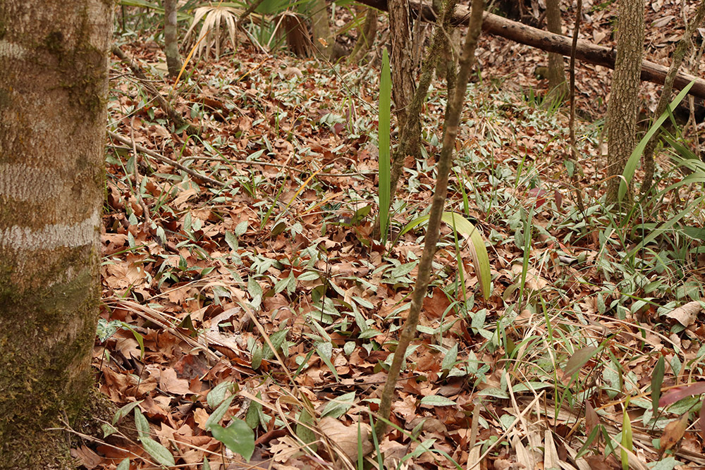
Trout lilies have leafed out along a couple wide slopes, which should soon make for an impressive sight. I’ve seen a photo of a trout lily flower here, taken within the last few days. So I walk slowly, and I scan the ground. I do that anyway, if I’m walking somewhere with a camera.
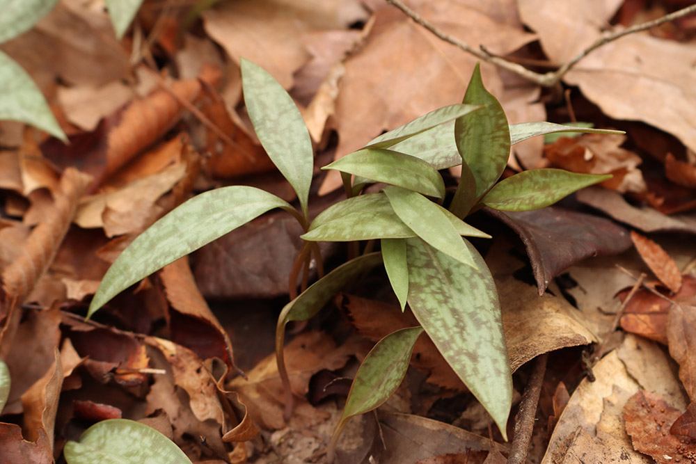
Here’s a closer look at their mottled leaves. And here is a flower:
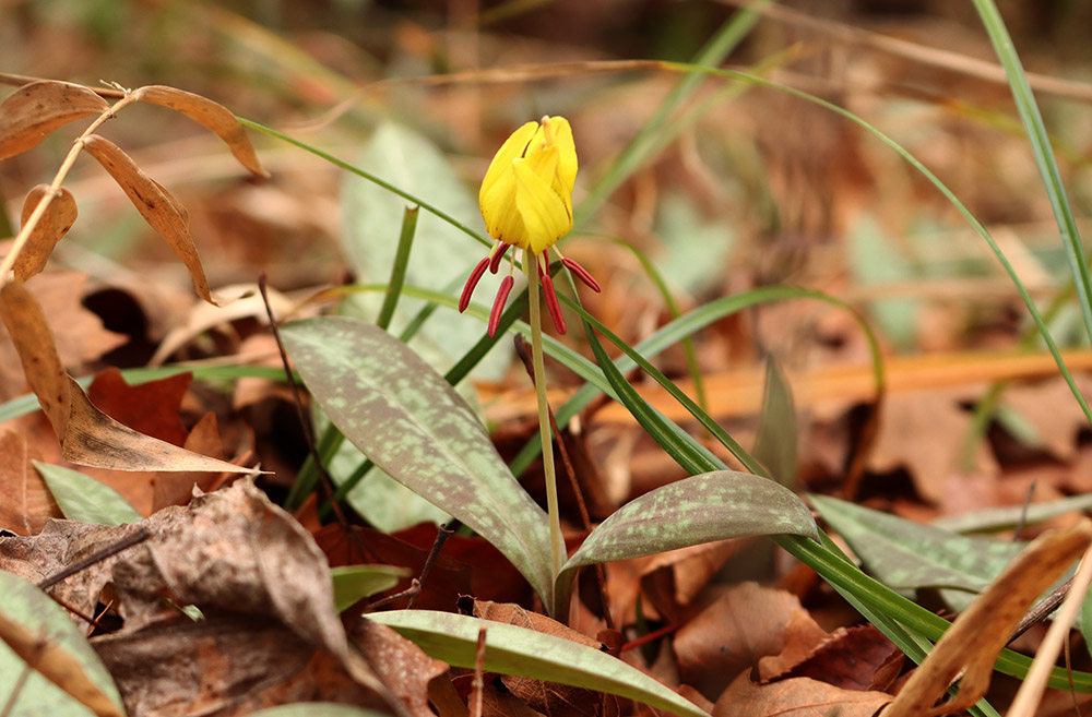
There are a handful in bloom on the slopes, giving us a preview of what is soon to come.
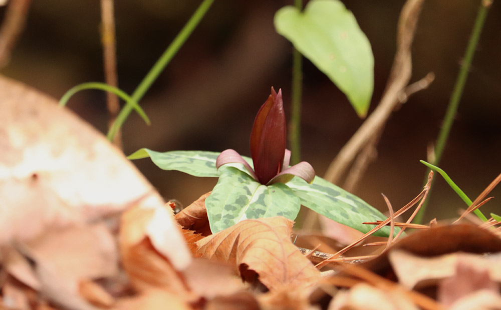
There are several trillium leaves among the trout lilies, and I finally find one in bloom right at the edge of the slope of the creek bed. Underwood’s trillium is the most common of our area trilliums, but this park also has the much rarer lanceleaf wakerobin. I don’t see any today, but it’s a goal to find it on my next visit.
Dimpled Trout lilies: an Appalachian wildflower in Florida

You can see how dimpled trout lilies are widespread in the Appalachian Mountains, and then less so in the southern half of Georgia. But then look at our area. If you zoom in, there are three major populations: at Torreya State Park, Angus Gholson Nature Park, and Wolf Creek Trout Lily Preserve in Whigham, Georgia. There are also a couple scattered round Lake Jackson, which means keeping a closer eye on the ground in Klapp-Phipps Park.
There are a few plants here with a similar distribution, and I hope to photograph them all in my upcoming visits.
The trail devolves
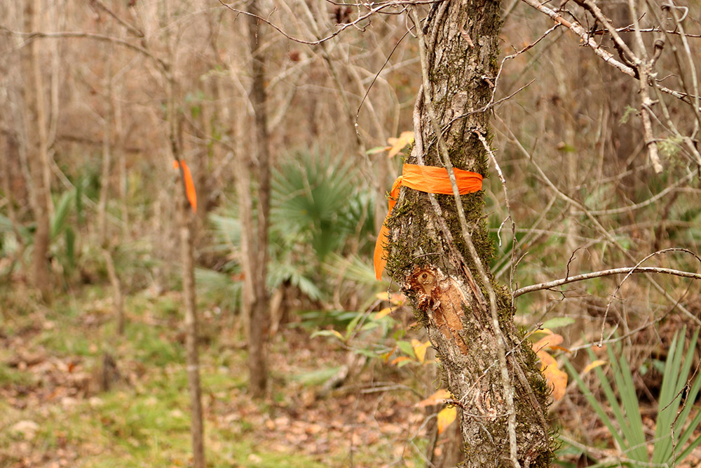
Let me say again how much I love the minimalist trail here. At one point, I follow the trail away from the creek and almost lose it altogether, when I notice the orange flagging tape tied around trees. Where the trail is hardest to follow, they’ve marked trees more closely together.
When I reach a large pond next to a campground, I lose the trail. The park once connected to a trailhead at the Chattahoochee Boat Landing, where RiverTrek kicks off every year. That way has been cut off by Michael. On my way back, I see where the trail branches. Somewhere to explore another day, hopefully soon.
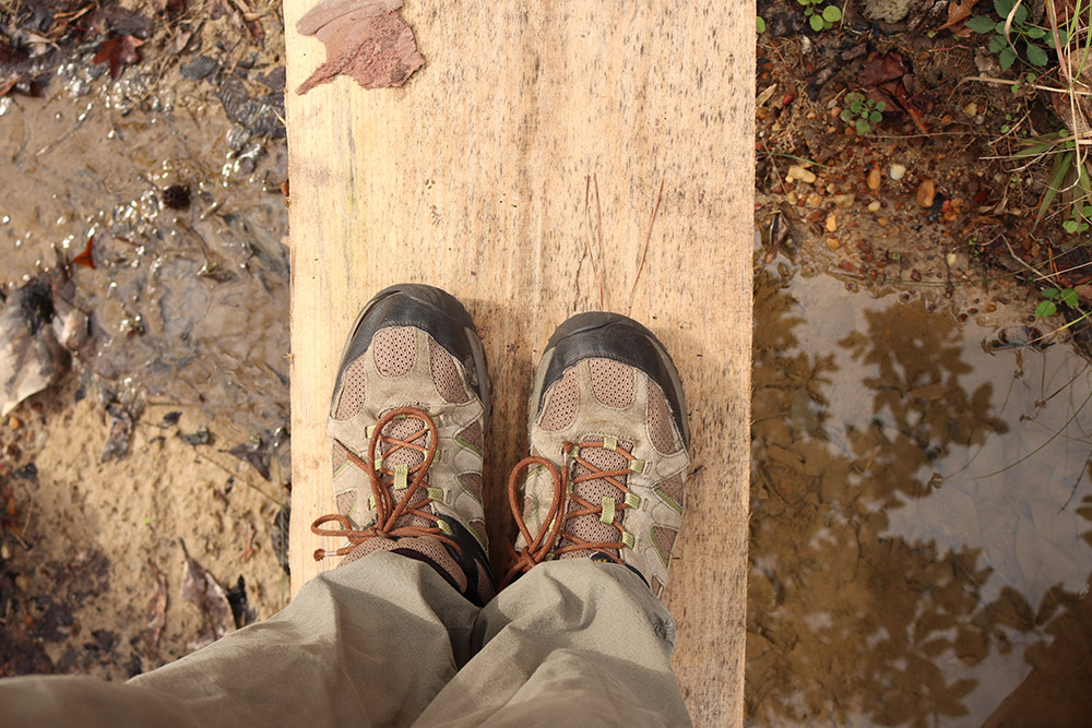
I take a different path back, crossing the creek on a couple of planks. There are also fully-built bridges here, but I like the feel of these. I wonder, are there Apalachicola dusky salamanders in this stream? There many adventures ahead here, and I will keep adding them to this post. What will I see here by the end of the year, I wonder?