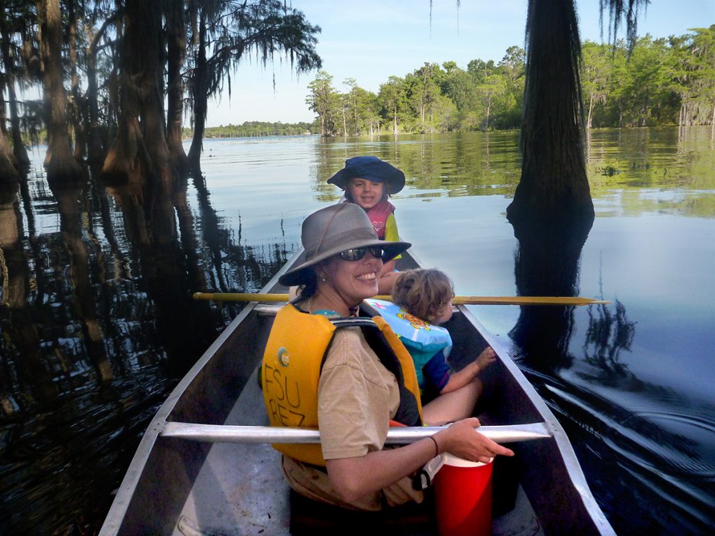
The WFSU Ecology Blog has an updated Leon County Lake Report, posted in June of 2021 (Click here).
In 2014, we posted a look at the health of Leon County lakes. Noticing that a number of people are still visiting the page, we’ve produced an updated summary with current data for each major lake in the area.
Rob Diaz de Villegas WFSU-TV
Leon County has a good number of lakes where people can kayak, fish, or hike. We care about the cleanliness of these waterways because we want to play in and around healthy waters. Nature is key to Tallahassee’s quality of life, and a draw for tourists. Well maintained ecosystems and abundant wildlife are a part of that draw.
But it’s about more than happy turtles and well fed osprey. Tallahassee has four large sinkhole lakes that feed the Floridan aquifer, the source of our springs and drinking water. And, as we learned earlier this year, it’s the water source for ephemeral wetlands and a range of critters that live there. If troubled water enters the aquifer, it can affect multiple water bodies.
With that in mind, we’re taking another look at each major lake in Leon County. Our last Lake Report used 2011 data; Leon County currently has 2014-2015 on their web site.
Measuring Water Quality in Lakes
As we did in 2014, we’ll be measuring water cleanliness by looking at the amount of nutrients in the water and any health advisory regarding fish. Let’s quickly review our sources for the data and the methods used:
Nutrients: Leon County routinely samples its waterways, checking for chlorophyll-a, nitrogen, and phosphorous. These nutrients are an important part of the food web, but an excess can impair water quality and spur toxic algae (cyanobacteria) blooms.
The ideal nutrient level for each lake depends on whether it is clear or dark, and if it’s clear, on its alkalinity. Leon County uses Florida Department of Environmental Protection thresholds for nutrients based on these qualities.
The county has changed a couple of things since our last report. For one, instead of a 200+ page report, the information is now presented on an interactive website. This makes it easier for us to link to source information more directly. Also, they no longer use the Trophic State Index number to define the thresholds. TSI is determined by levels of cholorophyll-a, nitrogen, and phosphorous; Leon County now lists these individually.
Fish Safety: The Florida Department of Health regularly updates its Fish Consumption Advisories, which lists food safety information for state waterways. DOH recommends limits for fish containing a certain amount of mercury; mercury level varies by species and waterway. The guide also has a section for fish and carcinogens. Only one area lake has a fish advisory of this type.
Lake Iamonia (5,554 acres)
Recreation: Most of Lake Iamonia is surrounded by privately owned land, but there is a public boat ramp on Iamonia Landing Road. Iamonia features fishing, kayaking, and duck hunting. As with other area lakes, permanent hunting blinds are not allowed. Earlier this year, as part of our Roaming the Red Hills series, we tagged along for a duck hunt here.
Lake Iamonia is one of the area’s four sinkhole lakes. While its water does drain into the sinkhole every few years, it also receives water when the Ochlockonee River floods. During periods of heavy rainfall or prolonged dryness, think about scouting the location before planning your Iamonia adventure.
FDEP Criteria for: Colored Lakes.
Nutrients: Below threshold for Chlorophyll-a, Total Nitrogen, and Total Phosphorous.
Chlorophyll-a threshold: 20.0 micrograms (μg)/ Liter (3.26 in 2014)
Total nitrogen threshold: 1.27-2.23 milligrams (mg)/L (.75 in 2014)
Total phosphorous threshold: .05-.16 mg/L (.03 in 2014)
Fish Advisory (number in parentheses are recommendations for pregnant women, women trying to conceive, and young children): Bluegill, Redear sunfish, Black crappie- Twice a Week (Once a week). Brown bullhead catfish- two per week. Largemouth bass- one per week (one per month).
Lake Miccosukee (6,257 acres)
Recreation: Lake Miccosukee forms the northeast border between Leon and Jefferson counties; however, its water is located within Jefferson. You can access the water from a number of landings around the lake. When we cycled historic roads in Monticello for another Red Hills segment, we filmed some nice scenery from Hoskins Landing.
Recreational activities include fishing, kayaking, and duck hunting. Permanent blinds are forbidden. And, as mentioned above, Jefferson County has several scenic paved and dirt roads that make for good cycling around the lake.
Lake Miccosukee is one of the area’s four sinkhole lakes. It does drain into the sinkhole every few years. During periods of low rainfall, it might be difficult to get out on the water.
FDEP Criteria for: Colored Lakes.
Nutrients: Below threshold for Chlorophyll-a, Total Nitrogen, and Total Phosphorous. Chlorophyll and nitrogen levels sampled higher after Miccosukee drew down in 2012. This may be associated with the process of refilling the following year.
Chlorophyll-a threshold: 20.0 micrograms (μg)/ Liter (9.5 in 2014)
Total nitrogen threshold: 1.27-2.23 milligrams (mg)/L (.86 in 2014)
Total phosphorous threshold: .05-.16 mg/L (.03 in 2014)
Fish Advisory (number in parentheses are recommendations for pregnant women, women trying to conceive, and young children): Bluegill- twice a week. Largemouth bass- one per week (one per month).
Lake Jackson (4,000 acres)
Recreation: Lake Jackson was recently designated a State Paddling Trail. This means that there is now a trail guide with information on the lake’s many access points. Other activities include fishing and duck hunting. As with other area lakes, permanent hunting blinds are not allowed.
You’ll notice the green spaces in the map below. Lake Jackson Mounds Archeological State Park contains four temple mounds from the days of the Apalachee people. The City of Tallahassee and the Northwest Florida Water Management District established Elinor Klapp-Phipps Park to protect the Lake Jackson watershed. The park contains a maze of trails and a preserve for the rare (in our area) golden banded skipper butterfly.
FDEP Criteria for: Clear lake, low alkalinity.
Nutrients: Below threshold for Chlorophyll-a, and above threshold for Total Nitrogen, and Total Phosphorous. While the nitrogen and phosphorous were above threshold, the county does not consider them to exceed State criteria, as chlorophyll-a was not above threshold. To quote the county page on water quality standards, “‘Chlorophyll a’ is the predominant type of chlorophyll found in algae and cyanobacteria (blue-green algae) and is the form of chlorophyll that is most often analyzed in water quality tests.” So this is the nutrient that most concerns the county.
Lake Jackson exceeded criteria for chlorophyll-a in 2009 and 2011. However, the water in the lake has gotten clearer over the years, and so its ideal nutrient levels may have been changing.
Chlorophyll-a threshold: 6.0 micrograms (μg)/ Liter (2.6 in 2014)
Total nitrogen threshold: .51-.93 milligrams (mg)/L (.69 in 2014)
Total phosphorous threshold: .01-.03 mg/L (.02 in 2014)
Fish Advisory (number in parentheses are recommendations for pregnant women, women trying to conceive, and young children): Bluegill, redear sunfish- two per week. Largemouth bass- one per week (one per month).
Lake Hall (182 acres)
Recreation: The public can access Lake Hall through Alfred B. Maclay Gardens State Park. It’s one of just a few local lakes with a designated swimming area. There is also a boat ramp, and kayak rentals are available. Fishing is popular here, though only boats with electric motors are allowed on the lake.
Lake Hall also makes a nice backdrop to several vistas within the gardens section of the park.
FDEP Criteria for: Clear lake, low alkalinity.
Nutrients: Below threshold for Chlorophyll-a, Total Nitrogen, and Total Phosphorous.
Chlorophyll-a threshold: 6.0 micrograms (μg)/ Liter (1.6 in 2014)
Total nitrogen threshold: .51-.93 milligrams (mg)/L (.26 in 2014)
Total phosphorous threshold: .01-.03 mg/L (.01 in 2014)
Fish Advisory: Florida DOH has no advisories for Lake Hall.
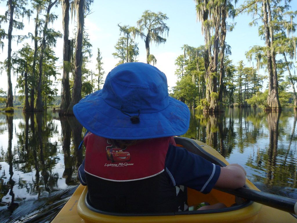
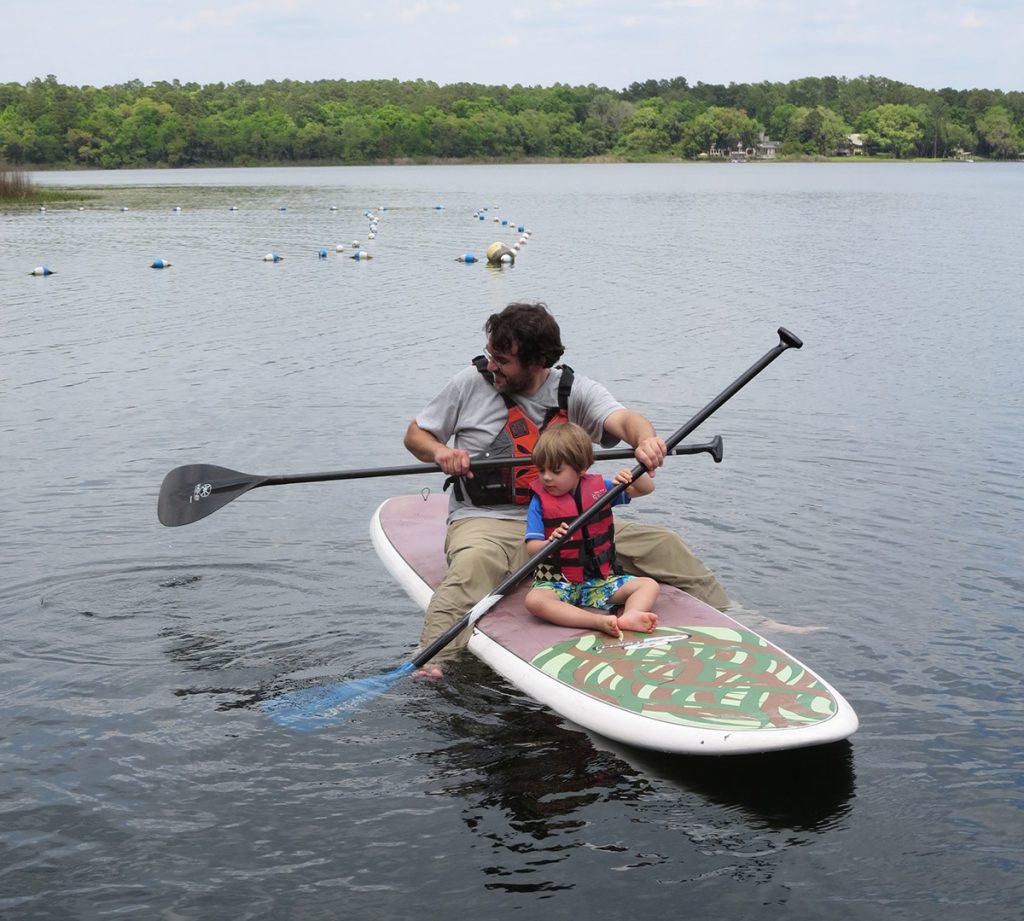
Piney Z. is a small lake, great for kayaking with kids. Here, my son Max and I were getting used to the kayak we would use on Apalachicola RiverTrek 2015.
Lake Lafayette
The fourth of our area’s sinkhole lakes is the one most altered by humans. Lake Lafayette was divided into four separate “sub-lakes” in the mid 1900s.
Our sinkhole lakes had, over thousands of years, developed their own rhythms of draining and filling. The plant and animal communities within them evolved with these rhythms. When this lake was cut in four, it disrupted the ecology of each section, each in a different way.
Recreation: Three interconnected city parks wrap around the lakes, making them the lakes most Tallahasseeans see on a regular basis. The Cadillac Trail connects Tom Brown Park with Lafayette Heritage Trail Park. That trail is a braid of three paths that crawl alongside a hill overlooking Upper Lake Lafayette. The highest trail is the easiest, the lower two are more challenging dirt bike trails.
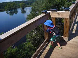
Taking a break from kayaking, we parked at the earthen dike separating Piney Z. from Lower Lake Lafayette. We walked up to the pedestrian bridge to the Alford Greenway and enjoyed the view.
The Cadillac Trail gives way to the Lafayette Heritage Trail, which travels along Piney Z. Lake. You’ll notice what look like docks jutting into Piney Z., those are fishing fingers. There is also a ramp where kayaks and canoes can launch. It’s a small lake, but fun for a short trip with kids. It’s fun to weave through cypress trees and kayak alongside trains on the north shore.
When you reach the end of the Lafayette Heritage Trail, you can walk across the earthen dike separating Piney Z. Lake and Lower Lake Lafayette. This leads to a large pedestrian bridge crossing over the train track, taking you into the JR Alford Greenway. You can portage a kayak across the dike to cross into the larger Lower Lafayette. You can also access Lower Lafayette from a ramp in the Chaires Community Park on the lake’s eastern end.
Kayakers beware- there is duck hunting on Lower Lake Lafayette.
There is separate nutrient information for each lake segment:
Upper Lake Lafayette (300 acres)
FDEP Criteria for: Clear lake, high alkalinity.
Nutrients: Leon County staff were unable to sample Upper Lafayette in 2014 due to low water levels. However, it was above threshold for Chlorophyll-a and Total Phosphorous, and below threshold for Total Nitrogen for 2011 and 2012.
Upper Laker Lafayette is the section of Lake Lafayette where the sinkhole is located. It also receives runoff from multiple residential neighborhoods and the Super Walmart/ Costco complex on Mahan. Residential runoff often contains nutrient rich fertilizer, and the water body is regularly above threshold. Upper Lake Lafayette has a history of toxic algae blooms.
The City of Tallahassee renovated a nearby storm water facility, Weems Pond, in an effort to filter runoff.
Chlorophyll-a threshold: 20.0 micrograms (μg)/ Liter (32.7 in 2011, 31 in 2012, and 16.8 in 2013)
Total nitrogen threshold: 1.05-1.91 milligrams (mg)/L (.68 in 2011, .90 in 2012, and .79 in 2013)
Total phosphorous threshold: .03-.09 mg/L (.10 in 2011, .15 in 2012)
Fish Advisory: Florida DOH has no advisory for Upper Lake Lafayette.
Piney Z. Lake (228 acres)
FDEP Criteria for: Clear lake, low alkalinity.
Nutrients: Above threshold for Chlorophyll-a and Total Phosphorous, and Total Nitrogen. Piney Z. Lake exceeds thresholds in all categories on an almost yearly basis.
Leon County pins the blame for Piney Z.’s issues on the City of Tallahassee’s management of the waterway. The city uses herbicides and adds grass carp to Piney Z. Lake in an effort to open up the water for bass fishing. This removes aquatic plant life that would absorb nutrients. Instead, nutrients entering Piney Z. feed toxic algae, causing blooms.
Chlorophyll-a threshold: 6.0 micrograms (μg)/ Liter (6.02 in 2014)
Total nitrogen threshold: .51-.93 milligrams (mg)/L (1.05 in 2015)
Total phosphorous threshold: .01-.03 mg/L (.04 in 2015)
Fish Advisory (number in parentheses are recommendations for pregnant women, women trying to conceive, and young children): Redear sunfish, warmouth- two per week. Bluegill, brown bullhead catfish- twice a week (one per week). Largemouth bass- one per week (one per month).
Lower Lake Lafayette (1,006 acres)
FDEP Criteria for: Colored lakes.
Nutrients: No data for 2011-2015. “Intermittent sampling has made conclusions difficult.” Looking at previous years, Lower Lafayette has always been well below threshold. Piney Z. and Upper Lafayette buffer Lower Lafayette from higher density neighborhoods.
As we saw on our 2013 EcoAdventure on the lake, it can get choked with vegetation. Cut off from the sinkhole, it doesn’t drain the way it once had. Dead plant matter gathers on the water surface and creates floating islands called tussocks. Seeds take root in tussocks, and trees grow out of them. Since we shot that segment, the City and Florida Fish and Wildlife used heavy machinery to shred a trail through the vegetation.
Fish Advisory: Florida DOH has no advisory for Lower Lake Lafayette.
Alford Arm (231 acres)
Alford Arm is separated from Lower Lake Lafayette by a CSX railroad line constructed in the 1800s. The county stopped sampling the lake cut to dense vegetation covering much of it. However, Alford Arm mostly receives its runoff from areas with natural cover, such as the Miccosukee Greenway and the Welaunee Plantation.
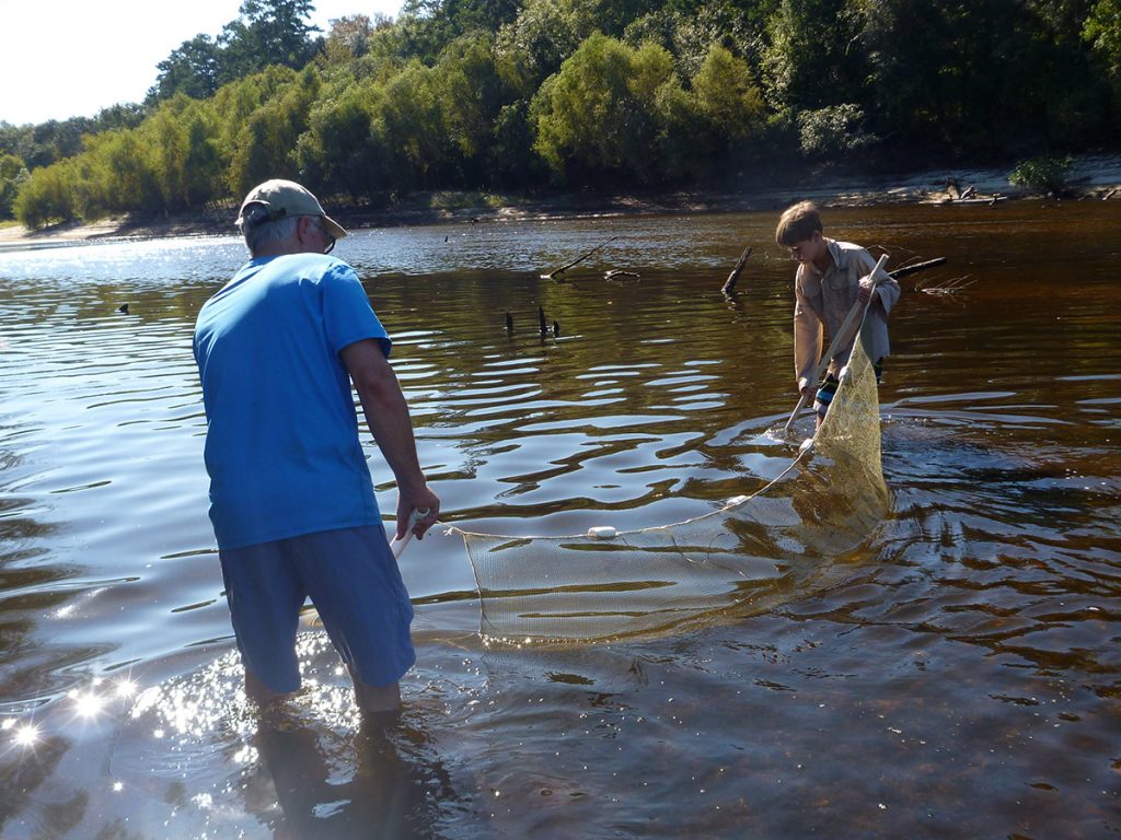
Dr. Todd Engstrom and a young volunteer drag a seine net in the Ochlockonee River south of the Jackson Bluff Dam. This was Tall Timbers’ 2015 Ochlockonee Bio-Blitz, where families gathered on a sandbar to see how many species of animals they could find. Formed by the dam, Lake Talquin is a part of the Ochlockonee, and helps to filter water flowing from the Georgia section of the river.
Lake Talquin (6,963 acres)
In 1929, the Jackson Bluff Dam was built on the Ochlockonee River. This created Lake Talquin. Because of its shape and length, DEP has divided it into two units. Leon County presents nutrient data for both units combined and individually. Below, we’ll present them individually. Doing so, we’ll get a good sense of the quality of water flowing in from the Georgia Ochlockonee, versus what flows out into the Apalachicola National Forest.
Recreation: You can see a lot of green around the lake in the map below. There are two Wildlife Management Areas around it: Talquin and Joe Budd. On the eastern end, you can visit Lake Talquin State Park, where you can hike a trail through ravines and on bluffs overlooking the water. The Lake Talquin State Forest is divided into ten units spread around the lake.
There is hunting in the WMAs, and duck hunting on the lake. You can also go kayaking or fishing.
Lake Talquin WBID 1297C
This is the north half of Talquin, which receives flow from the Ochlockonee River. We kayaked the Ochlockonee River in Georgia as part of our Roaming the Red Hills series. In the post attached to the video, we looked at pollution and agricultural runoff issues originating north of the Red Hills. Those excess nutrients enter Lake Talquin.
FDEP Criteria for: Colored Lakes.
Nutrients: Below threshold for Chlorophyll-a, Total Nitrogen, and Total Phosphorous.
Chlorophyll-a threshold: 20.0 micrograms (μg)/ Liter (6 in 2014)
Total nitrogen threshold: 1.27-2.23 milligrams (mg)/L (.73 in 2014)
Total phosphorous threshold: .05-.16 mg/L (.05 in 2014)
While chlorophyll-a was below threshold in 2014, it was over threshold in 2011 (32), 2012 (23), and 2013 (24).
Fish Advisory (number in parentheses are recommendations for pregnant women, women trying to conceive, and young children): Bluegill, Black crappie, brown bulkhead catfish, redbreast sunfish, redear sunfish, spotted bullhead catfish- Twice a Week. Largemouth bass- one per week (one per month).
Lake Talquin WBID 1297D
As water flows south through Talquin, nutrients are absorbed by sediments in the lake bottom. As a result, cleaner water flows back into the Ochlockonee from the Jackson Bluff Dam. Just south of the dam, in the Apalachicola National Forest, we had a great sand bar day on last year’s Ochlockonee Bio-Blitz.
FDEP Criteria for: Colored Lakes.
Nutrients: Below threshold for Chlorophyll-a, Total Nitrogen, and Total Phosphorous.
Chlorophyll-a threshold: 20.0 micrograms (μg)/ Liter (4 in 2014)
Total nitrogen threshold: 1.27-2.23 milligrams (mg)/L (.83 in 2014)
Total phosphorous threshold: .05-.16 mg/L (.07 in 2014)
While chlorophyll-a was above threshold in 2011 (22), it is generally lower than in the north unit.
Fish Advisory (number in parentheses are recommendations for pregnant women, women trying to conceive, and young children): Bluegill, Black crappie, brown bulkhead catfish, redbreast sunfish, redear sunfish, spotted bullhead catfish- Twice a Week. Largemouth bass- one per week (one per month).
The Bradford Brook Chain of Lakes
Recreation: With public access through the FSU Reservation, lakes Bradford, Hiawatha, and Cascade are connected waterways. The Rez is located on the shore of Lake Bradford. It has a swimming area as well as kayak, canoe, and standup paddle board rentals. Once on the water, head left.
The waterway connecting lakes Bradford and Hiawatha passes through a corridor of cypress trees next to the Tallahassee Museum. Depending on the water level, you can paddle right up to the Florida panther enclosure.
During dry periods, the links between the lakes dry out.
Lake Bradford
FDEP Criteria for: Colored Lake.
Nutrients: Below threshold for Chlorophyll-a, Total Nitrogen, and Total Phosphorous.
Chlorophyll-a threshold: 20.0 micrograms (μg)/ Liter (3 in 2014)
Total nitrogen threshold: 1.27-2.23 milligrams (mg)/L (.69 in 2014)
Total phosphorous threshold: .05-.16 mg/L (.02 in 2014)
While chlorophyll-a stayed below threshold in 2011 (11), 2012 (12), and 2013 (13), those numbers are higher than in most years. The report points out that water levels were lower in those years, and that algae may have become concentrated.
While nutrient levels in Lake Bradford are in a good range, the lead level exceeded water quality criteria in 2014. As the county points out, Lake Bradford has consistently exceeded water quality standards for lead. The county points to relict sources- the former Dale Mabry Airfield and a former shooting range. The Tallahassee Regional Airport is a possible current source, as aviation fuel contains lead.
Fish Advisory (number in parentheses are recommendations for pregnant women, women trying to conceive, and young children): Bluegill- Two per week (One per month).
Lake Hiawatha
FDEP Criteria for: Colored Lake.
Nutrients: Below threshold for Chlorophyll-a, Total Nitrogen, and Total Phosphorous.
Chlorophyll-a threshold: 20.0 micrograms (μg)/ Liter (2.2 in 2014)
Total nitrogen threshold: 1.27-2.23 milligrams (mg)/L (.67 in 2014)
Total phosphorous threshold: .05-.16 mg/L (.01 in 2014)
While nutrient levels in Lake Hiawatha are in a good range, the lead level exceeded water quality criteria in 2014. The county points to relict sources- the former Dale Mabry Airfield and a former shooting range. The Tallahassee Regional Airport is a possible current source, as aviation fuel contains lead.
Fish Advisory: There is no DOH advisory for Lake Hiawatha.
Lake Cascade
FDEP Criteria for: Colored Lake.
Nutrients: Below threshold for Chlorophyll-a, Total Nitrogen, and Total Phosphorous.
Chlorophyll-a threshold: 20.0 micrograms (μg)/ Liter (4.5 in 2014)
Total nitrogen threshold: 1.27-2.23 milligrams (mg)/L (.79 in 2014)
Total phosphorous threshold: .05-.16 mg/L (.02 in 2014)
While nutrient levels in Lake Cascade are in a good range, the lead level exceeded water quality criteria in 2014. The county points to relict sources- the former Dale Mabry Airfield and a former shooting range. The Tallahassee Regional Airport is a possible current source, as aviation fuel contains lead.
Fish Advisory: There is no DOH advisory for Lake Cascade.
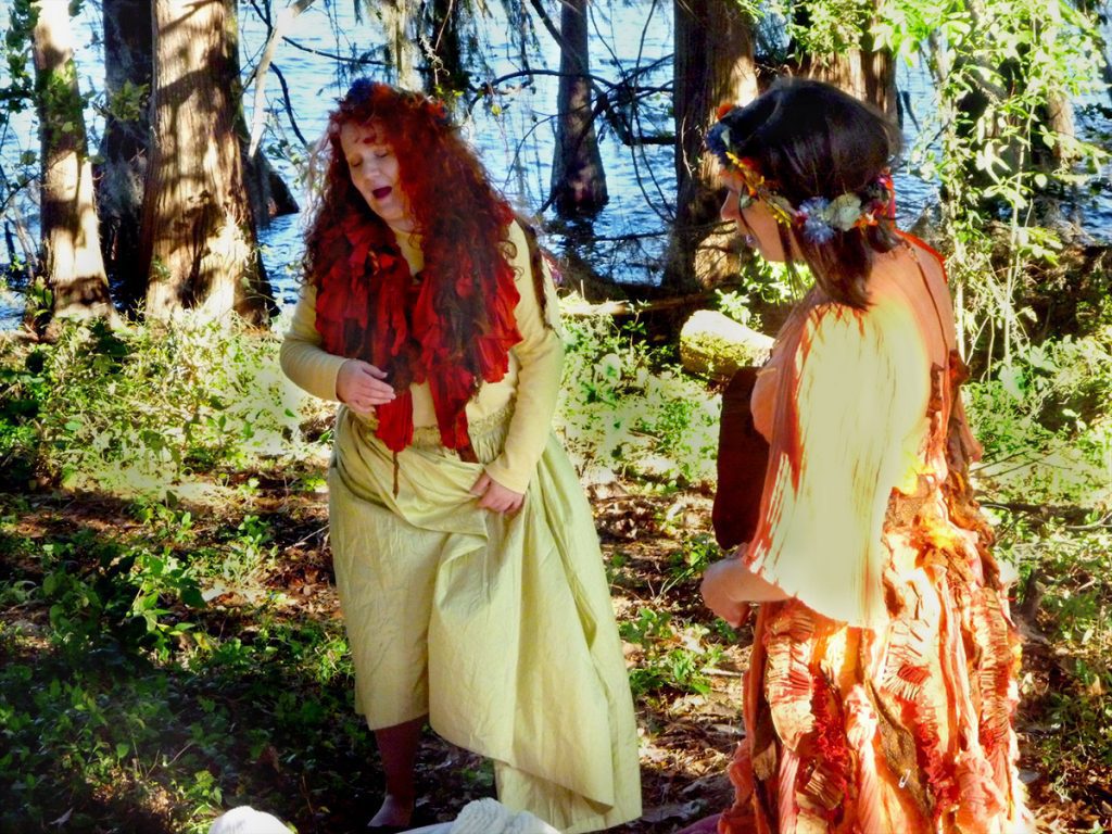
On the shores of Lake Munson, WFSU filmed its least conventional ecology program ever. Here, by Tallahassee’s most polluted water body, the fairy queen Titania is sung to sleep by her retinue. In EcoShakespeare, a Midsummer Night’s Dream is revealed to have quite a lot to say about modern environmental issues.
Lake Munson (255 acres)
This is possibly the most troubled water body in Leon County. To quote the report:
“The lake has a history of severe water quality and ecological problems including fish kills, algal blooms, exotic vegetation and snails, high nutrient and bacterial levels, low game fish productivity, sediment contamination, and depressed oxygen levels.”
Lake Munson had once been a dumping ground for industrial waste, and today receives nutrient rich runoff through the Munson Slough system. Munson Slough receives runoff from much of south Tallahassee. The city has made modifications to the drainage of this watershed, including dams on Lakes Munson and Henrietta (which also lies along Munson Slough). We know Cascades Park as Tallahassee’s centerpiece recreational space; it is also a stormwater treatment facility feeding Munson Slough.
Munson Slough continues to the south of Lake Munson, flowing through the Apalachicola National Forest and into Ames Sink. There, it enters the Floridan Aquifer. Dye traces have connected Ames Sink to Wakulla Springs.
Recreation: There is a boat ramp off of Crawfordville Highway. Reportedly dug out from a cypress swamp in the 1800s, Lake Munson is surrounded by a scenic colonnade of cypress trees. People fish there, but do consult the DOH fish advisories. Additionally, the park by the boat ramp has a little trail where you can walk along the shore.
FDEP Criteria for: Clear lake, high alkalinity.
Nutrients: Below threshold for Chlorophyll-a, and Total Nitrogen, and above threshold for Total Phosphorous.
Chlorophyll-a threshold: 20 micrograms (μg)/ Liter (13.9 in 2014)
Total nitrogen threshold: 1.05-1.91 milligrams (mg)/L (1.27 in 2014)
Total phosphorous threshold: .03-.09 mg/L (.24 in 2014)
Phosphorous has been above threshold since 2005. Chlorophyll-a and nitrogen were above threshold in 2012 (39 and 1.08) and 2013 (85 and 1.51).
Lake Munson also exceeded water criteria for lead several times in 2014. The county theorizes that the lead had previously arrived in the system as runoff carrying leaded gasoline.
Fish Advisory (number in parentheses are recommendations for pregnant women, women trying to conceive, and young children): Brown bullhead catfish, bluegill, redear sunfish- two per week. Largemouth bass- two per week (one per week). Black crappie- One per week (one per month).
There is also an advisory for PCB (polychlorinated biphenyl): Largemouth bass, 19 inches or more- One meal per month. PCB is a carcinogen known to cause cancer in humans. PCB likely arrived in the lake via industrial waste dumped there in the mid-1900s.

